Maps of Caribbean Netherlands
The Caribbee Islands, the Virgin Islands, and the Isle of Porto Rico.
1 : 1560000 Jefferys, Thomas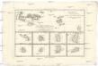
Cartes de supplément pour les isles Antilles
1 : 1330000 Antigua (Antigua a Barbuda) Bonne, Rigobert André
Carte des Antilles
1 : 2777775
Antilles, Charibbee Islands.
1 : 2700000 Faden, William, 1750?-1836
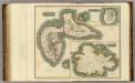
CANIBALES | INSVLÆ.
[Amsterdam : Joan Blaeu]
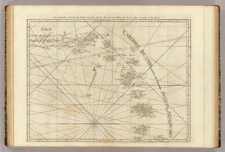
A CHART OF THE ANTILLES, or, CHARIBBE, or, CARIBS ISLANDS, WITH THE VIRGIN ISLES
This chart by cartographer L. S. de la Rochette (1731 ? 1802) was engraved by William Palmer and published by 'geographer to the King' William Faden in 1784. There is a compass rose at the centre of a network of rhumb lines (for sailing directions) and a smaller scale map of the region is inset at top right showing distances between the islands, sailing routes and a table recording latitude and longitude of each island. Down the right side of the map are represented the profiles of the headlands of the different islands- this is as they would appear to sailors from the sea. La Rochette. Cartographer.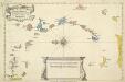
A New And Correct Map Of The Caribbean Islands From The Latest Observations
This map of the West Indies by Archebald Bontein was published in 1751. Bontein was the Chief Engineer in Jamaica and published a map of that island in 1763. A system of colour codes and letters, with the key in a panel at bottom centre, identifies the various European dominions in the region. Bontein, Archibald. Cartographer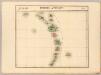
Petites Antilles. Amer. Sep. 75.
1 : 1641836 Vandermaelen, Philippe, 1795-1869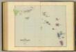
Leeward Islands.
1 : 887040 Stanford, Edward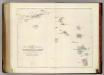
Map of The Leeward Islands.
1 : 950400 Arrowsmith, John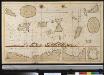
De Caribese eijlande tusschen St. Luzia en St. Christoffel
Lesser Antilles Gerard van Keulen
Tabula novissima atque accuratissima Caraibicarum insularum sive Cannibalum : quae etiam Antillae Gallicae dicuntur, item insulae Supraventum, et in Archipelago Mexicano sitae sunt, ac detectae a Christ. Columbo Ao. MCCCCLXXXXIII
1 : 960000 Ottens, R. (Reinier), 1698-1750 by de Wed. I. Ottens, op den Nieuwen Dyk in de Werelt Kaart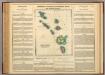
Leeward Islands.
1 : 1420000 Lea, I.
A map of the islands of St. Lucia and Martinique, with part of Dominica and St. Vincents, shewing the two passages between Martinique and St. Lucia, and Martinique and Dominica, to Fort Royal Bay and harbour, the station of the French fleets ...
1 : 1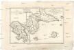
Isle de la Martinique
1 : 7320000 Guadeloupe Bonne, Rigobert André
Virgin Islands & c.
1 : 511753 Lucas, Fielding Jr.
Carte des Antilles francoises et des isles voisines
1 : 870000
Tabula novissima atque accuratissima Caraibicarum insularum sive Cannibalum, quae etiam Antillae Gallicae dicuntur, item insulae Supraventum, et in Archipelago Mexicano sitae sunt, ac detectae a Christ. Columbo Ao. MCCCCLXXXXIII
1 : 960000
Supplement pour les Isles Antilles, extrait des carte Angloises
1 : 1300000
Antilles Francoises, isles voisines.
1 : 890000 L'Isle, Guillaume de, 1675-1726
Antilles Francoises, isles voisines.
1 : 890000 L'Isle, Guillaume de, 1675-1726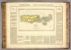
Porto Rico, Iles Vierges.
1 : 1100000 Buchon, J. A. C.; Carey, H. C.; Lea, I.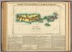
Map Of Porto Rico And The Virgin Islands.
1 : 950400 Lea, I.
Porto Rico.
1 : 507000 Rand McNally and Company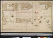
Afteekening van het eijland St. Juan de Porto Rico
Puerto Rico Gerard van Keulen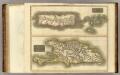
Porto Rico, Virgin Isles, Hispaniola.
1 : 700000 Thomson, John
Dutch Possessions in South America and the West Indies.
1 : 2407680 Fullarton, A. & Co.
The Dutch islands of St. Eustatia, Saba, and St. Martins ; the French island of St. Bartholomew ; the English islands of St. Christophers, Nevis, and Anguilla ; with the smaller islands and keys adjoining
1 : 430000
Guadaloupe & c.
1 : 283583 Lucas, Fielding Jr.