Maps of Guadeloupe

Carte des Antilles francoises et des isles voisines
1 : 870000
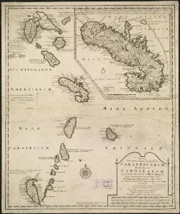
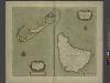
Tabula novissima atque accuratissima Caraibicarum insularum sive Cannibalum, quae etiam Antillae Gallicae dicuntur, item insulae Supraventum, et in Archipelago Mexicano sitae sunt, ac detectae a Christ. Columbo Ao. MCCCCLXXXXIII
1 : 960000
Antilles Francoises, isles voisines.
1 : 890000 L'Isle, Guillaume de, 1675-1726
Antilles Francoises, isles voisines.
1 : 890000 L'Isle, Guillaume de, 1675-1726
Tabula novissima atque accuratissima Caraibicarum insularum sive Cannibalum : quae etiam Antillae Gallicae dicuntur, item insulae Supraventum, et in Archipelago Mexicano sitae sunt, ac detectae a Christ. Columbo Ao. MCCCCLXXXXIII
1 : 960000 Ottens, R. (Reinier), 1698-1750 by de Wed. I. Ottens, op den Nieuwen Dyk in de Werelt Kaart
Windward Islands.
1 : 887040 Stanford, Edward
A map of the islands of St. Lucia and Martinique, with part of Dominica and St. Vincents, shewing the two passages between Martinique and St. Lucia, and Martinique and Dominica, to Fort Royal Bay and harbour, the station of the French fleets ...
1 : 1
Isle de la Martinique
1 : 7320000 Guadeloupe Bonne, Rigobert André
Tobago; Barbados.
1 : 338000 Peterson, Augusts
Guadaloupe.
1 : 300000 Jefferys, Thomas
Guadaloupe, done from actual surveys and observations of the English, whilst the island was in their possession
1 : 300000
Guadeloupe.
1 : 65000 Boyer-Peyreleau, Eugene Edouard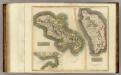
Martinico, Dominica.
1 : 200000 Thomson, John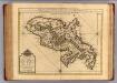
Martinique.
1 : 175000 L'Isle, Guillaume de, 1675-1726
Colonies Francaises (en Amerique).
1 : 476000 Levasseur, Victor.
The Iland of BARBADOS
from The sea-atlas : containing an hydrographical description of most of the sea-coasts of the known parts of the world.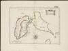
Isle de la Guadeloupe
1 : 367500
CHARTE von der Insel GUADELOUPE
1 : 500000 Guadeloupe Pluth, Fr.

Charte von der Insel Guadeloupe

Carte de la Dominique prise par les françois le 7 septembre 1778, avec le Plan du débarquement, et de l'attague des forts et batteries par les troupes et les frégates de Sa Majesté
1 : 60000
Dominica from an actual survey compleated in the year 1773
1 : 85000
Guadaloupe, one of the Caribbee Islands subject to France in the West Indies
1 : 265000 Jefferys, Thomas, d. 1771 T. Jefferys at Charing Cross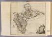
Guadaloupe.
1 : 265000 Jefferys, Thomas
Martinico.
1 : 167366 Lucas, Fielding Jr.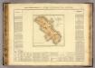
Martinique.
1 : 235000 Buchon, J. A. C.; Carey, H. C.; Lea, I.
Novissima et Acuratissima Barbados. Descriptio per Johannem Ogiluium Cosmographum Regium
from America: being the latest, and most accurate description of the Nevv vvorld; containing the original of the inhabitants, and the remarkable voyages thither. The conquest of the vast empires of Mexico and Peru, and other large provinces and territories, with the several European plantations in those parts. Also their cities, fortresses, towns, temples, mountains, and rivers. Their habits, customs, manners, and religions. Their plants, beasts, birds, and serpents. With an appendix, containing, besides several other considerable additions, a brief survey of what hath been discover'd of the vnknown south-land and the Arctick region. Collected from most authentick authors, augmented with later observations, and adorn'd with maps and sculptures, by John Ogilby ...
Insula Matanino Vulgo Martanico [Karte], in: Novus atlas absolutissimus, Bd. 9, S. 71.
1 Karte aus Atlas Janssonius Offizin