Maps of Guadeloupe
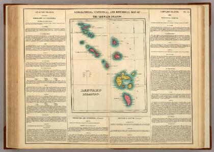
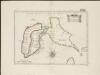
Leeward Islands.
1 : 1420000 Lea, I.
The Dutch islands of St. Eustatia, Saba, and St. Martins ; the French island of St. Bartholomew ; the English islands of St. Christophers, Nevis, and Anguilla ; with the smaller islands and keys adjoining
1 : 430000
Guadaloupe & c.
1 : 283583 Lucas, Fielding Jr.
Guadaloupe.
1 : 120000 Thomson, John
Guadaloupe.
1 : 300000 Jefferys, Thomas
Guadaloupe, done from actual surveys and observations of the English, whilst the island was in their possession
1 : 300000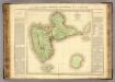
Guadeloupe.
1 : 65000 Boyer-Peyreleau, Eugene Edouard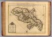
Martinique.
1 : 175000 L'Isle, Guillaume de, 1675-1726
Colonies Francaises (en Amerique).
1 : 476000 Levasseur, Victor.
Isle de la Guadeloupe
1 : 367500
CHARTE von der Insel GUADELOUPE
1 : 500000 Guadeloupe Pluth, Fr.
Charte von der Insel Guadeloupe

Carte de la Dominique prise par les françois le 7 septembre 1778, avec le Plan du débarquement, et de l'attague des forts et batteries par les troupes et les frégates de Sa Majesté
1 : 60000
Dominica from an actual survey compleated in the year 1773
1 : 85000
Guadaloupe, one of the Caribbee Islands subject to France in the West Indies
1 : 265000 Jefferys, Thomas, d. 1771 T. Jefferys at Charing Cross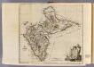
Guadaloupe.
1 : 265000 Jefferys, Thomas
SAINT KITTS, Leeward Islands Island (1875).
St. Christophe, Nièves, St. Eustache et Saba. (Île St. Eustache. Orange Town). [Paris] : Dépôt des Cartes et Plans de la Marine
Dominica.
1 : 223268 Lucas, Fielding Jr.
SAINT KITTS, Leeward Islands Island (1899).
[Leeward Islands. St. Christopher and Nevis ... Eustatius and Saba. Surveyed ... 1850. Natural scale, 1 : 56,700 [Admiralty Chart]]
Dominica.
1 : 85000 Jefferys, Thomas
SAINT KITTS, Leeward Islands Island (1864).
Leeward Islands. St. Christopher and Nevis ... Eustatius and Saba. Surveyed ... 1850. Natural scale, 1 : 56,700 [Admiralty Chart]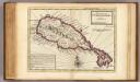
Island of St. Christophers, alias St. Kitts.
1 : 140000 Moll, Herman, d. 1732
DOMINIA ANGLORUM in praecipius Insulis AMERICAE ut sunt Insula S. CHHRISTOPHORI, ANTEGOA, IAMAICA, BARBADOS nec non Insulae BERMUDOS vel SOMMER dictae
1 : 1320000 Antigua (Antigua a Barbuda) ab Homannianis Heredibus
Antigua.
1 : 243000 Peterson, Augusts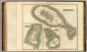
St. Christophers.
1 : 70000 Thomson, John
St Kitts-Nevis (1920)
St. Christopher or St. Kitts, GSGS 2941. Great Britain. General Staff. Geographical Section. [London] : [GSGS, War Office].
St. Christophers or St. Kitts
1 : 53000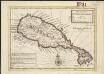
The island of St. Christophers, alias St. Kitts
1 : 140799