Maps of Virgin Islands
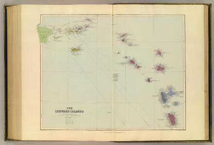
Leeward Islands.
1 : 887040 Stanford, Edward
Map of The Leeward Islands.
1 : 950400 Arrowsmith, John
Leeward Islands.
1 : 1420000 Lea, I.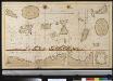
De Caribese eijlande tusschen St. Luzia en St. Christoffel
Lesser Antilles Gerard van Keulen
Virgin Islands & c.
1 : 511753 Lucas, Fielding Jr.
Supplement pour les Isles Antilles, extrait des carte Angloises
1 : 1300000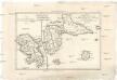
Isle de la Martinique
1 : 7320000 Guadeloupe Bonne, Rigobert André
Dutch Possessions in South America and the West Indies.
1 : 2407680 Fullarton, A. & Co.
Porto Rico.
1 : 507000 Rand McNally and Company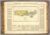
Porto Rico, Iles Vierges.
1 : 1100000 Buchon, J. A. C.; Carey, H. C.; Lea, I.
The Dutch islands of St. Eustatia, Saba, and St. Martins ; the French island of St. Bartholomew ; the English islands of St. Christophers, Nevis, and Anguilla ; with the smaller islands and keys adjoining
1 : 430000
Guadaloupe & c.
1 : 283583 Lucas, Fielding Jr.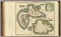
Guadaloupe.
1 : 120000 Thomson, John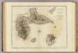
Guadaloupe.
1 : 300000 Jefferys, Thomas
Guadaloupe, done from actual surveys and observations of the English, whilst the island was in their possession
1 : 300000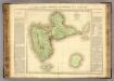
Guadeloupe.
1 : 65000 Boyer-Peyreleau, Eugene Edouard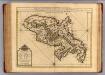
Martinique.
1 : 175000 L'Isle, Guillaume de, 1675-1726
Colonies Francaises (en Amerique).
1 : 476000 Levasseur, Victor.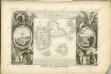

St. Thomas, St. Jan, St. Crook.
1 : 206000 Peterson, Augusts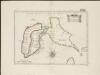
Isle de la Guadeloupe
1 : 367500
CHARTE von der Insel GUADELOUPE
1 : 500000 Guadeloupe Pluth, Fr.

Charte von der Insel Guadeloupe

Carte de la Dominique prise par les françois le 7 septembre 1778, avec le Plan du débarquement, et de l'attague des forts et batteries par les troupes et les frégates de Sa Majesté
1 : 60000
Dominica from an actual survey compleated in the year 1773
1 : 85000
Guadaloupe, one of the Caribbee Islands subject to France in the West Indies
1 : 265000 Jefferys, Thomas, d. 1771 T. Jefferys at Charing Cross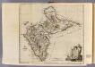
Guadaloupe.
1 : 265000 Jefferys, Thomas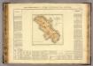
Martinique.
1 : 235000 Buchon, J. A. C.; Carey, H. C.; Lea, I.