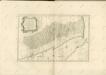
Maps of Ethiopian Highlands

Abyssinia, surrounding countries.
1 : 6450000 Rand McNally and Company
AEthiopisches Hochland Alpenland Habesch und Vorstuffe von Darfur und Sennaar
Dárfúr (Súdán) Arrowsmith, John
Abyssinië in vogelvlucht gezien = Abyssinie vue a vol d'oiseau / Seghers
titelvariant: Abyssinie vue a vol d'oiseau; Annotatie: Gegevens verzameld over de periode/Data collected over the period: 1935; With photographs of current world leaders; Fragment: foto's van wereldleiders ontbreken; Annotatie geografische gegevens: Bijkaart: Van Gibraltar tot Abessinië = De Gibraltar a l'Abessinie W. Seghers Antwerpen [etc.] : [Patria, etc.]
Ethiopia. Pergamon World Atlas.
1 : 5000000 Polish Army Topography Service
Upper Nubia and Abyssinia.
1 : 2854868 Johnston, W. & A.K.
Upper Nubia and Habesh or Abyssina.
1 : 5000000 Rand McNally and Company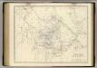
Nubia, Abyssinia.
1 : 2854868 Johnston, Alexander Keith, 1804-1871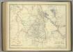
Upper Nubia and Abyssinia.
1 : 2854868 Johnston, Alexander Keith
Carta della colonia Eritrea coll'Abissinia : e regioni limitrofe tra il Nilo, Suakin e il Golfo d'Aden
1 : 4000000 Cora, Guido, 1851-1917 Fratelli Bocca
Cestovatele Viléma Němce přehledná mapa Císařství habešského s poznámkami zoografickými a místopisnými
1 : 2070000 Etiopie Němec, Vilém Československá grafická unie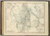
Upper Nubia and Abyssinia.
1 : 2854868 Johnston, Alexander Keith
Countries In The Northern Tropical Regions of Africa.
Fullarton, A. & Co.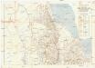
Seconda edizione della nuova carta dei domini e protettorati italiani nell' Eritrea e regioni limitrofe
1 : 1500000 Eritrea Ministero della guerra
Carte générale d'Abyssinie
1 : 1800000 dressée par M. le lieutenant de vaisseau Théophile Lefebvre pendant son voyage d'exploration en 1839, 40, 41, 42, 43 Paris : Arthus Bertrand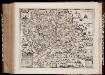
Habessinia seu Abassia, presbyteri Johannis regio perperam dicta ... / Jobi Lodolfi [cart.] ; Christianus Ludolfus J. Filius delineavit ex autographo Parentis
1 : 2400000 Annotatie: Origineel is Blad 211 in atlas factice Jobus Ludolphus 1624-1704; Christianus Ludolfus [Amsterdam] : [s.n.]
Carte de l'Abyssinie, du pays des Galla, de Choa et d'Ifat
1 : 2500000 dressée par Mrs. Combes et Tamisier dessinée par A. Vuillemin ; gravée par Massuet ; écrite par Martin ainé Paris : Desessart
Carte d'Abyssinie et des contrées adjacentes dressée partie d'après des observations faites sur les lieux par l'auteur, partie d'après les informations prises dans le pays en 1809 et 1810
1 : 5000000 par Henry Salt [S.l.] : [s.n.]
Karte von Aethiopien (H'abeš, Takah & Ost-Senar)
1 : 2500000 Eritrea Heuglin, Theodor von Bruce Hermann Costenoble
Nubia and Abyssinia to Bab El Mandeb.
1 : 3380000 Sharpe, J.
1re partie de la Carte de la Mer Rouge
1 : 2500000 Rudé moře-oblast
Sennaar. Afrique 25.
1 : 1641836 Vandermaelen, Philippe, 1795-1869
Carta della colonia Eritrea
1 : 1500000 Italie. Ministero degli Affari esteri [Florence] : Ministero degli affari esteri
Abissinie. Afrique 32.
1 : 1641836 Vandermaelen, Philippe, 1795-1869
Jobi Ludolfi Habessinia seu Abassia, presbyteri Johannis regio
Etiopie Ludolf, Christian Habess, Gregorius
Liberia (1914)
Liberia, TSGS 2083. Great Britain. General Staff. Topographical Section. [London] : [TSGS, War Office]
Carta dimostrativa della Etiopia (Sheet 5)
Carta dimostrativa della Etiopia, in 6 fogli e 2 aggiunte, alla scala di 1 : 100,000. Compilata dal Capitano ... Ethiopia de Chaurand, etc. [Rome]
Terrae Yemen maxima pars, seu imperii Imami, principatus Kaukebân, nec non ditionum Haschid u Bekîl, Nehhm, Chaulân, Abu Arîsch et Aden, tabula : ex observationibus astronomicis et hodometricis jussu et sumtibus potentissimor. Daniae regum Friderici V, et Christiani VII. institutis, delineata
1 : 1200000 auctore C. Niebuhr Gustav Conrad Lotter sculps. Aug. Vind. : Tob. Conr: Lotter geogr. excud.
Karte von dem groessten Theil des Landes Jemen Imame, Kaukeban &
1 : 775000 Jemen Niebuhr, Carsten Benedicti, Hieronymus F.A. Schraembl