Maps of Amhara

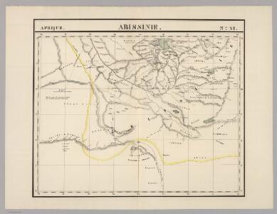
Abissinie. Afrique 32.
1 : 1641836 Vandermaelen, Philippe, 1795-1869
Liberia (1914)
Liberia, TSGS 2083. Great Britain. General Staff. Topographical Section. [London] : [TSGS, War Office]
Carta dimostrativa della Etiopia (Sheet 5)
Carta dimostrativa della Etiopia, in 6 fogli e 2 aggiunte, alla scala di 1 : 100,000. Compilata dal Capitano ... Ethiopia de Chaurand, etc. [Rome]
Carte de la côte française des Somalis et régions avoisinantes. Addis-Ababa
1 : 500000 Meunier, A., cartographe [Paris] : Service géographique des colonies
Carte générale d'Abyssinie
1 : 1800000 dressée par M. le lieutenant de vaisseau Théophile Lefebvre pendant son voyage d'exploration en 1839, 40, 41, 42, 43 Paris : Arthus Bertrand
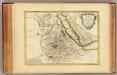
Carte de l'Abyssinie, du pays des Galla, de Choa et d'Ifat
1 : 2500000 dressée par Mrs. Combes et Tamisier dessinée par A. Vuillemin ; gravée par Massuet ; écrite par Martin ainé Paris : Desessart
Habessinia seu Abassia, presbyteri Johannis regio perperam dicta ... / Jobi Lodolfi [cart.] ; Christianus Ludolfus J. Filius delineavit ex autographo Parentis
1 : 2400000 Annotatie: Origineel is Blad 211 in atlas factice Jobus Ludolphus 1624-1704; Christianus Ludolfus [Amsterdam] : [s.n.]
Karte von Aethiopien (H'abeš, Takah & Ost-Senar)
1 : 2500000 Eritrea Heuglin, Theodor von Bruce Hermann Costenoble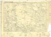
Carte internationale du monde au 1000,000 E
1 : 1000000 Súdán Sudan survey dept.
Countries In The Northern Tropical Regions of Africa.
Fullarton, A. & Co.
Abyssinia, surrounding countries.
1 : 6450000 Rand McNally and Company
AEthiopisches Hochland Alpenland Habesch und Vorstuffe von Darfur und Sennaar
Dárfúr (Súdán) Arrowsmith, John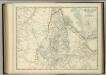
Upper Nubia and Abyssinia.
1 : 2854868 Johnston, W. & A.K.
Abyssinië in vogelvlucht gezien = Abyssinie vue a vol d'oiseau / Seghers
titelvariant: Abyssinie vue a vol d'oiseau; Annotatie: Gegevens verzameld over de periode/Data collected over the period: 1935; With photographs of current world leaders; Fragment: foto's van wereldleiders ontbreken; Annotatie geografische gegevens: Bijkaart: Van Gibraltar tot Abessinië = De Gibraltar a l'Abessinie W. Seghers Antwerpen [etc.] : [Patria, etc.]
[Kaart], uit: Colonie dell'Africa Orientale Italiana
1 : 4000000 Annotatie: Ondertitel op omslag: Eritrea - Somalia Italiana - Etiopia - Somalia Francese e Britannica; Annotatie geografische gegevens: Inzetkrt.: [Omgevingskaart]. - 1:50.000.000 Milano : Vallardi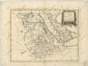
La Nubia ed Abissinia
Nubie, Abissinie.
1 : 7000000 Bonne, Rigobert, 1727-1794
Abessinien
1 : 5000000 Afrika východní Josef Ulbricht
Spezial-Karte von Afrika
1 : 4000000 Blatt 6 Habenicht, Hermann Perthes
Sudan and Ethiopia, Plate 87, V. IV
1 : 5000000 Bartholomew, John
Afrique Orientale.
1 : 7000000 Montemont, A.
Abessinien - Somaliländer
1 : 7500000 Etiopie Barich, Carl Justus Perthes
Egypt and the Nile.
1 : 5000000 John Bartholomew and Son
Ethiopia. Pergamon World Atlas.
1 : 5000000 Polish Army Topography Service
Spezial - karte von AfricaSektion Abessinien (6)
1 : 4000000 1 full d'1 mapa en 10 fulls i estoig Hermann Habenicht; Justus Perthes
Composite: NO Afrika.
1 : 5450000 Flemming, Carl
Ostafrika – Vých. Afrika

Nillander.
1 : 5000000 Weiland, C. F. (Carl Ferdinand), d. 1847
Ethiopia, Somalia, Kenya, Uganda, Rwanda, Tanzania, Burundi. Pergamon World Atlas.
Polish Army Topography Service