Maps of Scandinavia

Schweden, Norwegen, Daenemark.
1 : 4000000 Ziegler, J. M.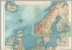
Northern Europe. Pergamon World Atlas.
1 : 5000000 Polish Army Topography Service
Schweden Daenemarck u. Norwegen
Dánsko Mollo, Tranquillo Tranquillo Mollo
[Ethnographische Karte von Europa]
Zweiter Band, enthaltend in vier Abtheilungen die Vertheilung der Organismen: 5. Pflanzen-Geographie, 6. Thier-Geographie, 7. Anthropographie, 8. Ethnographie Humboldt, Alexander von Verlag von Justus Perthes
Karte von Europa, 1
4 Blätter : 53 x 70 cm Verlag der Königlich-Preussischen Academie-Kunst- und Buchhandlung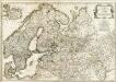
Europe 2.
1 : 2800000 Anville, Jean Baptiste Bourguignon d, 1697-1782
Kaart van Noorwegen, Denemarken, ijsland, Zweden, Finland, Engeland en de Noordzee / W. Seghers
1 : 4000000 Seghers, W. Antwerpen : Patria [etc.]
Dänemark, Island u Färöer, Schweden und Norwegen
Hand-Atlas über alle Theile der Erde nach dem neuesten Zustande und über das Weltgebäude Stieler, Adolf bei Justus Perthes
Evropa, 1
1 Blatt : mehrfarbig ; 49 x 57 cm Homännische Erben
Dänemark, Jsland u. Färöer, Schweden und Norwegen
Stieler's Hand-Atlas Stieler, Adolf bei Justus Perthes
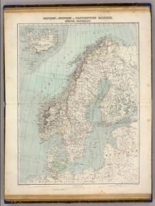
Länder der Nord- und Ostsee
1 : 10000000 Nordeuropa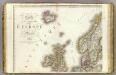
Europe 1.
1 : 3850000 Brue, Adrien Hubert, 1786-1832
Schonlandia XIII Nova Tabula [Karte], in: Claud. Ptolemaeus. Geographia lat. cum mappis [...], S. 389.
1 Karte aus Atlas Münster, Sebastian [und Ptolemaeus, Claudius]
Western part of the northern states including the British Islands Norway Denmark and part of Sweden
1 Blatt : 53 x 68 cm Sayer
Schonlandia XIII Nova Tabula [Karte], in: Geographia universalis vetus et nova complectens Claudii Ptolemaei Alexandrini enarrationis libros VIII, S. 335.
1 Karte aus Atlas Münster, Sebastian [und Ptolemaeus, Claudius]
Charte von Schweden und Norwegen
1 : 3700000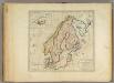
Sweden, Denmark, Norway and Finland.
1 : 6600000 Carey, Mathew
Missions catholiques des pays scandinaves
1 : 2200000 [Lyon : Oeuvre de la propagation de la foi]
Nordeuropa 1922
Nordeuropa Kunz, Andreas ; Treiling, Thomas
Spesielle kart 77: Bathymetrical and hypsometrical map of Norway
1 : 2400000 Kristiania Lithografiske Aktiebolag
Spannungen in Nordeuropa
1 : 5000000 Evropa severní List & von Bressensdorf
The countries of northern Europe

Sweden, Denmark, Norway and Finland.
1 : 6336000 Carey, Mathew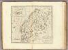
Sweden, Denmark, Norway and Finland.
1 : 8236800 Carey, Mathew
Sweden, Denmark, Norway and Finland.
1 : 8236800 Carey, Mathew
North Sea, Baltic cables, wireless stations.
1 : 12500000 Philip, George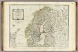
A new map of the Northern States containing the Kingdoms of Sweden, Denmark, and Norway.
1 : 4400000 Kitchin, Thomas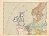
Evropa XIX. století: od vídeňského kongresu r. 1815, do rozhodnutí na frontách světové války r. 1918
Kašpar, Jan
Northern States.
1 : 4400000 Robert Laurie & James Whittle