Maps of Scandinavia

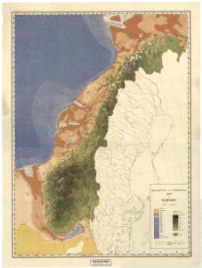
Spesielle kart 77: Bathymetrical and hypsometrical map of Norway
1 : 2400000 Kristiania Lithografiske Aktiebolag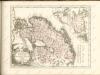

Nordeuropa 1922
Nordeuropa Kunz, Andreas ; Treiling, Thomas
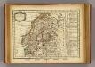
Sweden, Denmark, Norway and Finland.
1 : 6336000 Carey, Mathew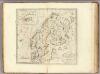
Sweden, Denmark, Norway and Finland.
1 : 8236800 Carey, Mathew
Sweden, Denmark, Norway and Finland.
1 : 8236800 Carey, Mathew
Statistikk kart 22: Tonnage de navires 1873
1 : 2400000
Spesielle kart 66-4: Kart udvisende de med bidrag af Statskassen understøttende Dampskibsrouter
1 : 2400000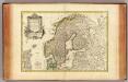
Suede, Danemarck et Norwege.
1 : 6900000 Janvier, Jean
Spesielle kart 129-3: Oversigtskart over fà ̧rste ordens trianguleringen og præcisionsnivellementet
1 : 2800000
Spesielle kart 130-2: Oversigt over tætbebyggelse, stà ̧rre industrielle bedrifter og vigtige gruber ...
1 : 2800000
Statistikk kart 23: Les marchandises exportees
1 : 2400000
Spesielle kart 62: Pflanzengeographisce Karte über das Königreich Norwegen
1 : 2000000
Schweden und Norwegen oder Scandinavische Halbinsel Königr. Daenemark
Geographischer Atlas über alle Theile der Erde Ziegler, Jakob Melchior Verlag von Joh. Wurster um Comp.
Spesielle kart 66-5: Kart udvisende de med bidrag af Statskassen understøttende Dampskibsrouter
1 : 2400000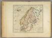
Sweden, Denmark, Norway and Finland.
1 : 6600000 Carey, Mathew

Suede, Danemark.
1 : 4650000 Andriveau-Goujon, J.
La Scandinavie.
1 : 4200000 Lapie, M. (Pierre), 1779-1850

Statistikk 9- Norvege. Mouvement de la population
1 : 2400000
Charte von Schweden und Norwegen
1 : 3700000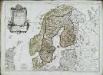
Les couronnes du Nord comprenant les royaumes de Suede Danemarck et Norwege
1 Karte : Kupferdruck ; 46 x 64 cm Janvier; Lattré; Choffard chés Lattré graveur rue Saint Jacques au coin de celle de la parcheminerie à la ville de Bordeaux
Statistikk kart 20- Fremstilling af den Norske Fædrift. Hesten. Dyrenes antal pr. 1000 Maal afhøstet areal
1 : 2400000
[Scandinavien und Dänemark]
[Allgemeiner Atlas über alle Theile der Erde in 29 Blättern] Ziegler, Jakob Melchior Top. Anstalt v. J. Wurster u. Comp.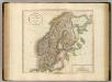
Sweden, Denmark and Norway.
1 : 4550000 Cary, John, ca. 1754-1835
Sweden, Denmark, Norway (outline)
1 : 8500000 Patteson, Edward
Sweden, Denmark, Norway.
1 : 8500000 Patteson, Edward
The Scandinavian kingdoms Norway, Sweden & Denmark.
1 : 4900000 Warner & Beers