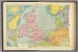
Maps of United Kingdom

Western part of the northern states including the British Islands Norway Denmark and part of Sweden
1 Blatt : 53 x 68 cm Sayer
Karte von Europa, 1
4 Blätter : 53 x 70 cm Verlag der Königlich-Preussischen Academie-Kunst- und Buchhandlung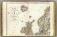
Europe 1.
1 : 3850000 Brue, Adrien Hubert, 1786-1832
Evropa, 1
1 Blatt : mehrfarbig ; 49 x 57 cm Homännische Erben
Dänemark, Jsland u. Färöer, Schweden und Norwegen
Stieler's Hand-Atlas Stieler, Adolf bei Justus Perthes
Dänemark, Island u Färöer, Schweden und Norwegen
Hand-Atlas über alle Theile der Erde nach dem neuesten Zustande und über das Weltgebäude Stieler, Adolf bei Justus Perthes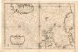
Museumskart 155: Carte Réduite De Partie De La Mer Du Nord
1 : 3000000 S. Bellin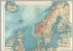
Northern Europe. Pergamon World Atlas.
1 : 5000000 Polish Army Topography Service
Schweden, Norwegen, Daenemark.
1 : 4000000 Ziegler, J. M.
[Ethnographische Karte von Europa]
Zweiter Band, enthaltend in vier Abtheilungen die Vertheilung der Organismen: 5. Pflanzen-Geographie, 6. Thier-Geographie, 7. Anthropographie, 8. Ethnographie Humboldt, Alexander von Verlag von Justus Perthes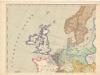
Evropa XIX. století: od vídeňského kongresu r. 1815, do rozhodnutí na frontách světové války r. 1918
Kašpar, Jan
Länder der Nord- und Ostsee
1 : 10000000 Nordeuropa
Kaart van Noorwegen, Denemarken, ijsland, Zweden, Finland, Engeland en de Noordzee / W. Seghers
1 : 4000000 Seghers, W. Antwerpen : Patria [etc.]
Schweden Daenemarck u. Norwegen
Dánsko Mollo, Tranquillo Tranquillo Mollo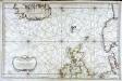
Carte réduite de partie de la mer du Nord comprise entre l'Ecosse, le Dannemark, la Norwege et l'Islande
1 Karte : Kupferdruck ; 55 x 83 cm Bellin s.n.
North Sea, Baltic cables, wireless stations.
1 : 12500000 Philip, George
Tabula Nova Hibernie Anglie Et Scotie [Karte], in: Claudii Ptolemei viri Alexandrini mathematice discipline philosophi doctissimi geographie opus [...], S. 236.
1 Karte aus Atlas Waldseemüller, Martin [und Ptolemaeus, Claudius] Übelin, Georg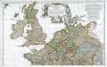
Prémière partie de la carte d'Europe contenant la France, l'Alemagne, l'Italie, l'Espagne & les isles britanniq.s, 1
1 Blatt : 53 x 84 cm s.n.
Carte generale de toute l'Europe, 1
1 Blatt : 57 x 48 cm J.M. Will
Pas Caart van de Noort Zee .. Verthoonende in zich alle de Custen en Havens daer rontom gelegen. [Karte], in: De Nieuwe Groote Vermeerderde Zee-Atlas ofte Water-Werelt, S. 15.
1 Karte aus Atlas Doncker, Hendrick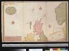
Nieuwe paskaert vant Noorderdeel der Noord Zee als meede een gedeelte van de West cust van Schotlant en Irland seer dienstigh voor de kruijsers op de Oostindise scheepen
Scotland Gerard van Keulen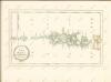
Tabula Europae I. [Karte], in: Claud. Ptolemaeus. Geographia lat. cum mappis [...], S. 254.
1 Karte aus Atlas Münster, Sebastian [und Ptolemaeus, Claudius]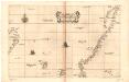
Museumskart 17 Kart over Norskehavet med Island, Færøyene, Shetland og norskekysten
1 : 500000 Robert Dudley
Mare Germanicum ac tractus maritimus retro Hiberniam et Scotiam
1 Karte : Kupferdruck ; 47 x 56 cm Renard apud L. Renard
[123][126] Pascaert vande Noort-Zee om achter Yrland en Schotland om te seylen, uit: Atlas sive Descriptio terrarum orbis
Annotatie: Gedigitaliseerde versie. Amsterdam. Heiloo : Picturae (vervaardiger), 2015. tiff-bestand. Gedigitaliseerd: 07-01-2015; Origineel: Universiteitsbibliotheek Vrije Universiteit (XL.05127.-) ; Netherlands; Titelpagina ontbreekt Wit, Frederik de Amsterdam : Frederick de Wit
Tabula Europae I. [Karte], in: Geographia universalis vetus et nova complectens Claudii Ptolemaei Alexandrini enarrationis libros VIII, S. 222.
1 Karte aus Atlas Münster, Sebastian [und Ptolemaeus, Claudius]
Pas caart van de Noort Zee
1 Karte : Kupferdruck ; 43 x 53 cm Doncker by Hendrick Doncker boeckverkooper en graadbooghmaker in de nieuwbrugh steegh in 't Stuurmans gereedschap
British Isles - Physical Geography..
Milner, Thomas