Maps of Texas

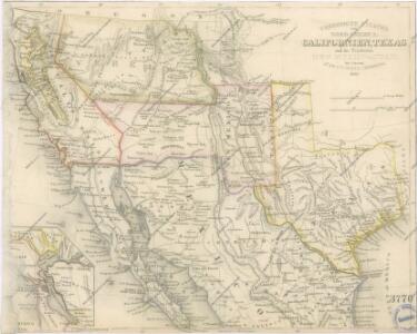
Vereinigte Staaten von Nord America : Californien, Texas und die Territorien New Mexico u. Utah

Map of California New Mexico Texas &c.
1 : 5300000 Tanner, Henry S.
U.S. West, Mexico North.
1 : 6589440 Letts, Son & Co.
Texas, Calif., N. Mexico.
1 : 7600000 Society for the Diffusion of Useful Knowledge (Great Britain)
Sante Fe Route and connections.
1 : 6000000 Atchison, Topeka, and Santa Fe Railroad Company
Map Of Texas And The Countries Adjacent.
1 : 4562000 Emory, William H.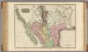
Spanish dominions in North America, northern part.
1 : 4500000 Pinkerton, John, 1758-1826
Black and White Mileage Map of the United States (western half).
1 : 5132000 Rand McNally and Company
Carta de los reconocimientos hechos en 1602.
1 : 3950000 Martinez de Palacios, Geronimo
Map of The Internal Provinces of New Spain.
1 : 4815360 Pike, Zebulon Montgomery
Texas
Grosser Hand-Atlas über alle Theile der Erde in 170 Karten Meyer, J. Verlag des Bibliographischen Instituts
Texas.
1 : 7200000 Radefeld, Carl Christian Franz, 1788-1874
Map of Mexico Showing the Seat of War.
1 : 15400000 Sinclair, Thomas
Carta Esferica de los Reconocimientos Hechos en la Costa N.O.
1 : 7500000 Espinosa y Tello, J.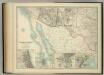
United States of North America (South West Sheet).
1 : 3984000 Johnston, W. & A.K.
Californias.
1 : 6600000 Farnham, Thomas Jefferson, 1804-1848
Route of the California Limited.
1 : 20000000 Atchison, Topeka, and Santa Fe Railroad Company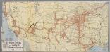
The Atchison, Topeka and Santa Fe railway system
1 : 3500000 New York, N.Y. : Montross & Clarke
54. Areas irrigated 1889.
1 : 7000000 Gannett, Henry, 1846-1914; United States. Census Office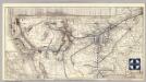
Santa Fe.
1 : 9380000 Atchison, Topeka, and Santa Fe Railroad Company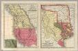
Geographical Description Of The State Of Texas.
1 : 10137600 Thomas, Cowperthwait & Co.
Carte générale du royaume de la Nouvelle Espagne depuis le parallèle de 16° jusqu'au parallèle de 38° (latitude nord)
1 : 3400000 Humboldt, Alexander von Barrière, cle père
Composite: Nouvelle Espagne.
1 : 3000000 Humboldt, Alexander von, 1769-1859
Carte Militaire des Etats - Unis (Partie Occidentale).
1 : 5800000 Jouvet et Cie.
North America, S.W. Sheet.
1 : 7600000 Tanner, Henry S.
(U.S. Southwest, Mexico) Railroad Map of the United States.
1 : 1140480 Rand McNally and Company
Etats Unis Flle. S.O.
1 : 5000000 Vivien St Martin, L.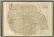
Western States.
1 : 5000000 Black, Adam & Charles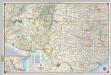
Shell Sectional Map No. 10 - Southwestern States.
1 : 3104640 Shell Oil Company