Maps of Chihuahuan Desert

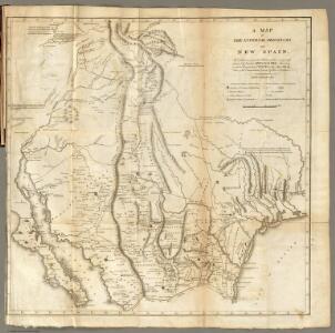
Map of The Internal Provinces of New Spain.
1 : 4815360 Pike, Zebulon Montgomery
Vereinigte Staaten von Nord America : Californien, Texas und die Territorien New Mexico u. Utah

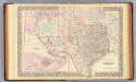
Texas
Grosser Hand-Atlas über alle Theile der Erde in 170 Karten Meyer, J. Verlag des Bibliographischen Instituts
Texas.
1 : 7200000 Radefeld, Carl Christian Franz, 1788-1874
Map of California New Mexico Texas &c.
1 : 5300000 Tanner, Henry S.
Map of Mexico Showing the Seat of War.
1 : 15400000 Sinclair, Thomas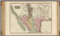
Spanish dominions in North America, northern part.
1 : 4500000 Pinkerton, John, 1758-1826
Carte générale du royaume de la Nouvelle Espagne depuis le parallèle de 16° jusqu'au parallèle de 38° (latitude nord)
1 : 3400000 Humboldt, Alexander von Barrière, cle père
Composite: Nouvelle Espagne.
1 : 3000000 Humboldt, Alexander von, 1769-1859
Shell Sectional Map No. 10 - Southwestern States.
1 : 3104640 Shell Oil Company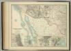
United States of North America (South West Sheet).
1 : 3984000 Johnston, W. & A.K.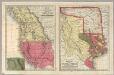
Geographical Description Of The State Of Texas.
1 : 10137600 Thomas, Cowperthwait & Co.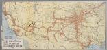
The Atchison, Topeka and Santa Fe railway system
1 : 3500000 New York, N.Y. : Montross & Clarke
Map of the Indian Territory, Northern Texas and New Mexico.
from Supplement to the New York observer.
Etats Unis Flle. S.O.
1 : 5000000 Vivien St Martin, L.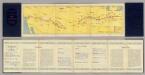
Air Route from Los Angeles to Columbus.
1 : 5702400 Transcontinental Air Transport, Inc.
Charte pour servir au voyage des cap.es Lewis et Clarke a l'ocean Pacifique 1804
Severní Amerika
Californias.
1 : 6600000 Farnham, Thomas Jefferson, 1804-1848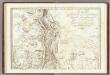
Carte Generale Du Royaume De La Nouvelle Espagne.
1 : 3000000 Humboldt, Alexander von, 1769-1859
U.S. West of Mississippi R. 5.
1 : 2000000 Freyhold, Edward; Warren, Gouverneur Kemble, 1830-1882; United States. Army. Corps of Engineers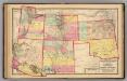
Kansas, and Arizona, Colorado, New Mexico, Utah, and Indian Territory.
1 : 3000000 Lloyd, H.H.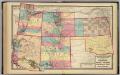
Kansas, and Arizona, Colorado, New Mexico, Utah, and Indian Territory.
1 : 3000000 Walling, H. F.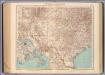
143-44. N.M., Okla., Tex.
1 : 3000000 Touring club italiano
Map Of The States Of Kansas And Texas And Indian Territory.
1 : 1500000 U.S. War Department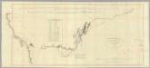
Military Reconnaissance Of The Arkansas Rio Del Norte And Rio Gila.
1 : 1520640 Emory, William H.
Texas.
1 : 6800000 Mitchell, Samuel Augustus
U.S.A. Great Plains South, Plate 109, Vol. V
1 : 2500000 Bartholomew, John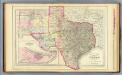
Texas.
1 : 3200000 Mitchell, Samuel Augustus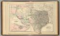
Texas.
1 : 3200000 Mitchell, Samuel Augustus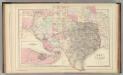
Texas.
1 : 3200000 Mitchell, Samuel Augustus Jr.