Maps of Great Plains
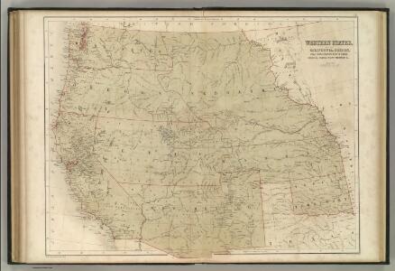
Western States.
1 : 5000000 Black, Adam & Charles
Oregon, Californien, Utah, New Mexico, etc.
1 : 10800000 Lange, Henry, 1821-1893.
California and the Western Territories.
1 : 8100000 Schonberg & Co.
Skeleton Map Of the Territory of the United States west of the Mississippi River.
1 : 6000000 Wheeler, G.M.
209-210. United States of America, West. The World Atlas.
1 : 5000000 USSR (Union of Soviet Socialist Republics).
Colton's Map Of The States And Territories West Of The Mississippi River.
1 : 3105000 Colton, J. H.
Progress Map Of Lines And Areas Of Explorations And Surveys.
1 : 6000000 Wheeler, G.M.
Progress Map Of Lines And Areas Of Explorations And Surveys.
1 : 6000000 Wheeler, G.M.
Watson's New County and Railroad Map of the Western States and Territories.
1 : 2534400 Watson, Gaylord
1882. Progress Map Of The U.S. Geographical Surveys West Of The 100th Meridian.
1 : 6000000 Wheeler, G.M.
1880. Progress Map Of The U.S. Geographical Surveys West Of The 100th Meridian.
1 : 6000000 Wheeler, G.M.
1878. Progress Map Of The U.S. Geographical Surveys West Of The 100th Meridian.
1 : 6000000 Wheeler, G.M.
1878. Progress Map Of The U.S. Geographical Surveys West Of The 100th Meridian.
1 : 6000000 Wheeler, G.M.
1878. Progress Map Of The U.S. Geographical Surveys West Of The 100th Meridian.
1 : 6000000 Wheeler, G.M.
1876. Progress Map Of The U.S. Geographical Surveys West Of The 100th Meridian.
1 : 6000000 Wheeler, G.M.
1875. Progress Map Of The Geographical Surveys West Of The 100th Meridian.
1 : 6000000 Wheeler, G.M.
Map Of The Areas Of Drainage To The Atlantic And Pacific Oceans.
1 : 6000000 Wheeler, G.M.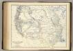
United States W.
1 : 4748000 Johnston, Alexander Keith, 1804-1871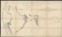
Map of an exploring expedition to the Rocky Mountains in the year 1842 and to Oregon & north California in the years 1843-44
1 : 2000000 Frémont, John Charles United States. Congress. Senate
Black and White Mileage Map of the United States (western half).
1 : 5132000 Rand McNally and Company
West-Indien, Central-Amerika bis zum südlichen Canada in 4 Blättern
1 : 7500000 Nordwest-Blatt Petermann, August Heinrich ; Habenicht, H. Justus Perthes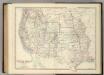
Western United States.
1 : 6047811 Johnston, Alexander Keith
U.S. Western.
1 : 8870400 Letts, Son & Co.
Map of Oregon, California, New Mexico, N.W. Texas & ... Ne-Bras-Ka.
1 : 4600000 Sage, Rufus B.
Etats Unis. Flle. N.O.
1 : 5000000 Vivien St Martin, L.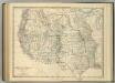
Western United States.
1 : 6047811 Johnston, Alexander Keith
Map Showing The General Topographical Features ... West of the Mississippi River.
1 : 6000000 Wheeler, G.M.
Die Atlantischen Staaten zwischen Washington & Boston, Blatt 1]
Adolf Stieler's Handatlas über alle Theile der Erde und über das Weltgebäude Stieler, Adolf Justus Perthes
United States