Maps of Great Plains

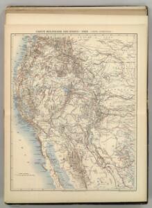
Carte Militaire des Etats - Unis (Partie Occidentale).
1 : 5800000 Jouvet et Cie.
54. Areas irrigated 1889.
1 : 7000000 Gannett, Henry, 1846-1914; United States. Census Office
Shell Highway Map of Western United States.
1 : 4752000 Shell Oil Company
United States

Black and White Mileage Map of the United States (western half).
1 : 5132000 Rand McNally and Company
U.S. Western.
1 : 8870400 Letts, Son & Co.
Vereinigte Staaten von NordAmer(ika, nebst Mexico und Centralamerika, West)
1 : 7000000 Stein, Christ. Gottfr. Dan.
National Map Of The Territory Of The United States.
1 : 3801600 Keeler, William J.
United States W.
1 : 4748000 Johnston, Alexander Keith, 1804-1871
Western United States.
1 : 6047811 Johnston, Alexander Keith
Cordilleras.
1 : 3801600 King, Clarence
Map Of Mexico & California.
1 : 6000000 Hutawa, Julius
Western United States.
1 : 6047811 Johnston, Alexander Keith
Map Showing The General Topographical Features ... West of the Mississippi River.
1 : 6000000 Wheeler, G.M.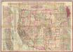
Watson's New County and Railroad Map of the Western States and Territories.
1 : 2534400 Watson, Gaylord
West-Indien, Central-Amerika bis zum südlichen Canada in 4 Blättern
1 : 7500000 Nordwest-Blatt Petermann, August Heinrich ; Habenicht, H. Justus Perthes
Map Of The Territory Of The United States From The Mississippi River To The Pacific Ocean.
1 : 3041280 Warren, Gouverneur Kemble, 1830-1882
United States - western section.
1 : 5000000 John Bartholomew & Co.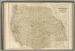
Western States.
1 : 5000000 Black, Adam & Charles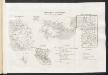
[Ergänzungen und Berichtigungen]
Geographischer Atlas über alle Theile der Erde Ziegler, Jakob Melchior Verlag von Dietrich Reimer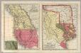
Geographical Description Of The State Of Texas.
1 : 10137600 Thomas, Cowperthwait & Co.
Commercial Map, Denver to Pacific Coast.
1 : 3950000 Rand McNally and Company
1882. Progress Map Of The U.S. Geographical Surveys West Of The 100th Meridian.
1 : 6000000 Wheeler, G.M.
1880. Progress Map Of The U.S. Geographical Surveys West Of The 100th Meridian.
1 : 6000000 Wheeler, G.M.
1878. Progress Map Of The U.S. Geographical Surveys West Of The 100th Meridian.
1 : 6000000 Wheeler, G.M.
1878. Progress Map Of The U.S. Geographical Surveys West Of The 100th Meridian.
1 : 6000000 Wheeler, G.M.
1878. Progress Map Of The U.S. Geographical Surveys West Of The 100th Meridian.
1 : 6000000 Wheeler, G.M.
1876. Progress Map Of The U.S. Geographical Surveys West Of The 100th Meridian.
1 : 6000000 Wheeler, G.M.
1875. Progress Map Of The Geographical Surveys West Of The 100th Meridian.
1 : 6000000 Wheeler, G.M.