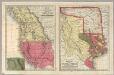
Maps of California
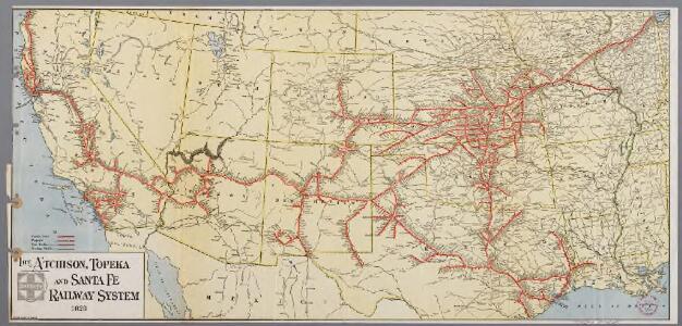
The Atchison, Topeka and Santa Fe railway system
1 : 3500000 New York, N.Y. : Montross & Clarke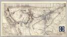
Santa Fe.
1 : 9380000 Atchison, Topeka, and Santa Fe Railroad Company
Route of the California Limited.
1 : 20000000 Atchison, Topeka, and Santa Fe Railroad Company
1882. Progress Map Of The U.S. Geographical Surveys West Of The 100th Meridian.
1 : 6000000 Wheeler, G.M.
1880. Progress Map Of The U.S. Geographical Surveys West Of The 100th Meridian.
1 : 6000000 Wheeler, G.M.
1878. Progress Map Of The U.S. Geographical Surveys West Of The 100th Meridian.
1 : 6000000 Wheeler, G.M.
1878. Progress Map Of The U.S. Geographical Surveys West Of The 100th Meridian.
1 : 6000000 Wheeler, G.M.
1878. Progress Map Of The U.S. Geographical Surveys West Of The 100th Meridian.
1 : 6000000 Wheeler, G.M.
1876. Progress Map Of The U.S. Geographical Surveys West Of The 100th Meridian.
1 : 6000000 Wheeler, G.M.
1875. Progress Map Of The Geographical Surveys West Of The 100th Meridian.
1 : 6000000 Wheeler, G.M.
Map Of The Areas Of Drainage To The Atlantic And Pacific Oceans.
1 : 6000000 Wheeler, G.M.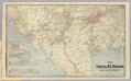
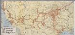
Sante Fe Route and connections.
1 : 6000000 Atchison, Topeka, and Santa Fe Railroad Company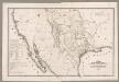
Map Of Texas And The Countries Adjacent.
1 : 4562000 Emory, William H.
Progress Map Of Lines And Areas Of Explorations And Surveys.
1 : 6000000 Wheeler, G.M.
Progress Map Of Lines And Areas Of Explorations And Surveys.
1 : 6000000 Wheeler, G.M.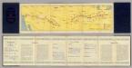
Air Route from Los Angeles to Columbus.
1 : 5702400 Transcontinental Air Transport, Inc.
Carta de los reconocimientos hechos en 1602.
1 : 3950000 Martinez de Palacios, Geronimo
U.S. West, Mexico North.
1 : 6589440 Letts, Son & Co.
Texas, Calif., N. Mexico.
1 : 7600000 Society for the Diffusion of Useful Knowledge (Great Britain)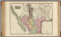
Spanish dominions in North America, northern part.
1 : 4500000 Pinkerton, John, 1758-1826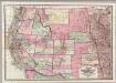
Colton's Map Of The States And Territories West Of The Mississippi River.
1 : 3105000 Colton, J. H.
Map of California New Mexico Texas &c.
1 : 5300000 Tanner, Henry S.
Texas.
1 : 7200000 Radefeld, Carl Christian Franz, 1788-1874
Vereinigte Staaten von Nord America : Californien, Texas und die Territorien New Mexico u. Utah

Texas
Grosser Hand-Atlas über alle Theile der Erde in 170 Karten Meyer, J. Verlag des Bibliographischen Instituts
Reduced section, sketch, W. pt. of North America, 1818.
1 : 18000000 Warren, Gouverneur Kemble, 1830-1882
Skeleton Map Of the Territory of the United States west of the Mississippi River.
1 : 6000000 Wheeler, G.M.
Charte pour servir au voyage des cap.es Lewis et Clarke a l'ocean Pacifique 1804
Severní Amerika
Map of the Indian Territory, Northern Texas and New Mexico.
from Supplement to the New York observer.