Maps of Oxford
Oxfordshire XXXIII.SE - OS Six-Inch Map
1 : 10560 Topographic maps Ordnance Survey Ordnance Survey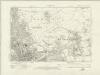
Oxfordshire XXXIII.SE - OS Six-Inch Map
1 : 10560 Topographic maps Ordnance Survey Ordnance Survey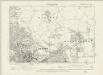
Oxfordshire XXXIII.SE - OS Six-Inch Map
1 : 10560 Topographic maps Ordnance Survey Ordnance Survey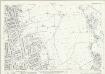
Oxfordshire XXXIII.11 (includes: Marston; Oxford) - 25 Inch Map
1 : 2500 Topographic maps Ordnance Survey Ordnance Survey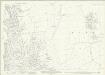
Oxfordshire XXXIII.11 (includes: Marston; Oxford) - 25 Inch Map
1 : 2500 Topographic maps Ordnance Survey Ordnance Survey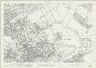
Oxfordshire XXXIII.15 (includes: Marston; Oxford) - 25 Inch Map
1 : 2500 Topographic maps Ordnance Survey Ordnance Survey
Oxfordshire XXXIII.16 (includes: Forest Hill with Shotover; Marston; Oxford) - 25 Inch Map
1 : 2500 Topographic maps Ordnance Survey Ordnance Survey
Oxfordshire XXXIII.16 (includes: Forest Hill with Shotover; Marston; Oxford) - 25 Inch Map
1 : 2500 Topographic maps Ordnance Survey Ordnance Survey
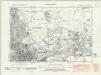
Oxfordshire XXXIII.12 (includes: Beckley and Stowood; Elsfield; Marston; Oxford) - 25 Inch Map
1 : 2500 Topographic maps Ordnance Survey Ordnance Survey
Oxfordshire XXXIII.12 (includes: Beckley and Stowood; Elsfield; Marston; Oxford) - 25 Inch Map
1 : 2500 Topographic maps Ordnance Survey Ordnance Survey
Oxfordshire XXXIII.12 (includes: Beckley and Stowood; Elsfield; Marston; Oxford) - 25 Inch Map
1 : 2500 Topographic maps Ordnance Survey Ordnance Survey
University and city of Oxford
1 : 1
Plan of and] Elevation of East Front next the Center Avenue of the new Market Oxford
Plan of the new market of Oxford and a elevation of its east front. A handwritten and signed note on this drawing explains "2nd Oct 1773 the Plan & Elevation referred to by certain articles of agreement executed this Day between us". This agreement was between the Corporation and the builder.The names are Fran. Randolph, Wm. Wickham, Rich. Fawney, R. Kirby, John Phillipe, Phip. Ward, Edwd. Fawney, Wm. Green.
Plan of Magdalen Bridge and the streets of Oxford
"Plan of Magdalen Bridge as at present with parts adjacent", being the original design for removal of the east gate and for forming a new road to St Clements. Magdalen Bridge, which crossed the River Charwell,was designed by John Gwynn of Shrewsbury (1713-1786) Surveyor to the Commissioners of the Oxford Paving Act. It was built between 1772 and 1782. Gwynn was a largely self taught architect and surveyor and he worked on Christopher Wren’s plan for rebuilding St Paul’s Cathedral, many public buildings in Oxford such as the workhouse and covered market and a bridge across the River Severn in Shrewsbury. Magdalen bridge became a focal point for Oxford town and every year May Day celebrations are held there- Choristers traditionally sing from the Tower of Magdalen College, which is located at one end of the bridge.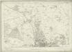
Berkshire II - OS Six-Inch Map
1 : 10560 Topographic maps Ordnance Survey Ordnance Survey
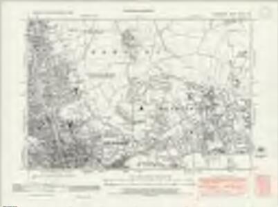
Oxfordshire XXXIII - OS Six-Inch Map
1 : 10560 Topographic maps Ordnance Survey Ordnance Survey
SP50 - OS 1:25,000 Provisional Series Map
1 : 25000 Topographic maps Ordnance Survey Ordnance Survey
Ot Moor
1 : 31680 .The county border between Oxfordshire and Buckinghamshire is indicated on this map by a red dotted line near the left margin., Ot Moor, an area of some 4,000 acres of fenland, appears at the centre of the drawing., Depicted around the moor are the remains of ancient woodlands: Prattle Woods, Horton Spinney, Studley Wood and Whitecross Green Wood. Stanley, William
A topographical map, of the county, of Berks, Blatt X und XVI
2 Blätter : 99 x 52 cm John Rocque
Wallingford
1 : 31680 This drawing covers part of the Thames Valley in the counties of Buckinghamshire, Berkshire and Oxfordshire. The plan is oriented to the east, with a compass depicted at middle right. Symbols distinguish woodland, heathland, arable enclosed land and formal parkland. Brushstroke interlining indicates relief and hills. The River Thames is depicted in the lower part of the sheet, meandering through Oxfordshire between Oxford and Wallingford. Stanley, William
Oxford and Newbury - OS One-Inch Map
1 : 63360 Topographic maps Ordnance Survey Ordnance Survey
Banbury - OS One-Inch Map
1 : 63360 Topographic maps Ordnance Survey Ordnance Survey
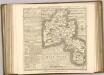
Hamp Shire ; Berk Shire ; Wilt Shire
1 : 330000 Berkshire (Anglie) Moll, Herman
A map of the county of Berks
1 Karte : Kupferdruck ; 43 x 66 cm Rocque; Rocque published according to act of parliament by Mary Ann Rocque near old Round Court in the Strand
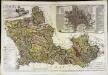
An accurate map of Berkshire
1 Karte : Kupferdruck ; 52 x 68 cm Bowen; Tinney; Bowles; Sayer; Bowles; Bowles sold by I. Bowles and son in Cornhill T. Bowles in St. Pauls church yard I. Tinney at the Golden Lion and R. Sayer at the Golden Buck in Fleet street
Bercheria vernacule Bark Shire
1 Karte : Kupferdruck ; 37 x 48 cm Blaeu Joan Blaeu
A new improved map of Oxfordshire
1 Karte : Kupferdruck ; 69 x 51 cm Kitchin; Hinton sold by J. Hinton at the Kings Arms in St. Pauls Church Yard