Maps of Cherwell

Banbury - OS One-Inch Map
1 : 63360 Topographic maps Ordnance Survey Ordnance Survey
Bicester
1 : 31680 Enclosed farmland dominates the landscape of this part of Oxfordshire. Heythrop Park, at top left, and Middleton Park and Kirtlington Park, in the centre, are fine examples of 17th-century formal park landscapes. Stanley, William
Towcester
1 : 31680 This drawing covers parts of Northamptonshire, Oxfordshire and Warwickshire. Different types of land use are distinguished symbolically, with relief indicated by brushstroke interlining ('hachuring'). The Watling Street is depicted down the right of the sheet forming the boundary of the surveyed area. This Roman road ran from London to Wroxeter in Wales, via St. Albans and Leicester (where it intersected the Fosse Way, the Roman road from Exeter to Lincoln).
Banbury (Hills) - OS One-Inch Revised New Series
1 : 63360 Topographic maps Ordnance Survey Ordnance Survey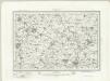
Banbury (Outline) - OS One-Inch Revised New Series
1 : 63360 Topographic maps Ordnance Survey Ordnance Survey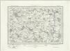
Chipping Norton (Outline) - OS One-Inch Revised New Series
1 : 63360 Topographic maps Ordnance Survey Ordnance Survey
Chipping Norton (Hills) - OS One-Inch Revised New Series
1 : 63360 Topographic maps Ordnance Survey Ordnance Survey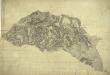
Woodstock
1 : 31680 The map of the area surrounding the Royal Wychwood Forest and Oxford was drawn by teaching draughtsman at the Tower of London, William Stanley. After inaccuracies were found in the plan during routine checks in 1820, Stanley hastened to explain that the employment by the Board of Ordnance of local civilian surveyors "of various abilities" to carry out much of the mapping meant that accuracy was often sacrificed for speed as these civilian personnel were paid according to the number of miles surveyed and drawn. An ochre-coloured turnpike road forms a boundary from Shipton Down at the top left of the map to Yarnton at the centre right. The cumulative mileage appears alongside the route in figures. The close attention Stanley pays to communication routes emphasises the military focus of these studies. Stanley, William
Oxford (Hills) - OS One-Inch Revised New Series
1 : 63360 Topographic maps Ordnance Survey Ordnance Survey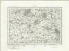
Oxford (Outline) - OS One-Inch Revised New Series
1 : 63360 Topographic maps Ordnance Survey Ordnance Survey
Shipston-on-Stour
1 : 31680 This area at the edge of the Cotswolds is dominated by enclosed farmland. Depicted at top left is the Fosse Way, the old Roman road running from Exeter to Lincoln, via Bath, Cirencester and Leicester (where it intersected the Watling Street from London).
Ot Moor
1 : 31680 .The county border between Oxfordshire and Buckinghamshire is indicated on this map by a red dotted line near the left margin., Ot Moor, an area of some 4,000 acres of fenland, appears at the centre of the drawing., Depicted around the moor are the remains of ancient woodlands: Prattle Woods, Horton Spinney, Studley Wood and Whitecross Green Wood. Stanley, William
Banbury
1 : 31680 .This plan of part of Oxfordshire features Nadbury Camp at the top left. An iron-age hill fort, the camp overlooks the site of the Battle of Edgehill, fought in 1642 during the English Civil War. Tollgates and turnpikes appear on all major roads in the region. The earliest of these was established in the 17th century, using tolls to pay for the upkeep of the road network. Stevens, Henry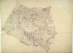
Ladbroke
1 : 31680 This part of Warwickshire is dominated by enclosed land, characterised by regular hedgerows and fish ponds for watering stock. A section of the Oxford Canal, between Napton and Croperdy, is depicted in blue along the right side of the sheet. Completed in 1790, the canal was used to ferry coal from the north to Oxford. At top left, forming the boundary of the surveyed area, is the Fosse Way. This Roman road ran from Exeter to Lincoln via Bath, Cirencester and Leicester (where it intersected the Watling Street from London). At lower right, the county border between Warwickshire and Northamptonshire is indicated by a red dotted line. Stevens, Henry
Buckingham (Hills) - OS One-Inch Revised New Series
1 : 63360 Topographic maps Ordnance Survey Ordnance Survey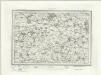
Buckingham (Outline) - OS One-Inch Revised New Series
1 : 63360 Topographic maps Ordnance Survey Ordnance Survey
Towcester (Hills) - OS One-Inch Revised New Series
1 : 63360 Topographic maps Ordnance Survey Ordnance Survey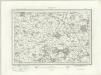
Towcester (Outline) - OS One-Inch Revised New Series
1 : 63360 Topographic maps Ordnance Survey Ordnance Survey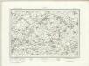
Thame (Outline) - OS One-Inch Revised New Series
1 : 63360 Topographic maps Ordnance Survey Ordnance Survey
Thame (Hills) - OS One-Inch Revised New Series
1 : 63360 Topographic maps Ordnance Survey Ordnance Survey
Worminghall
1 : 31680 The border between Buckinghamshire and Oxfordshire is drawn as a red dashed line along the path of the River Thame, near the bottom of the map., Worminghall is on the Buckinghamshire side of the border., Soft pencil rays criss-cross the map, used by the surveyor when taking measurements between fixed points., These are most clearly visible at 'Brill on the Mill' near the top of the plan. Stanley, William
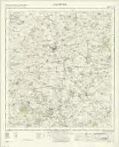
SP64 - OS 1:25,000 Provisional Series Map
1 : 25000 Topographic maps Ordnance Survey Ordnance Survey
SP63 - OS 1:25,000 Provisional Series Map
1 : 25000 Topographic maps Ordnance Survey Ordnance Survey
SP62 - OS 1:25,000 Provisional Series Map
1 : 25000 Topographic maps Ordnance Survey Ordnance Survey
SP54 - OS 1:25,000 Provisional Series Map
1 : 25000 Topographic maps Ordnance Survey Ordnance Survey
SP61 - OS 1:25,000 Provisional Series Map
1 : 25000 Topographic maps Ordnance Survey Ordnance Survey
SP53 - OS 1:25,000 Provisional Series Map
1 : 25000 Topographic maps Ordnance Survey Ordnance Survey
SP52 - OS 1:25,000 Provisional Series Map
1 : 25000 Topographic maps Ordnance Survey Ordnance Survey
SP44 - OS 1:25,000 Provisional Series Map
1 : 25000 Topographic maps Ordnance Survey Ordnance Survey