Maps of Europe

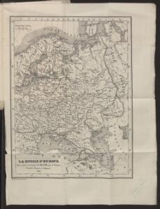
La Russie d'Europe
Russland Bielaerts, J. B.
Europäisches Russland
1 : 20500000 Russland / Europäischer Teil
Des Russischen Reichs Europäischer Theil
Stieler's Hand-Atlas Stieler, Adolf bei Justus Perthes
Karte der Vergrösserungen Russlands unter Peter dem Grossen und seinen Nachfolgern
Russland Peter I.
Karte der Vergrösserungen Russlands unter Peter dem Grossen und seinen Nachfolgern
Russland Peter I.
Europäisches Russland
1 : 14500000 Russland / Europäischer Teil
Europaeisches Russland mit Kasan, Astrachan und Georgien
Russland / Europäischer Teil
Karte der Bevölkerung Russlands im 9. Jahrhundert
Russland Bevölkerungsdichte
Ruszland
1 : 18000000 Russland / Europäischer Teil
Russia.
1 : 7760000 Johnson, A.J.
Russia.
1 : 7760000 Johnson, A.J.
Europaeisches Russland mit Kasan, Astrachan und Georgien
Schul-Atlas über alle Theile der Erde nach dem neuesten Zustande, und über das Weltgebäude Stieler, Adolf bei Justus Perthes
Russland
1 : 15000000 Russland / Europäischer Teil
Karte der Bevölkerung Russlands im 19. Jahrhundert
Russland Bevölkerungsdichte
TABVLA | RVSSIÆ | ex autographo, quod delineandum | curavit Foedor filius Tzaris Boris desum- | ta; et ad fluvios Dwinam, Zuchanam, aliaque | loca, quantum ex tabulis ex notitiis ad nos dela- | tis fieri potuit, amplificata...
Amstelodami, | Excusum Apud Guiljelmum Blaeu
Wirtschaftskarten I. Rußland
1 : 18000000 Russland / Europäischer Teil Wirtschaft
Europäisches Russland
1 : 13300000 Russland / Europäischer Teil
Das europäische Russland
Schul-Atlas in 36 Karten Völter, Daniel Verlag der J.M. Dannheimer'schen Buchhandlung
Europäisches Russland
Russland / Europäischer Teil Skizzenbuch
Ost Europa
1 : 12500000 Russland / Europäischer Teil
Ravensteinkarte Osteuropa
1 : 3333333 Evropa střední a východní Ravensteins Geographische-Verlagsanstalt und Druckerei
Russland
1 : 15000000 Evropa východní Kocen, Blaž Eduard Hölzel
Russland
Russland / Europäischer Teil Skizzenbuch
Praktische Geschäfts und Reisekarte sämmtlicher Staaten von Europa enthaltend die vorzüglichsten Strassen-Verbindungen mit Angage der Distanzen und der bestehenden Eisenbahnen: Nebst einem Theile von Africa u. Asien, und zwar die Länder: Marocco, Algerien u. Tunis, ganz Kleinasien, und ein Theil von Persien
Schulz, R. A.
Carte de la Pologne à son apogee, sous Sigismond-Auguste, en face du Principat de Russie sous le czar Ivan IV, vers l’an 1570 de notre ère
Polen Russland Polen-Litauen Zygmunt August
Europaeisches Russland mit Polen
Geographischer Atlas über alle Theile der Erde Ziegler, Jakob Melchior Verlag von Dietrich Reimer
Russland
1 : 15225000 Russland / Europäischer Teil
Russland
Russland / Europäischer Teil
Europaeisches Russland mit Polen
Geographischer Atlas über alle Theile der Erde Ziegler, Jakob Melchior Verlag von Joh. Wurster um Comp.