Maps of Europe

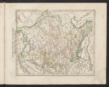
Europaeisches Russland mit Kasan, Astrachan und Georgien
Schul-Atlas über alle Theile der Erde nach dem neuesten Zustande, und über das Weltgebäude Stieler, Adolf bei Justus Perthes
Russia.
1 : 7760000 Johnson, A.J.
Russia.
1 : 7760000 Johnson, A.J.
Russland
Russland / Europäischer Teil Skizzenbuch
TABVLA | RVSSIÆ | ex autographo, quod delineandum | curavit Foedor filius Tzaris Boris desum- | ta; et ad fluvios Dwinam, Zuchanam, aliaque | loca, quantum ex tabulis ex notitiis ad nos dela- | tis fieri potuit, amplificata...
Amstelodami, | Excusum Apud Guiljelmum Blaeu
Europäisches Russland
1 : 20500000 Russland / Europäischer Teil
La Russie d'Europe
Russland Bielaerts, J. B.
Des Russischen Reichs Europäischer Theil
Stieler's Hand-Atlas Stieler, Adolf bei Justus Perthes
Europaeisches Russland mit Kasan, Astrachan und Georgien
Russland / Europäischer Teil
Russland
1 : 15000000 Russland / Europäischer Teil
Karte der Vergrösserungen Russlands unter Peter dem Grossen und seinen Nachfolgern
Russland Peter I.
Karte der Vergrösserungen Russlands unter Peter dem Grossen und seinen Nachfolgern
Russland Peter I.
Ravensteinkarte Osteuropa
1 : 3333333 Evropa střední a východní Ravensteins Geographische-Verlagsanstalt und Druckerei
Russland
1 : 16000000 Russland / Europäischer Teil
Europäisches Russland
1 : 14500000 Russland / Europäischer Teil
Ruszland
1 : 18000000 Russland / Europäischer Teil
Russland
Russland / Europäischer Teil
Europäisches Russland
1 : 14500000 Russland / Europäischer Teil
Russisches Reich. Verwaltungsgrenzen von 1914. Europäischer Teil
Russland / Europäischer Teil Verwaltungsgliederung
Carte de la Pologne à son apogee, sous Sigismond-Auguste, en face du Principat de Russie sous le czar Ivan IV, vers l’an 1570 de notre ère
Polen Russland Polen-Litauen Zygmunt August
Europäisches Russland 1801-1855
1 : 15500000 Russland / Europäischer Teil
Karte der Bevölkerung Russlands im 9. Jahrhundert
Russland Bevölkerungsdichte
Europäisches Russland
1 : 16000000 Russland / Europäischer Teil

Europäisches Russland
Russland / Europäischer Teil Skizzenbuch
Karte der Bevölkerung Russlands im 19. Jahrhundert
Russland Bevölkerungsdichte
Europäisches Russland

Wirtschaftskarten I. Rußland
1 : 18000000 Russland / Europäischer Teil Wirtschaft
Russland
1 : 15000000 Evropa východní Kocen, Blaž Eduard Hölzel