Maps of Matrouh Governorate

[XXIV], uit: Geognostische Karte des Oesterreichischen Kaiserstaates mit einem grossen Theile Deutschland's u. Italien / hauptsachlich nach ... Haidinger's geognostischer Karte dieses Staates bearb. von Josef Scheda
1 : 3000000 titelvariant: General-Karte von Europa in 25 Blättern; Annotatie: Bijlage bij: General-Karte von Europa in 25 Blättern. - 1:2.592.000. - 1845-1847 Scheda, Joseph Wien : K.K. Militär. Geografisch. Institut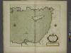
A chart of the LEVANT or the sea coast of Egypt, Syria, Caramania and the Island Cyprus
from The sea-atlas : containing an hydrographical description of most of the sea-coasts of the known parts of the world.
Aegypten und Sues-Canal
1 : 3500000 Egypt Justus Perthes
[Kaart], uit: Aegypten und Sues-Canal
1 : 3500000 titelvariant: Oorlogskaart; Egypte en Suez-kanaal; Annotatie: In omslag met titel: Oorlogskaart : Egypte en Suez-kanaal. - Amsterdam : Seyffardt, 1882; Annotatie geografische gegevens: Aangegeven zijn vaarroutes over de Middellandse Zee en de Rode Zee; Inzetkrt.: Nil-Delta und Landenge von Sues. - 1:1.500.000; [Noord-Afrika, West-Azië, Zuid-Europa] Gotha : Justus Perthes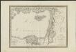
Carte physique & politique de la Syrie, pour servir à l'histoire des conquêtes du général Bonaparte en Orient
faite au Kaire en l'an 8, par Charles Paultre [...] dessiné par Lapie [...] ; gravé par Blondeau [...] ; l'écriture gravée par L. Aubert [...] A Paris [etc.] : chez Lapie [...] ; Picquet [...] [etc.]
Die asiatische Türkei...

Abraham Patriarchae Peregrinatio, Et Vita. [Karte], in: Theatrum orbis terrarum, S. 445.
1 Karte aus Atlas Ortelius, Abraham
Deserta AEgypti, Thebaidis, Arabiae, Syriae, etc. ubi accurate notata sunt loca inhabitata per Sanctos Patres Anachoretas
Egypt Seutter, Matthäus Rogg, Gottfried Matth. Seutter
Feuille 47 (E VII), uit: Carte géologique internationale de l'Europe : la carte, votée au congrès géologique international de Bologne en 1881, est exécutée conformément aux décisions d'une commission internationale, avec le concours des gouvernements, sous le dir. de M.M. Beyrich et Hauchecorne
Annotatie: Blad 48 gamme des couleurs; blad 49: bladwijzer en titelblad Heinrich Ernst Beyrich 1815-1896; Wi. Hauchecorne Berlin : Reimer / (Berlin: Institut lithographique)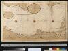
De kuste van Egipten en Barbaria beginnende van Jaffa tot I: Soliman int groot
Egypt Gerard van Keulen
[Syrien, die Sinai-Halbinsel und Aegypten]
Geographischer Atlas über alle Theile der Erde Ziegler, Jakob Melchior Verlag von Dietrich Reimer
Syrien u. Aegypten
[Allgemeiner Atlas über alle Theile der Erde in 29 Blättern] Ziegler, Jakob Melchior Top. Anstalt v. J. Wurster u. Comp.
[Syrien und Aegypten]
Hypsometrischer Atlas Ziegler, Jakob Melchior Topogr. Anstalt v. J. Wurster u. Comp.
Abrahami Patriarchae Peregrinatio, Et Vita. [Karte], in: Theatrum orbis terrarum, S. 444.
1 Karte aus Atlas Ortelius, Abraham Vrients, Jan Baptista
Übersichtskarte Konya-Kairo
1 : 1000000 Gen St d H Abt f Kr Kart u Verm Wes
[Syrien, die Sinai-Halbinsel u. Aegypten]
Geographischer Atlas über alle Theile der Erde Ziegler, Jakob Melchior Verlag von Joh. Wurster um Comp.
Syrien, Sinai u. Aegypten.
1 : 1600000 Ziegler, J. M.
Partie, l'Egypte. Afrique 5.
1 : 1641836 Vandermaelen, Philippe, 1795-1869
Palaestinae Sive Totius Terrae Promissionis Nova Descriptio [Karte], in: Theatrum orbis terrarum, S. 435.
1 Karte aus Atlas Ortelius, Abraham Vrients, Jan Baptista
[Recto], uit: Situs terrae promissionis. S.S. Bibliorum intelligentiam exacte aperiens / per Chr. Adrichom ; sculpserunt Everardus Sim. Hamers-veldt et Salomon Rogeri
1 : 830000 Annotatie: Oorspr. verschenen in: L'Appendice de l'atlas de Gerard Mercator et Iudocus Hondius ... - A Amsterdam : chez Henry Hondius, 1633; Annotatie geografische gegevens: Zuidoost boven Adrichom, Christiaan van; Hamersveldt, Everard Symonsz. van; Rogiers, Salomon Amstelodami : sumptibus Henrici Hondii
Carte De La Mer Mediterranee. X.
Roux, Joseph
Palestinae Sive Totius Terrae Promissionis Nova Descriptio [Karte], in: Theatrum orbis terrarum, S. 117.
1 Karte aus Atlas Ortelius, Abraham
Syrien und die angraenzenden Laender zur Zeit der Kreuzzuge.
1 : 3000000 Spruner von Merz, Karl
Palestine - Physical Geography.
Milner, Thomas

Palaestinae Sive Totius Terrae Promissionis Nova Descriptio [Karte], in: Theatrum orbis terrarum, S. 425.
1 Karte aus Atlas Ortelius, Abraham
Biblische-Karte
Jeruzalém Růžička, Jan Hichmann, A.
TERRA SANCTA | quae in Sacris | Terra Promissionis olim | PALESTINA
Amstelodami | Ex officina Guiljelmi Blaeuw 1629
La Palestine...

![[XXIV], uit: Geognostische Karte des Oesterreichischen Kaiserstaates mit einem grossen Theile Deutschland's u. Italien / hauptsachlich nach ... Haidinger's geognostischer Karte dieses Staates bearb. von Josef Scheda](https://images-2.georeferencer.com/images/iiif/947483815912/full/,300/0/native.jpg)

