Maps of Mediterranean Region

Übersichtskarte Konya-Kairo
1 : 1000000 Gen St d H Abt f Kr Kart u Verm Wes
Syrien u. Aegypten
[Allgemeiner Atlas über alle Theile der Erde in 29 Blättern] Ziegler, Jakob Melchior Top. Anstalt v. J. Wurster u. Comp.
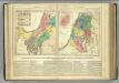
Syrien und die angraenzenden Laender zur Zeit der Kreuzzuge.
1 : 3000000 Spruner von Merz, Karl
[Syrien und Aegypten]
Hypsometrischer Atlas Ziegler, Jakob Melchior Topogr. Anstalt v. J. Wurster u. Comp.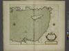
A chart of the LEVANT or the sea coast of Egypt, Syria, Caramania and the Island Cyprus
from The sea-atlas : containing an hydrographical description of most of the sea-coasts of the known parts of the world.

La Palestine...

Afbeelding van 't Koningryk Israëls, benevens de door 't zelve overheerde landen; gedurende de regering der koningen Saul, David, en Salomo
1 : 2300000 door W.A. Bachiene J. van Jagen mapp. sculpsit, et figur. apposit. sculpturam curavit ; J. Folkema f. Uitgegeven te Gorinchem : by Nicolaas Goetzee
Syrie et de la Palestine, 624 ans apres J.C.
1 : 3300000 Houze, Antoine Philippe
Abrahami Patriarchae Peregrinatio, Et Vita. [Karte], in: Theatrum orbis terrarum, S. 444.
1 Karte aus Atlas Ortelius, Abraham Vrients, Jan Baptista
Syria to Sinai.
1 : 2200000 Society for the Diffusion of Useful Knowledge (Great Britain)
[Recto], uit: Situs terrae promissionis. S.S. Bibliorum intelligentiam exacte aperiens / per Chr. Adrichom ; sculpserunt Everardus Sim. Hamers-veldt et Salomon Rogeri
1 : 830000 Annotatie: Oorspr. verschenen in: L'Appendice de l'atlas de Gerard Mercator et Iudocus Hondius ... - A Amsterdam : chez Henry Hondius, 1633; Annotatie geografische gegevens: Zuidoost boven Adrichom, Christiaan van; Hamersveldt, Everard Symonsz. van; Rogiers, Salomon Amstelodami : sumptibus Henrici Hondii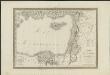
Carte physique & politique de la Syrie, pour servir à l'histoire des conquêtes du général Bonaparte en Orient
faite au Kaire en l'an 8, par Charles Paultre [...] dessiné par Lapie [...] ; gravé par Blondeau [...] ; l'écriture gravée par L. Aubert [...] A Paris [etc.] : chez Lapie [...] ; Picquet [...] [etc.]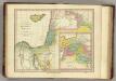
Places Recorded in the Five Books of Moses. (1826)
1 : 4600000 Tanner, Henry S.
Palestinae Sive Totius Terrae Promissionis Nova Descriptio [Karte], in: Theatrum orbis terrarum, S. 117.
1 Karte aus Atlas Ortelius, Abraham
Ancient Syria
1 : 2200000 Blízký východ Hughes, William Chapman & Hall
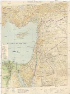
Syrien, Sinai u. Aegypten.
1 : 1600000 Ziegler, J. M.
Terra Sancta quae in Sacris Terra Promissionis olim Palestina [Karte], in: Novus Atlas, das ist, Weltbeschreibung, Bd. 2, S. 300.
1 Karte aus Atlas Blaeu, Joan Blaeu, Willem Janszoon
[Syrien, die Sinai-Halbinsel und Aegypten]
Geographischer Atlas über alle Theile der Erde Ziegler, Jakob Melchior Verlag von Dietrich Reimer
Situs Terrae Promissionis. S.S. Bibliorum intelligentiam exacte aperiens [Karte], in: Gerardi Mercatoris et I. Hondii Newer Atlas, oder, Grosses Weltbuch, Bd. 2, S. 347.
1 Karte aus Atlas Mercator, Gerhard und Hondius, Jodocus Jansson, Jan
[Syrien, die Sinai-Halbinsel u. Aegypten]
Geographischer Atlas über alle Theile der Erde Ziegler, Jakob Melchior Verlag von Joh. Wurster um Comp.
Terra Sancta quae in Sacris Terra Promissionis olim Palestina [Karte], in: Theatrum orbis terrarum, sive, Atlas novus, Bd. 2, S. 283.
1 Karte aus Atlas Blaeu, Joan Blaeu, Willem Janszoon
Situs Terrae Promissionis. S.S. Bibliorum intelligentiam exacte aperiens [Karte], in: Novus atlas absolutissimus, Bd. 6, S. 108.
1 Karte aus Atlas Janssonius Offizin
Palaestinae Sive Totius Terrae Promissionis Nova Descriptio [Karte], in: Theatrum orbis terrarum, S. 435.
1 Karte aus Atlas Ortelius, Abraham Vrients, Jan Baptista
Syria.
1 : 3801600 Tallis, J. & F.
Terre Sainte, pendant la premiere croisade de 1096 a 1144.
1 : 3300000 Houze, Antoine Philippe
Terre Sainte en 1839.
1 : 3300000 Houze, Antoine Philippe
Carte De La Mer Mediterranee. X.
Roux, Joseph
De beyde koningryken Juda en Israël, die na Salomo's dood zig van elkanderen afgescheurt hebben; benevens de overheerde landen aan elk dier beiden behorende
1 : 1400000 afgebeeldt door W.A. Bachiene J. van Jagen mapp. sculpsit, et figur. apposit. sculpturam curavit ; S. Fokke fec. Uitgegeven te Gorinchem : by Nicolaas Goetzee