Maps of West Indies

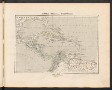
Central-Amerika u. Westindien
[Allgemeiner Atlas über alle Theile der Erde in 29 Blättern] Ziegler, Jakob Melchior Top. Anstalt v. J. Wurster u. Comp.
Texas, der Mexicanische Bundesstaat, der Mittelamericanische Bundesstaat, und West Indien
Schul-Atlas in 36 Karten Völter, Daniel Verlag der J.M. Dannheimer'schen Buchhandlung
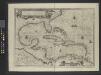
Insulae Americanae in Oceano Septentrionali ac Regiones Adiacentes, a. C. de May usque ad Lineam Aequinoctialem. [Karte], in: Novus atlas absolutissimus, Bd. 9, S. 68.
1 Karte aus Atlas Janssonius Offizin
Mittel-America und Westindien
Neuer Handatlas über alle Theile der Erde Kiepert, Heinrich Verlag von Dietrich Reimer
Pilot chart of the Central American waters
1 : 6000000 Mexický záliv Maury, Matthew Fontaine Hydrographic Office
Pilot chart of the Central American waters
1 : 6000000 Mexický záliv Maury, Matthew Fontaine Hydrographic Office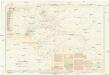
Pilot chart of the Central American waters
1 : 6000000 Mexický záliv Maury, Matthew Fontaine Hydrographic Office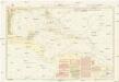
Pilot chart of the Central American waters
1 : 6000000 Mexický záliv Maury, Matthew Fontaine Hydrographic Office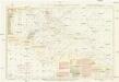
Pilot chart of the Central American waters
1 : 6000000 Mexický záliv Maury, Matthew Fontaine Hydrographic Office
Insulae Americanae in Oceano Septentrionali ac regiones adjacentes a C. de May usque ad Lineam Aequinoctialem
1 : 10000000 per Nicolaum Visscher [Amsterdam] : nunc apud Petrum Schenk Junior
Insulae Americanae in Oceano Septentrionali ac REGIONES ADIACENTES, a C. de May usque ad Lineam Aequinoctialem
This early 18th century map of the West Indies was produced by Nicolaes Visscher II who was the grandson of celebrated Dutch map maker Claes Jansz Visscher. It was originally published in c.1690 in his Atlas Minor but this is a reprint of c.1717 by Pieter Schenk. It is a typical elaborately decorated Dutch map and the colouring of the islands is decorative as opposed to functional. Visscher, Nicholaum. Cartographer.
Mappa geographica Americae Septentrionalis : ad emendatiora exemplaria adhuc edita jussu Acad. reg. scient. et eleg. litt. descripta.
from Charts and maps
West Indies, Central America and Northern and Northwestern South America

INSULAE AMERICANAE in Oceano Septentrionalis ac REGIONES ADIACENTES
1 : 10300000 Karibská oblast Visscher, Nicolaes Jansz. per Nicolaum Visscher
Mittel-America und Westindien
1 : 8000000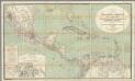
H. Kiepert's Karte des nordlichen Tropischen America.
1 : 3600000 Smith, Martin Luther, 1819-1866
Insulae Americanae in Oceano Septentrionali cum terris adiacentibus
1 : 10000000 Blaeu, Willem Janszoon, 1571-1638 G. Blaeu
Insulae Americanae in Oceano Septentrionali ac regiones adiacentes, a C. de May usque ad Lineam Aequinoctialem
1 : 9936000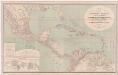
A new map of tropical-America, north of the Equator : comprising the West-Indies, Central-America, Mexico, New Cranada [sic] and Venezuela
1 : 3600000 Kiepert, Heinrich, 1818-1899 Dietrich Reimer
West India islands
1 : 1
West Indies.
1 : 17500000 Arrowsmith, Aaron; Lewis, Samuel
West Indies.
1 : 17500000 Arrowsmith, Aaron; Lewis, Samuel
Cent. Amer., W.I. ports
1 : 10000000 Philip, George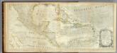
An Accurate Map Of North America. (Southern section)
1 : 5400000 Jefferys, Thomas
153-54. America Centrale, Colombia, Ecuador, Peru, Venezuela.
1 : 10000000 Touring club italiano
[Central-Amerika und Westindien]
Geographischer Atlas über alle Theile der Erde Ziegler, Jakob Melchior Verlag von Dietrich Reimer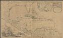
Archipelague du Mexique ou sont les Isles de Cuba, Espagnole, Jamaïque &c.
1 : 5000000 [par Pierre Mortier] A Amsterdam : nouvellement mis au jour par Covens & Mortier
Carte Particuliere des Antilles du Golfe du Mexique avec l'Isthme de Panama.
1 : 12700000 Vivien de St Martin, L.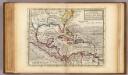
Map of the West-Indies, Mexico or New Spain.
1 : 21000000 Moll, Herman, d. 1732