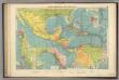
Maps of United States
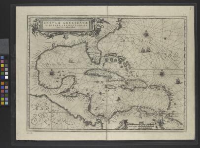
Insulae Americanae in Oceano Septentrionale.
From Whole
A new mapp of the Empire of Mexico describing the continent to the Istmus of Panama : together with all the islands in the North Sea / F. Lamb sculp.
from Charts and maps
Composite: A Map of the British Empire in America.
1 : 2000000 Popple, Henry
Regni Mexicani seu Novae Hispaniae, Ludovicianae, N. Angliae, Carolinae, Virginiae, Pensylvaniae, ... in America Septentrionali
from John H. Levine Collection
Mappa geographica regionem Mexicanam et Floridam terrasque adjacentes, ut et anteriores Americae insulas, cursus itidem et reditus navigantium versus flumen Missisipi et alias colonias ob oculos ponens
1 : 9300000 cura et sumptibus Tobiae Conradi Lotteri, Geographi Et Chalcographi Tob. Con. Lotter sculps. Augustae Vindel : [Tobias Conrad Lotter]
Map of the United States of America, the British provinces, Mexico, the West Indies and Central America, with part of New Granada and Venezuela / map drawn by Geo. W. Colton; engraved by John M. Atwood; border desig'd. & eng'd. by W.S. Barnard.
from Parts George W. Colton; John M. Atwood; W. S. Barnard,

America septentrionalis
1 Karte : Kupferdruck ; 45 x 53 cm Janssonius excudit Ioannes Janssonius
America septentrionalis
1 Karte : Kupferdruck ; 45 x 53 cm Valck; Schenk penes Gerardum Valk et Petrum Schenk
Regni Mexicani seu Novae Hispaniae, Floridae, Novae Angliae, Carolinae, Virginiae et Pensylvaniae necnon insularum archipelagi Mexicani in America Septentrionali
from Charts and maps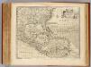
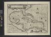
West Indies.
1 : 12500000 Bowen, Emanuel

Amerikanisch-spanischer Kriegsschauplatz
1 : 7500000 Habenicht, Hermann Justus Perthes
Mappa geographica regionem Mexicanam et Floridam
1 : 11560000 Antily (souostroví) Lotter, Tobias Conrad [sumptibus] Tobiae Conradi Lotteri
Mappa geographica regionem Mexicanam et Floridam
1 : 11560000 Antily (souostroví) Seutter, Matthäus Lotter, Tobias Conrad sumptibus Mathaei Seutteri
Regni Mexicani seu Novae Hispaniae, Ludovicianae, N. Angliae, Carolinae, Virginiae, Pensylvaniae, necnon insvlarvm archipelagi Mexicani in America Septentrionali / accurata tabula exhibita a Ioh. Baptista Homanno.
from Parts John Baptista Homann, S.,
Regni Mexicani seu Novae Hispaniae, Ludovicianae, N. Angliae, Carolinae, Virginiae, Pensylvaniae, necnon insularum archipelagi Mexicani in America Septentrionali / accurata tabula exhibita à Ioh. Baptista Homanno.
from Charts and maps John Baptista Homann, S.,
Carte du Mexique et de la Floride des Terres Angloises et des Isles Antilles du cours et des environs de la riviere de Mississipi
1 : 9000000 dressée sur un grand nombre de memoires principalement sur ceux de Mrs. d'Iberville et le Sueur par Guillaume De l'Isle geographe de l'Academie Royale des Sciences I. Stemmers Senior sculp. A Amsterdam : chez Jean Covens & Corneille Mortier
North America / performed under the patronage of Louis Duke of Orleans, First Prince of the Blood by the Sieur d'Anville ; greatly improved by Mr. Bolton ; engrav,d by R. W. Seale ; Gravelot, delin. ; Walker, sculp.
from Charts and maps
Insulae Americanae in Oceano Septentrionali cum terris adiacentibus
1 : 10000000 Blaeu, Willem Janszoon, 1571-1638 G. Blaeu
[144][147] Indiarum Occidentalium Tractus Littorales cum Insulis Caribicis ..., uit: Atlas sive Descriptio terrarum orbis
Annotatie: Gedigitaliseerde versie. Amsterdam. Heiloo : Picturae (vervaardiger), 2015. tiff-bestand. Gedigitaliseerd: 07-01-2015; Origineel: Universiteitsbibliotheek Vrije Universiteit (XL.05127.-) ; Netherlands; Titelpagina ontbreekt Wit, Frederik de Amsterdam : Frederick de Wit
North America / performed under the patronage of Louis Duke of Orleans, First Prince of the Blood by the Sieur d'Anville ; greatly improved by Mr. Bolton ; engrav,d by R. W. Seale ; Gravelot, delin. ; Walker, sculp.
from Whole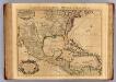
Mexique, Floride, Terres Angloises, Isles Antilles.
1 : 9000000 L'Isle, Guillaume de, 1675-1726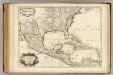
Mexique, Floride, Terres Angloises, Isles Antilles.
1 : 9000000 L'Isle, Guillaume de, 1675-1726
Insulae Americanae in Oceano Septentrionali ac Regiones Adiacentes, a. C. de May usque ad Lineam Aequinoctialem. [Karte], in: Novus atlas absolutissimus, Bd. 9, S. 68.
1 Karte aus Atlas Janssonius Offizin
A new map of the north parts of America claimed by France under ye names of Louisiana, Mississipi, Canada and New France, with ye adjoyning territories of England and Spain ... / ... laid down according to the newest and most exact observations by H. Mol
from The world described, or, A new and correct sett of maps : shewing the kingdoms and states in all the known parts of the earth, with the principal cities, and most considerable towns in the world ... / ... by Herman Moll, geographer ...
Regni Mexicani seu Novæ Hispaniæ, Ludovicianæ, N. Angliæ, Carolinæ, Virginiæ, et Pensylvaniæ, nec non insvlarvm archipelagi Mexicani in America septentrionali accurata tabula
1 Karte : Kupferdruck ; 46 x 55 cm Homann Johann Baptist Homann
Carte du Mexique et de la Floride, des terres angloises et des Isles Antilles, du cours et des environs de la riviere de Mississipi / dressée sur un grand nombre de memoires principalement sur ceux de Mrs. d'Iberville et le sueur, par Guillaume De l'Isle, geographe de l'Academie Royale des Sciences; I. Stemmers senior sculp.
from Mexico Guillaume de l'Isle; I. Stemmers,
Carte générale de l'Amérique séptentrionale: avec les posséssions Angloises dans cette partie du nouveau monde / dressée sur la carte de Pople [sic], publiée à Londres en 20 feuilles, pour servir à l'intelligence de la guerre présente.
from Whole Henry Popple,