Maps of West Indies

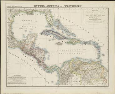
Mittel-America und Westindien
1 : 8000000
West Indies.
1 : 17500000 Arrowsmith, Aaron; Lewis, Samuel
West Indies.
1 : 17500000 Arrowsmith, Aaron; Lewis, Samuel
West India islands
1 : 1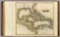
West Indies.
1 : 7900000 Thomson, John
[Central-Amerika und Westindien]
Geographischer Atlas über alle Theile der Erde Ziegler, Jakob Melchior Verlag von Dietrich Reimer
Carte Particuliere des Antilles du Golfe du Mexique avec l'Isthme de Panama.
1 : 12700000 Vivien de St Martin, L.
INSULAE AMERICANAE in Oceano Septentrionalis ac REGIONES ADIACENTES
1 : 10300000 Karibská oblast Visscher, Nicolaes Jansz. per Nicolaum Visscher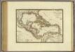
Iles-Antilles ou Indes Occidentales.
1 : 9300000 Brue, Adrien Hubert, 1786-1832
Mittel-America und Westindien
Neuer Handatlas über alle Theile der Erde Kiepert, Heinrich Verlag von Dietrich Reimer
Teatre de la guerre en Amerique telle que'elle est a present possedee par les Espagnols, Anglois, Francois, et Hollandois &c. : nouvellement mis au jour
1 : 5533975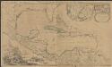
Archipelague du Mexique ou sont les Isles de Cuba, Espagnole, Jamaïque &c.
1 : 5000000 [par Pierre Mortier] A Amsterdam : nouvellement mis au jour par Covens & Mortier
Chart of the West Indies.
1 : 11750000 Carey, Mathew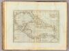
Chart of the West Indies.
1 : 11750000 Carey, Mathew
Chart of the West Indies.
1 : 11000000 Carey, Mathew
Chart of the West Indies.
1 : 11750000 Carey, Mathew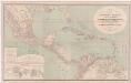
A new map of tropical-America, north of the Equator : comprising the West-Indies, Central-America, Mexico, New Cranada [sic] and Venezuela
1 : 3600000 Kiepert, Heinrich, 1818-1899 Dietrich Reimer
153-54. America Centrale, Colombia, Ecuador, Peru, Venezuela.
1 : 10000000 Touring club italiano
Mittel America.
1 : 16500000 Reichard, C. G.
Texas, der Mexicanische Bundesstaat, der Mittelamericanische Bundesstaat, und West Indien
Schul-Atlas in 36 Karten Völter, Daniel Verlag der J.M. Dannheimer'schen Buchhandlung
Central-Amerika u. Westindien
[Allgemeiner Atlas über alle Theile der Erde in 29 Blättern] Ziegler, Jakob Melchior Top. Anstalt v. J. Wurster u. Comp.
Insulae Americanae in Oceano Septentrionali ac regiones adiacentes, a C. de May usque ad Lineam Aequinoctialem
1 : 9936000
Insulae Americanae in Oceano Septentrionali ac regiones adjacentes a C. de May usque ad Lineam Aequinoctialem
1 : 10000000 per Nicolaum Visscher [Amsterdam] : nunc apud Petrum Schenk Junior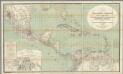
H. Kiepert's Karte des nordlichen Tropischen America.
1 : 3600000 Smith, Martin Luther, 1819-1866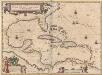
Insulae Americanae In Oceano Septentrionali, cum Terris adiacentibus. [Karte], in: Novus Atlas, das ist, Weltbeschreibung, Bd. 2, S. 311.
1 Karte aus Atlas Blaeu, Joan Blaeu, Willem Janszoon
West India Islands.
1 : 14500000 Darton, William
Insulae Americanae in Oceano Septentrionali cum terris adiacentibus
1 : 10000000 Blaeu, Willem Janszoon, 1571-1638 G. Blaeu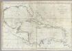
A new general chart of the West Indies.
1 : 4500000 Norman, William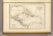
Antilles, du Golfe de Mexique, et du Guatemala.
1 : 14000000 Malte-Brun, Conrad, 1775-1826