Maps of West Indies
An Accurate Map Of North America. (Southern section)
1 : 5400000 Jefferys, Thomas
(A new map of North America, with the West India Islands. Southern section)
1 : 5300000 Pownall, Thomas
Amérique Septentrionale publiée sous les auspices de Monseigneur le Duc d'Orleans prémier prince du sang / par le Sr. D'Anville.
from Charts and maps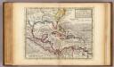
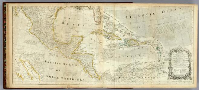
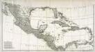
Map of the West-Indies, Mexico or New Spain.
1 : 21000000 Moll, Herman, d. 1732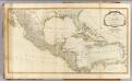
West Indies.
1 : 6400000 Robert Laurie & James Whittle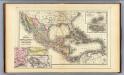
Mexico, Central America, West Indies.
1 : 12000000 Mitchell, Samuel Augustus
Cuba.
1 : 3300000 Mitchell, Samuel Augustus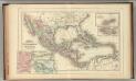
Mexico, Central America, West Indies.
1 : 12000000 Mitchell, Samuel Augustus Jr.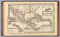
Mexico, Central America, West Indies.
1 : 12000000 Mitchell, Samuel Augustus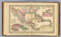
Mexico, Central America, West Indies.
1 : 12000000 Williams, W. (Wellington)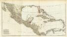
(Amerique Septentrionale. Southern section).
1 : 6300000 Anville, Jean Baptiste Bourguignon d, 1697-1782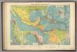
Cent. Amer., W.I. ports
1 : 10000000 Philip, George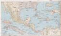
Mexico, Central America and the West Indies
1 : 5702400 Bermudy (Velká Británie : souostroví) National Geographic Society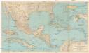
Mexico, Central America and the West Indies
1 : 5702400 Bermudy (Velká Británie : souostroví) National Geographic Society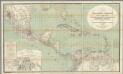
H. Kiepert's Karte des nordlichen Tropischen America.
1 : 3600000 Smith, Martin Luther, 1819-1866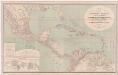
A new map of tropical-America, north of the Equator : comprising the West-Indies, Central-America, Mexico, New Cranada [sic] and Venezuela
1 : 3600000 Kiepert, Heinrich, 1818-1899 Dietrich Reimer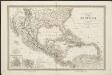
Carte du Méxique, des Antilles, d'une partie des Etats-Unis, et des pays circonvoisins
1 : 8333000 dressée d'après les nouvelles divisions, et les dernières observations par A. H. Dufour [gravée par] Guyot ; [écrite par] A. Pelicier Paris : Guyot [etc.]
Mexique, Amerique Centrale, les Antilles.
1 : 11000000 Garnier, F. A., 1803-1863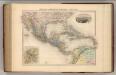
Mexique, Amerique Centrale et Antilles.
1 : 13000000 Migeon, J.
Mexico. West Indies and Central America.
1 : 7920000 Colton, G. Woolworth
Central America, Mexico & West Indies.
1 : 14500000 Black, Adam & Charles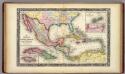
Map Of Mexico, Central America, And The West Indies.
1 : 12000000 Mitchell, Samuel Augustus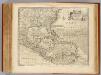
West Indies.
1 : 12500000 Bowen, Emanuel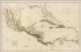
Chart Of The West Indies And Spanish Dominions In North America.
1 : 2700000 Arrowsmith, Aaron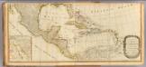
(North America south)
1 : 5400000 Kino, Eusebio Francisco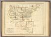
Index Map. Explanation of Signs Used In The Atlas.
1 : 17233920 Rogers, Henry Darwin
Amérique septentrionale, 1
2 Blätter : mehrfarbig ; 52 x 113 cm chez l'auteur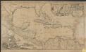
Archipelague du Mexique ou sont les Isles de Cuba, Espagnole, Jamaïque &c.
1 : 5000000 [par Pierre Mortier]