Maps of Ethiopia

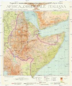
Programma di massima della triangolazione geodetica di I° ordine dell' altopiano etiopico
1 : 3000000 Eritrea Istituto geografico militare
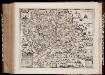
Abessinien
1 : 5000000 Etiopie G. Freytag & Berndt
[Kaart], uit: Colonie dell'Africa Orientale Italiana
1 : 4000000 Annotatie: Ondertitel op omslag: Eritrea - Somalia Italiana - Etiopia - Somalia Francese e Britannica; Annotatie geografische gegevens: Inzetkrt.: [Omgevingskaart]. - 1:50.000.000 Milano : Vallardi
Ostafrika – Vých. Afrika

Abessinien
1 : 5000000 Afrika východní Josef Ulbricht
116-17. Eritrea, Etiopia, Somalia.
1 : 5000000 Touring club italiano
Sudan and Ethiopia, Plate 87, V. IV
1 : 5000000 Bartholomew, John
Spezial-Karte von Afrika
1 : 4000000 Blatt 6 Habenicht, Hermann Perthes
Abyssinië in vogelvlucht gezien = Abyssinie vue a vol d'oiseau / Seghers
titelvariant: Abyssinie vue a vol d'oiseau; Annotatie: Gegevens verzameld over de periode/Data collected over the period: 1935; With photographs of current world leaders; Fragment: foto's van wereldleiders ontbreken; Annotatie geografische gegevens: Bijkaart: Van Gibraltar tot Abessinië = De Gibraltar a l'Abessinie W. Seghers Antwerpen [etc.] : [Patria, etc.]
Spezial - karte von AfricaSektion Abessinien (6)
1 : 4000000 1 full d'1 mapa en 10 fulls i estoig Hermann Habenicht; Justus Perthes
Abessinien - Somaliländer
1 : 7500000 Etiopie Barich, Carl Justus Perthes
Ethiopia. Pergamon World Atlas.
1 : 5000000 Polish Army Topography Service
AEthiopisches Hochland Alpenland Habesch und Vorstuffe von Darfur und Sennaar
Dárfúr (Súdán) Arrowsmith, John
Abyssinia, surrounding countries.
1 : 6450000 Rand McNally and Company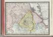
Upper Nubia and Habesh or Abyssina.
1 : 5000000 Rand McNally and Company
Cestovatele Viléma Němce přehledná mapa Císařství habešského s poznámkami zoografickými a místopisnými
1 : 2070000 Etiopie Němec, Vilém Československá grafická unie
British Somaliland and Sokotra
in British Somaliland and Sokotra. [With a map.] iv, 40 p. ; 8 -- . Great Britain. Foreign Office. Historical Section.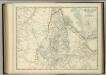
Upper Nubia and Abyssinia.
1 : 2854868 Johnston, W. & A.K.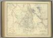
Upper Nubia and Abyssinia.
1 : 2854868 Johnston, Alexander Keith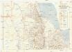
Seconda edizione della nuova carta dei domini e protettorati italiani nell' Eritrea e regioni limitrofe
1 : 1500000 Eritrea Ministero della guerra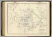
Nubia, Abyssinia.
1 : 2854868 Johnston, Alexander Keith, 1804-1871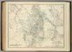
Upper Nubia and Abyssinia.
1 : 2854868 Johnston, Alexander Keith
Carta della colonia Eritrea coll'Abissinia : e regioni limitrofe tra il Nilo, Suakin e il Golfo d'Aden
1 : 4000000 Cora, Guido, 1851-1917 Fratelli Bocca
Countries In The Northern Tropical Regions of Africa.
Fullarton, A. & Co.
Carte générale d'Abyssinie
1 : 1800000 dressée par M. le lieutenant de vaisseau Théophile Lefebvre pendant son voyage d'exploration en 1839, 40, 41, 42, 43 Paris : Arthus Bertrand
Carte de l'Abyssinie, du pays des Galla, de Choa et d'Ifat
1 : 2500000 dressée par Mrs. Combes et Tamisier dessinée par A. Vuillemin ; gravée par Massuet ; écrite par Martin ainé Paris : Desessart
Carte d'Abyssinie et des contrées adjacentes dressée partie d'après des observations faites sur les lieux par l'auteur, partie d'après les informations prises dans le pays en 1809 et 1810
1 : 5000000 par Henry Salt [S.l.] : [s.n.]
Adel. Afrique 33.
1 : 1641836 Vandermaelen, Philippe, 1795-1869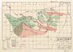
Plant ecology (Somalia)
[A collection of maps illustrating an economic survey and reconnaissance report on British Somaliland, G.P. numbers 2577 - 2593]. Great Britain. Army. East Africa Force. [S.l.] : 157 (E.A. & S.R.) Base Svy. Coy., E.A.E.