Maps of Switzerland

Helvetia, cum finitimis regionibus confoederatis. [Karte], in: Le théâtre du monde, ou, Nouvel atlas contenant les chartes et descriptions de tous les païs de la terre, Bd. 1, S. 276.
1 Karte aus Atlas Blaeu, Willem Janszoon und Blaeu, Joan Blaeu, Willem Janszoon
Helvetia, cum finitimis regionibus confoederatis. [Karte], in: Novus Atlas, das ist, Weltbeschreibung, Bd. 1, S. 245.
1 Karte aus Atlas Blaeu, Joan Blaeu, Willem Janszoon
Carte de Suisse
1 Karte dressée sur les mémoires de Merveilleux par Guillaume De l'Isle ; augmenté en 1759 par Phil. Buache chez l'auteur sur le Quay de l'Horloge, Paris
Charte von der Republik Schweiz
Neuester Schul-Atlas Walch, Johann im Verlag bei Joh. Walch
Switzerland.
1 : 1450000 Bowen, Frances
Nova Helvetiae, foederatarumque cum ea, nec non subditarum regionum tabula, ad usum serenissimi Burgundiae ducis, secundum commentarios domini Merveilleux
1 Karte composita per Guilielmum de l'Isle apud Joh. Covens & Corn. Mortier, Amstelodami
Zweite Keller'sche Reisekarte der Schweiz
Vorderseite: Überarbeitete und ergänzte Ausgabe der ersten Auflage von 1833. Mit einer Nebenkarte der Region Vintschgau/Tirol sowie vier Nebenkarten der Routen aus der Schweiz nach Paris, Würtemberg, Bayern, Tirol, Lyon, Chambery, Mailand, Genua und Turin. Rückseite: Kommentar von Heinrich Keller zur Karte, Übersicht über weitere von Keller gezeichnete und herausgegebene Karten sowie Übersichtsblatt einer anderen Karte. Keller, Heinrich (1778-1862), Kartograf, Panoramenzeichner und Verleger, von Zürich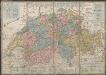
Petite carte de la Suisse pour les écoles
1 : 800000 Keller, Heinrich [H. Keller'sgeogr. Verlag]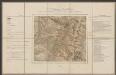
Helvetia cum finitimis regionibus confoederatis. [Karte], in: Gerardi Mercatoris et I. Hondii Newer Atlas, oder, Grosses Weltbuch, Bd. 1, S. 256.
1 Karte aus Atlas Mercator, Gerhard und Hondius, Jodocus Jansson, Jan
Switzerland.
1 : 450000 Lucas, Fielding Jr.
Helvetia, cum finitimis regionibus confoederatis. [Karte], in: Theatrum orbis terrarum, sive, Atlas novus, Bd. 1, S. 291.
1 Karte aus Atlas Blaeu, Joan Blaeu, Willem Janszoon
Helvetiae Tredecim Statibvs Liberis qvos Cantones vocant, composita Una cum foederatis & subjectis Provinciis, ex probatissimis Subsidiis geographice
1 : 680000 Mollova mapová sbírka Mayer, Tobias Homann, Johann Baptista - dědici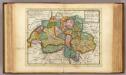
Suisse or Switzerland.
1 : 1500000 Moll, Herman, d. 1732

Switzerland.
1 : 1457280 Lucas, Fielding Jr.
Nouvelle carte de la Suisse dans laquelle sont exactement distingués les treize cantons, leurs alliés et leurs sujets
1 Karte dréssée sur les mémoires les plus corrects et assujettie aux observations astronomiques [par William Faden] chez W. Faden, Charing Cross, Londre
Novissima et accuratissima Helvetiae, Rhaetiae, Valesiae, et partis Sabaudiae tabula.
Amsterdam : ex officina R. & J. Ottens
Geographisches Verzeichniss der merkwürdigsten Orte in der Schweiz
1 : 700000 1 Karte Hein. Körner delin. ; J. Rodolf Holzhalb sculps. [Verlag nicht ermittelbar], [Zürich]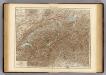
Switzerland.
1 : 800000 Andree, Richard; Times (London, England)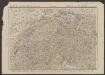
Carte de la Suisse pour les écoles
1 : 700000 Leuzinger, Rudolf J. Dalp'sche Buch und Kunsthandlung
Les Suisses Leurs Alliez Auec les Sujets des Suisses, et des Alliez
1 : 750000 Mollova mapová sbírka Du Tralage, Jean Nicolas Nolin, Jean Baptiste II.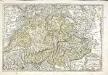
Les Suisses, les alliés des Suisses et leurs suiets
1 Karte : Kupferdruck ; 36 x 53 cm Sanson; Cordier Nicolas Sanson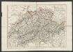
General-Charte der Schweiz in XXII Cantone abgetheilt
1 : 1200000 Scheuermann, Johann Jakob Orell, Füssli und Compagnie
Carte de la Suisse pour les écoles
1 : 700000 Leuzinger, Rudolf J. Dalp'sche Buch & Kunsthandlung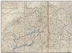
Reisekarte der Schweiz
Vorderseite: Karte mit fünf Nebenkarten. Rückseite: Titelblatt mit Erklärung der Zeichen und Höhenangaben einiger Seen. Zeichnung: Keller, Heinrich (1778-1862), Kartograf, Panoramenzeichner und Verleger, von Zürich Stich: Scheuermann, Johann Jakob, andere Schreibweise: Scheurmann, (1771-1844), Kupferstecher, von Zofingen AG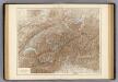
Die Schweiz.
1 : 800000 Andree, Richard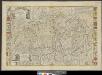
Helvetiae, Rhaetiae et Valesiae caeterorumque confoederatorum ut & finitimorum populorum tabula geographica et hydrographica nova & exacta
1 : 470000 1 Karte operâ & studio Ioh. Conradi Gygeri delineata & à Conrado Meyero in aes incisa, anno Christi 1657 [Verlag nicht ermittelbar], [Zürich]
Geographisches Verzeichniss der merkwürdigsten Orte in der Schweiz
1 : 700000 1 Karte Hein. Körner delin. ; J. Rodolf Holzhalb sculps. [Verlag nicht ermittelbar], [Zürich?]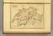
Suisse.
1 : 1270000 Malte-Brun, Conrad, 1775-1826
![Helvetia, cum finitimis regionibus confoederatis. [Karte], in: Le théâtre du monde, ou, Nouvel atlas contenant les chartes et descriptions de tous les païs de la terre, Bd. 1, S. 276.](https://images-2.georeferencer.com/images/iiif/452806768195/full/,300/0/native.jpg)

