Maps of Europe
Tabula Russiae [...] [Karte] Moscua ad Architypum Foedori Borißowitsi [Planvedute, Karte], in: Le théâtre du monde, ou, Nouvel atlas contenant les chartes et descriptions de tous les païs de la terre, Bd. 1, S. 67.
1 Karte aus Atlas Blaeu, Willem Janszoon und Blaeu, Joan Blaeu, Willem Janszoon
Russland
Volksschul-Atlas über alle Teile der Erde Lange, Henry Druck und Verlag von Georg Westermann
Novissima Russiae Tabula [Karte], in: Novus atlas absolutissimus, Bd. 1, S. 70.
1 Karte aus Atlas Janssonius Offizin
Tabula Russiae [...] [Karte] Moscua [Planvedute, [Nebenkarte], in: Novus Atlas, das ist, Weltbeschreibung, Bd. 1, S. 55.
1 Karte aus Atlas Blaeu, Joan Blaeu, Willem Janszoon
Europaeisches Russland
E. von Sydow's Schul-Atlas in sechs und dreissig Karten Sydow, Emil von bei Justus Perthes
Europaeisches Russland mit Kasan, Astrachan und Georgien
Schul-Atlas über alle Theile der Erde nach dem neuesten Zustande, und über das Weltgebäude Stieler, Adolf Justus Perthes
Eastern Europe.
1 : 14495100 Fisher, Richard Swainson
Russland
Neuer Handatlas über alle Theile der Erde Kiepert, Heinrich Verlag von Dietrich Reimer
Europaeisches Russland
Grosser Hand-Atlas über alle Theile der Erde in 170 Karten Meyer, J. Verlag des Bibliographischen Instituts
Novissima Russiae Tabula [Karte], in: Gerardi Mercatoris et I. Hondii Newer Atlas, oder, Grosses Weltbuch, Bd. 1, S. 124.
1 Karte aus Atlas Mercator, Gerhard und Hondius, Jodocus Jansson, Jan
Praktische Geschäfts und Reisekarte sämmtlicher Staaten von Europa enthaltend die vorzüglichsten Strassen-Verbindungen mit Angage der Distanzen und der bestehenden Eisenbahnen: Nebst einem Theile von Africa u. Asien, und zwar die Länder: Marocco, Algerien u. Tunis, ganz Kleinasien, und ein Theil von Persien
Schulz, R. A.
Carta politica della Russia / Francesco Vallardi
1 : 3300000 Francesco Vallardi
Sarmatische Tiefebene
Osteuropa, Ostmitteleuropa
Europaeisches Russland
Plastischer Schul-Atlas über alle Theile der Erde : in 24 Karten Woldermann, G Verlag von P. Eckerlein
Soubor němých map pro gymnasia a odborné školy

Das europäische Russland
Schul-Atlas in 36 Karten Völter, Daniel Verlag der J.M. Dannheimer'schen Buchhandlung
Mapa slovanského světa


Volkerkarte von Russland.
1 : 13300000 Andree, Richard
Mapa slovanského světa

Europäisches Russland
Russland / Europäischer Teil
Europa
1 Karte : Kupferdruck ; 46 x 53 cm Haas Homännische Erben
L'Europe
1 Karte : Kupferdruck ; 47 x 57 cm chez I. Cóvens et C. Mortier
Europa
1 Karte : Kupferdruck ; 48 x 58 cm Valck; Valck G. und L. Valck
L'Europe
1 Karte : Kupferdruck ; 47 x 57 cm Jaillot Alexis Hubert Jaillot
L'Europe
1 Karte : Kupferdruck ; 46 x 57 cm Valck chez Gerard Valck sur le Dam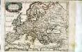
Evrope
1 Karte : Kupferdruck ; 18 x 23 cm Sanson; Winter s.n.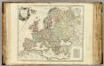
L'Europe divisee en ses principaux Etats.
1 : 9500000 Robert de Vaugondy, Gilles, 1688-1766
Rußland
1 : 18000000 Russland / Europäischer Teil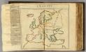
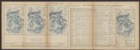
L'Europe (nom, maison, religion, etc. des souverains)
1 : 14000000 Dangeau, abbe de, 1643-1723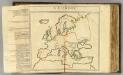
L'Europe (nom, maison, religion, etc. des souverains)
1 : 14000000 Dangeau, abbe de, 1643-1723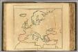
(Nom, maison, religion en Europe - outline)
1 : 14000000 Dangeau, abbe de, 1643-1723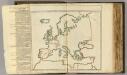
Nom, maison, religion en Europe.
1 : 14000000 Dangeau, abbe de, 1643-1723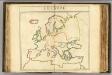
L'Europe (nom, maison, religion, etc. des souverains - outline)
1 : 14000000 Dangeau, abbe de, 1643-1723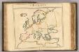
L'Europe (nom, maison, religion, etc. des souverains - outline)
1 : 14000000 Dangeau, abbe de, 1643-1723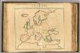
L'Europe (vents - outline)
1 : 14000000 Dangeau, abbe de, 1643-1723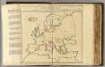
L'Europe, les viles.
1 : 14000000 Dangeau, abbe de, 1643-1723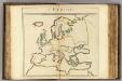
L'Europe (mers, fleuves, montagnes - outline).
1 : 14000000 Dangeau, abbe de, 1643-1723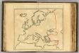
(L'Europe, confins - outline).
1 : 14000000 Dangeau, abbe de, 1643-1723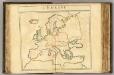
L'Europe (les viles - outline).
1 : 14000000 Dangeau, abbe de, 1643-1723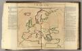
L'Europe (vents)
1 : 14000000 Dangeau, abbe de, 1643-1723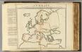
L'Europe mers, fleuves, montagnes.
1 : 14000000 Dangeau, abbe de, 1643-1723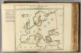
![Tabula Russiae [...] [Karte] Moscua ad Architypum Foedori Borißowitsi [Planvedute, Karte], in: Le théâtre du monde, ou, Nouvel atlas contenant les chartes et descriptions de tous les païs de la terre, Bd. 1, S. 67.](https://images-2.georeferencer.com/images/iiif/404510744352/full/,300/0/native.jpg)

