Maps of Malay Archipelago
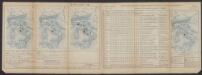
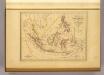
Insulae Indiae Orientalis Praecipuae, In quibus Moluccae celeberrimae sunt. [Karte], in: Gerardi Mercatoris Atlas, sive, Cosmographicae meditationes de fabrica mundi et fabricati figura, S. 538.
1 Karte aus Atlas Mercator, Gerhard Montanus, Petrus
Indiae Orientalis Nova Descriptio [Karte], in: Novus atlas absolutissimus, Bd. 6, S. 150.
1 Karte aus Atlas Janssonius Offizin
Indiae Orientalis Nova Descriptio [Karte], in: Gerardi Mercatoris et I. Hondii Newer Atlas, oder, Grosses Weltbuch, Bd. 2, S. 362.
1 Karte aus Atlas Mercator, Gerhard und Hondius, Jodocus Jansson, Jan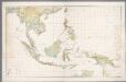
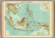
Nederlandsch-Indië en omgeving / Topografische Dienst
1 : 5000000 Topographische Dienst in Nederlandsch-Indië Batavia : Topografische Dienst
Hinterindien, Malayische Archipel.
1 : 18000000 Andree, Richard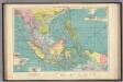
East Indian ports.
1 : 10000000 Philip, George
Indo-Chine et Archipel D'Asie.
1 : 14400000 Migeon, J.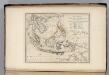
Islands of the East Indies.
1 : 23000000 Carey, Mathew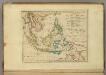
Islands of the East Indies.
1 : 23000000 Carey, Mathew
Iles de la Sonde, Philippines.
1 : 11700000 Garnier, F. A., 1803-1863
Malay Archipelago, Or East India Islands.
1 : 21500000 Tallis, J. & F.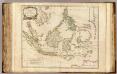
Indes Orientales.
1 : 8400000 Robert de Vaugondy, Gilles, 1688-1766
Malay Archipelago.
1 : 10000000 John Bartholomew and Son
Kaert van de Molocques : zeer correckt afgheteyckent met allen zijn eylanden ende sterckten, met een afbeeldinghe van de Straat van Botton / [Jan Cornelisz. Moy?]
[S.l. : s.n.]
Japanese aerodromes in Southwest Pacific Area, 20th November, 1944 / comp. by Allied Air Force SWPA
Allied Air Force SWPA [S.l.] : Allied Air Force SWPA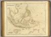
Asiatic Archipelago.
1 : 9500000 Arrowsmith, John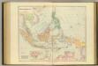
Asiatic Archipelago.
1 : 94000000 Stanford, Edward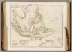
Asiatic Archipelago.
1 : 9500000 Arrowsmith, John
Islands: China-New Holland.
1 : 23000000 Bowen, Frances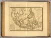
Grand Archipel d'Asie.
1 : 10200000 Picquet, C.
Atlas für Handel und Industrie: Für Kaufleute, Fabrikante u. Gewerbetreibende, Handlungs- u. Gewerbe-Schulen
Malaisie.
1 : 18500000 Malte-Brun, Conrad, 1775-1826
Die Ostindischen Inseln
Hand-Atlas über alle Theile der Erde nach dem neuesten Zustande und über das Weltgebäude Stieler, Adolf bei Justus Perthes
Die Ostindischen Inseln
Handatlas über alle Theile der Erde und über das Weltgebäude Stieler, Adolf Justus Perthes
Neueste Karte der Ostindischen Inseln
Grosser Hand-Atlas über alle Theile der Erde in 170 Karten Meyer, J. Verlag des Bibliographischen Instituts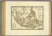
Grand Archipel d'Asie.
1 : 10200000 Brue, Adrien Hubert, 1786-1832
East India Islands.
1 : 10000000 Hall, S. (Sidney)
East Indies.
1 : 12672000 Colton, G.W.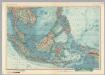
![Insulae Indiae Orientalis Praecipuae, In quibus Moluccae celeberrimae sunt. [Karte], in: Gerardi Mercatoris Atlas, sive, Cosmographicae meditationes de fabrica mundi et fabricati figura, S. 538.](https://images-2.georeferencer.com/images/iiif/786828808868/full/,300/0/native.jpg)

