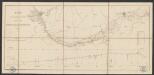
Maps of Lower Saxony
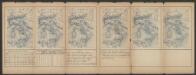
Le Cercle De Westphalie divisé en tous ses Estats et Souverainetés [Karte], in: Atlas nouveau, contenant toutes les parties du monde [...], Bd. 1, S. 295.
1 Karte aus Atlas Sanson, Nicolas Jaillot, Alexis Hubert und Mortier, Pieter
Nova et exacta mappa geographica exhibens circulum Westphalicum in omnes suos status et provincias accurate divisum
1 : 700000 Vestfálsko (Německo) Lotter, Tobias Conrad cura et sumptibus Tobiae Conrad Lotter
Nova et exacta mappa geographica exhibens circulum Westphalicum in omnes suos status et provincias accurate divisum
1 : 700000 Vestfálsko (Německo) Lotter, Tobias Conrad Tobiae Conrad Lotter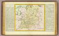
Westphalie.
1 : 1400000 Clouet, J. B. L. (Jean-Baptiste Louis), b. 1730

Operationen der alliirten und französischen Armee 1759

Circuli Westphaliae in omnes suos status et provincias accurate divisi
1 : 700000 Vestfálsko (Německo) Homann, Johann Baptist edita sumtibus Ioh. Baptistae Homann
Circuli Westphaliae in omnes suos status et provincias accurate divisi nova et exacta tabula
1 : 700000 Dolní Sasko (Německo) Homann, Johann Baptist Ioh. Baptistae Homann
Circuli Westphaliae in omnes suos status et provincias accurate divisi
1 : 700000 Vestfálsko (Německo) Homann, Johann Baptist edita sumtibus Ioh. Baptistae Homann
Circuli Westphaliae in omnes suos status et provincias accurate divisi
1 : 700000 Vestfálsko (Německo) Homann, Johann Baptist edita sumtibus Ioh. Baptistae Homann
Circuli Westphaliae in omnes suos status et provincias accurate divisi nova et exacta tabula
1 : 700000 Dolní Sasko (Německo) Homann, Johann Baptist Ioh. Baptistae Homann
Charte über die saemtlichen zum Westphaelischen Kreis gehörige Laender
1 : 834000 Vestfálsko (Německo) Güssefeld, Franz L. Homaenischen Erben
Circulus Westphalicus, Sive Germaniae Inferioris. [Karte], in: Novus atlas absolutissimus, Bd. 2, S. 92.
1 Karte aus Atlas Janssonius Offizin
Le cercle de Westphalie
1 : 740000 Vestfálsko (Německo) Jaillot, Alexis-Hubert I. Cóvens et C. Mortier
La Westphalie
1 : 692000 Vestfálsko (Německo) Le Rouge, Georges-Louis Homann, Johann Baptist Le Rouge
Circulus Westphalicus, Sive Germaniae Inferioris. [Karte], in: Theatrum orbis terrarum, sive, Atlas novus, Bd. 1, S. 197.
1 Karte aus Atlas Blaeu, Joan Blaeu, Willem Janszoon
Circulus Westphalicus, Sive Germaniae Inferioris. [Karte], in: Novus Atlas, das ist, Weltbeschreibung, Bd. 1, S. 120.
1 Karte aus Atlas Blaeu, Joan Blaeu, Willem Janszoon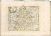
Circulus Westphalicus, Sive Germaniae Inferioris. [Karte], in: Le théâtre du monde, ou, Nouvel atlas contenant les chartes et descriptions de tous les païs de la terre, Bd. 1, S. 151.
1 Karte aus Atlas Blaeu, Willem Janszoon und Blaeu, Joan Blaeu, Willem Janszoon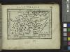
Westfalia.
from Abraham Ortelius his epitome of the theater of the worlde / nowe latlye ... renewed and augmented ... by Micheal Coignet, mathematitian of Antwarpe.
Le Cercle de Westphalie divisé en tous ses Estats et Souverainetés
1 : 760000 Mollova mapová sbírka Sanson, Guillaume Cordier, Louis Jaillot, Alexis Hubert
Le Cercle de Westphalie
1 : 600000 Mollova mapová sbírka Sanson, Guillaume Jaillot, Alexis Hubert
Circuli Westphaliae in omnes suos Status et Provincias accuratè divisi Nova et exacta Tabula
1 : 700000 Mollova mapová sbírka Homann, Johann Baptist Homann, Johann Baptista
S. R. I. Westphaliae Circulus, in omnes ejusdem subjacentes Provincias exactißimè distinctus.
1 : 690000 Mollova mapová sbírka Visscher, Nicolaes Jansz. Visscher, Nicolaus
Charte über die sæmtlichen zum Westphælischen Kreis gehörige Lænder
1 Karte : Kupferdruck ; 52 x 47 cm Güssefeld bey den Homænnischen Erben
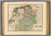
Holland und Berg
Allgemeiner Atlas [Walch, Johannes] im Verlag bei Johannes Walch
CIRCVLVS | WESTPHALICVS, | Sive | GERMANIÆ INFERIORIS.
[Amsterdam : Joan Blaeu]
Westphalia.
1 : 1000000 Lizars, Daniel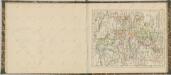
![Le Cercle De Westphalie divisé en tous ses Estats et Souverainetés [Karte], in: Atlas nouveau, contenant toutes les parties du monde [...], Bd. 1, S. 295.](https://images-2.georeferencer.com/images/iiif/774596312374/full/,300/0/native.jpg)

