Mappa catalogata
n/a


Titolo completo:n/a
Anno di illustrazione:1799
Data di pubblicazione:1799
Dimensione fisica:20 x 30 cm
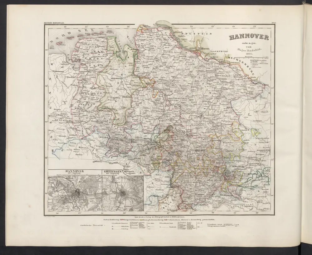
Hannover
1860
Meyer, J.
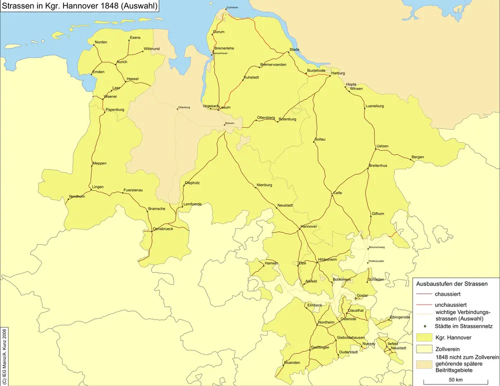
Straßen im Königreich Hannover 1848 (Auswahl)
1848
Kunz, Andreas ; Treiling, Thomas
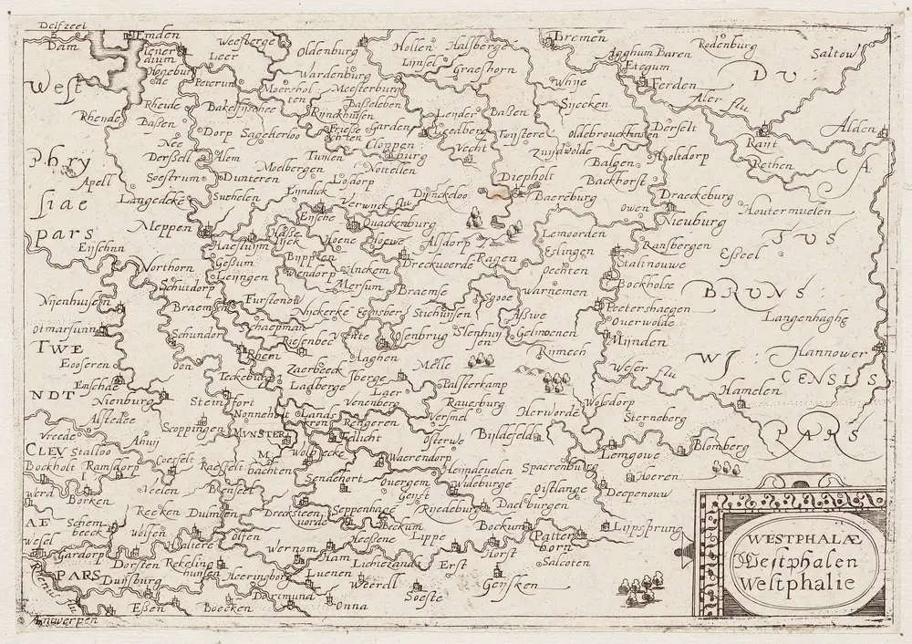
Westphaliae = Westphalen = Westfalie
1650
[S.l. : s.n.]
1:1m
n/a
1791
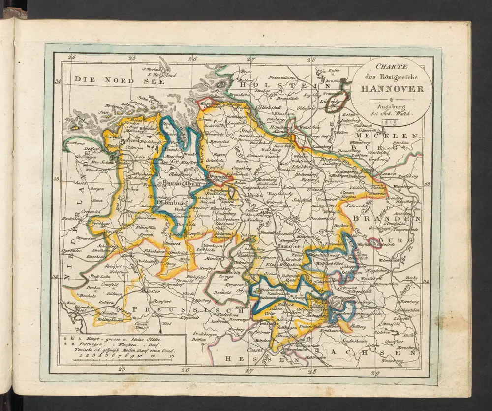
Charte des Königreichs Hannover
1819
Walch, Johann
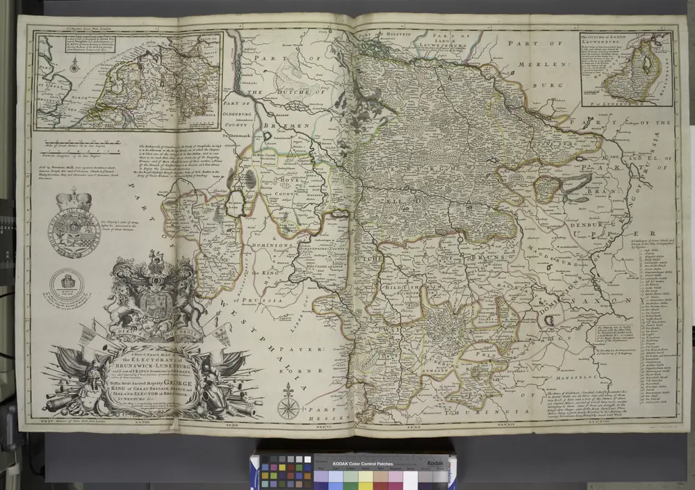
A new & exact map of the electorat of Brunswick-Lunenburg and ye rest of ye Kings Dominions in Germany.
1736
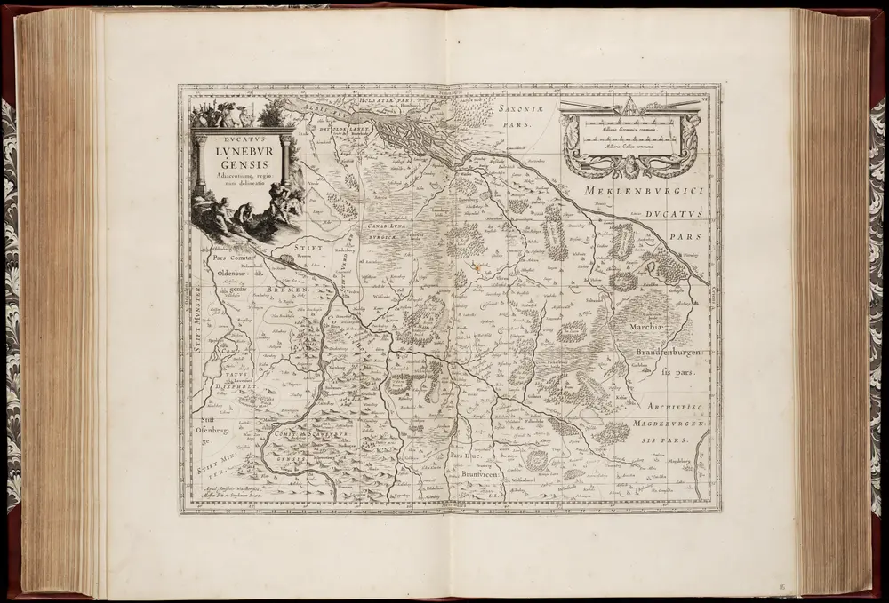
Dvcatvs Lvnebvrgensis : adiacentiumque regionum delineatio / auctor J. van den Aveele
1680
Johannes Janssonius van Waesberge -1681?; Moses Pitt ca. 1654-1696; Stephanus Swart
1:2m
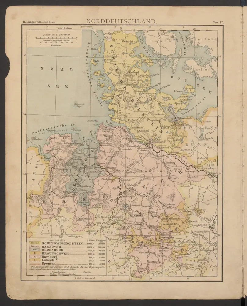
Norddeutschland
1886
Lange, Henry
Westphaliae totivs, finitimarvmqve regionvm accvrata descriptio
1579
Sgrooten; Ortelius
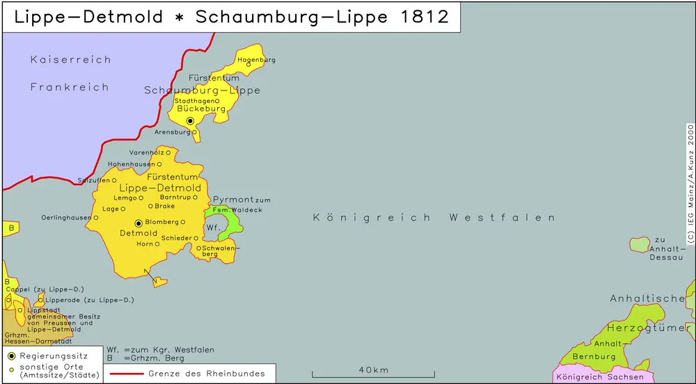
Lippe-Detmold, Schaumburg-Lippe 1812
1812
Hundt, Michael