Maps of Switzerland

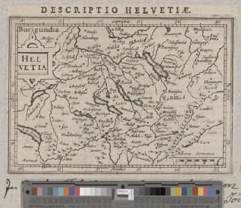
Helvetia
1 : 2700000 1 Karte [Petrus Bertius] [sumptibus et typis aeneis Iudoci Hondij], [Amsterodami]
<<Les>> Suisses, les alliés des Suisses et leurs sujets
1 Karte par N. Sanson d'Abbeville ; R. Cordier sculp. [Verlag nicht ermittelbar], [Erscheinungsort nicht ermittelbar]
Reisekarte der Schweiz
1 : 1000000 1 Karte entworfen und gezeichnet v. E. Winckelmann ; Lith. Anst. von Pobuda, Rees et Cie. Hoffmansche Verlagshandlung, Stuttgart
<<Die>> erst Tafel innhaltend das Schweytzerlandt mit anstossenden Ländern
1 : 750000 1 Karte [Sebastian Münster] [Henricpetri], [Basel]
<<Les>> Suisses, les alliés des Suisses et leurs sujets
1 Karte par N. Sanson d'Abbeville ; R. Cordier sculp. [Sanson], [Paris]
Helvetia ab antiquo pars Imperii Romano-Germanici
1 : 2100000 1 Karte [Johann Michael Franz] [Johann G. Breitkopf], [Leipzig]
Carte générale physique et routière des 22 cantons de la confédération Suisse
1 : 750000 1 Karte par A.H. Brué ; gravée sous la direction de l'auteur ; les montagnes gravées par Dandeleux Brué, Paris
Historisch-geographischer Atlas der Schweiz: Karte VI: Die Eidgenossenschaft der Acht Alten Orte beim Abschlusse des fünfzigjährigen Friedens mit Österreich
Bearbeitung: Vögelin, J. K.; Meyer von Knonau, G. Zeichnung: Ott, J. J. Lithografie: Schulthess, Friedrich (1804-1869), Leiter Buchhandlung und Druckerei, von Zürich
Charte des Gesichtskreises vom Rigi-Kulm
1 : 2710000 1 Karte H.K. [i.e. Heinrich Keller] [Heinrich Keller], [Zürich]
Historisch-geographischer Atlas der Schweiz: Karte V: Die Urschweiz oder Entstehung der Eidgenossenschaft
Bearbeitung: Vögelin, J. K.; Meyer von Knonau, G. Zeichnung: Ott, J. J. Lithografie: Schulthess, Friedrich (1804-1869), Leiter Buchhandlung und Druckerei, von Zürich
Strategische Uebersichts-Karte der Schweizerischen Eidgenossenschaft
1 : 1450000 1 Karte entworfen von [Johannes] Wieland ; gravé et dessiné par Wehrle et de Schach ; Lith. de Hurter [Schweighauser], [Basel]
<<Die>> Schweiz
1 : 1754419 1 Karte bei I. P. Spehr, Braunschweig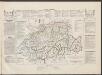
Historisch-Geographischer Atlas der Schweiz in 15 Blättern
1 : 770000 Helvetien 1218 - 1331 Voegelin, Johann Conrad ; Meyer von Knonau, Gerold ; Wyss, Georg von ; Meyer von Knonau, Gerold Schulthess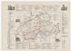
Historisch-geographischer Atlas der Schweiz: Karte XI: Politische Einteilung der zur Schweiz gehörigen Territorien im 18. Jahrhundert
Bearbeitung: Vögelin, J. K.; Meyer von Knonau, G.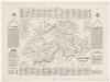
Geologische Spezialkarte des Grossherzogtums Baden, Blatt 144: Stühlingen: Karte III: Helvetien, geteilt zwischen den Deutschen Kaisern und den Königen von Klein-Burgund
Bearbeitung: Vögelin, J. K.; Meyer von Knonau, G. Zeichnung: Ott, J. J. Lithografie: Schulthess, Friedrich (1804-1869), Leiter Buchhandlung und Druckerei, von Zürich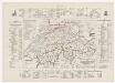
Historisch-geographischer Atlas der Schweiz: Karte IX: Die kirchliche Einteilung der Schweiz vor der Kirchentrennung
Bearbeitung: Vögelin, J. K.; Meyer von Knonau, G. Lithografie: Schulthess, Friedrich (1804-1869), Leiter Buchhandlung und Druckerei, von Zürich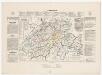
Geologische Spezialkarte des Grossherzogtums Baden, Blatt 144: Stühlingen: Karte V: Die Urschweiz oder Entstehung der Eidgenossenschaft
Bearbeitung: Vögelin, J. K.; Meyer von Knonau, G. Zeichnung: Ott, J. J. Lithografie: Schulthess, Friedrich (1804-1869), Leiter Buchhandlung und Druckerei, von Zürich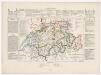
Geologische Spezialkarte des Grossherzogtums Baden, Blatt 144: Stühlingen: Karte VI: Die Eidgenossenschaft der Acht Alten Orte beim Abschlusse des fünfzigjährigen Friedens mit Österreich
Bearbeitung: Vögelin, J. K.; Meyer von Knonau, G. Zeichnung: Ott, J. J. Lithografie: Schulthess, Friedrich (1804-1869), Leiter Buchhandlung und Druckerei, von Zürich
Helvetiae, Rhetiae & Valesiae com omnibus finitimis regionibus tabula vulgo Schweitzerland
1 : 700000 1 Karte apud P. Schenk et G. Valk, Amstelodami
Carte générale de la Suisse
1 : 850000 1 Karte par Clermont 1781 ; Perrier sculp. [de l'Imprimerie de Clousier, rue Saint-Jacques], [Paris]
<<A>> new map of Swisserland
1 : 750000 1 Karte by John Cary printed for J. Cary, No. 181, Strand, London
Republick Schweiz
1 : 4000000 1 Karte [Verlag des Buchladens der Real-Schule], [Berlin]
Helvetiae, Rhetiae & Valesiae com omnibus finitimis regionibus tabula vulgo Schweitzerland
1 : 700000 1 Karte apud Ioannem Ianssonium, Amstelodami
Suisse
1 : 2500000 1 Karte by Rt. Morden [printed for Robert Morden and Thomas Cockerill?], [London]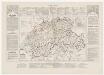
Historisch-geographischer Atlas der Schweiz: Karte VII: Die Eidgenossenschaft der Acht Alten Orte in ihrer völligen Ausbildung
Bearbeitung: Vögelin, J. K.; Meyer von Knonau, G. Lithografie: Schulthess, Friedrich (1804-1869), Leiter Buchhandlung und Druckerei, von Zürich
Switzerland and the country of the Grisons wherein is described the XIII Switz Cantons with their allies &c
1 Karte revised by I. Senex [Verlag nicht ermittelbar], [Erscheinungsort nicht ermittelbar]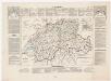
Geologische Spezialkarte des Grossherzogtums Baden, Blatt 144: Stühlingen: Karte VII: Die Eidgenossenschaft der Acht Alten Orte in ihrer völligen Ausbildung
Bearbeitung: Vögelin, J. K.; Meyer von Knonau, G. Lithografie: Schulthess, Friedrich (1804-1869), Leiter Buchhandlung und Druckerei, von Zürich.
<<Les>> 13 cantons suisses et leurs allietz
1 : 3500000 1 Karte [Alain Manesson Mallet] [in verlegung Johann David Zunners], [Franckfurt am Mayn]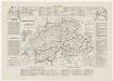
Historisch-geographischer Atlas der Schweiz: Karte VIII: Die Eidgenossenschaft der Dreizehn Alten Orte zur Zeit der Anerkennung ihrer Unabhängigkeit durch den Westfälischen Frieden
Bearbeitung: Vögelin, J. K.; Meyer von Knonau, G. Lithografie: Schulthess, Friedrich (1804-1869), Leiter Buchhandlung und Druckerei, von Zürich