Maps of Auvergne-Rhône-Alpes
Kriegstheater oder Grænzkarte zwischen Frankreich und Italien
1 Karte : Kupferdruck ; 47 x 68 cm Müller; Artaria zufinden bey Artaria Compagnie
Kriegstheater oder Graenzkarte zwischen Frankreich und Italien
1 : 1025000 Francie jihovýchodní
Kriegstheater oder Graenzkarte zwischen Frankreich und Italien
1 : 1025000 Francie jihovýchodní Müller, Franz Artaria
Kriegstheater oder Grænzkarte zwischen Frankreich und Italien
1 Karte : Kupferdruck ; 48 x 58 cm Walch; Will zu haben bey Ioh. Walch im Willischen Kunstverlag
France.
1 : 4400000 Vivien de St Martin, L.
Les royau.mes de Bourgogne, et d'Arles
1 Karte : Kupferdruck ; 39 x 49 cm, Bildgrösse 40 x 56 cm Duval chez l'auteur en l'isle du Palais sur le quay de l'Orloge au coin de la rüe de Harlay
Savoy.
from A new systeme of the mathematicks: containing I. Arithmetick, as well natural and decimal, as in species, or the principles of algebra. II. Practical geometry, together with the first six books of Euclid's Elements, as also the eleventh and twelfth, symbo
Vorstellvng des Weges den Hannibal genom[m]en durch Gallien und über die Alpen bis in Italien
1 : 2650000 Alpy Baumgarten, Siegmund Jakob Glasser, I. F. Johann Justinus Gebauer
Das Festland Sardinien
Carte de la France, 4
1 Blatt : 61 x 83 cm de Belleyme
France
Carte de la France, 4
1 Blatt : mehrfarbig ; 61 x 82 cm de Belleyme
Frankreich In 4 Blattern, Blatt 4.
1 : 1500000 Vogel, C.
Théatre de la guerre en Italie ou le cours du Rhone
1 Karte : Kupferdruck ; 54 x 68 cm Poirson; Jean; Macquet; Tardieu chez Jean M.d d'estampes rue S. Jean de Beauvais n.o 4
Théatre de la guerre en Italie ou le cours du Rhone
1 Karte : Kupferdruck ; 54 x 68 cm Poirson; Jean; Macquet; Tardieu chez Jean M.d d'estampes rue S. Jean de Beauvais n.o 4
[Frankreich, Blatt 4]
Adolf Stieler's Handatlas über alle Theile der Erde und über das Weltgebäude Stieler, Adolf Justus Perthes
[Frankreich in 4 Blättern, Blatt 4]
Handatlas über alle Theile der Erde und über das Weltgebäude Stieler, Adolf Justus Perthes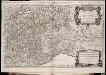
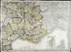
Les montagnes des Alpes ou sont remarqués les passages de France en Italie, le Duché de Milan, et les estats du duc de Savoye &c. / dressé sur les memoires les plus nouveaux par le Sr. Sanson ...
1 : 600000 Annotatie: Titel boven de kaart: Les montagnes des Alpes, ou sont remarqués les passages de France en Italie, le Duché de Milan, et les estats du duc de Savoye qui cõpreñent le Duché de Savoye et la Principauté de Piemont, &c; Avec privilège du Roy, pour 20 ans, 1676; Origineel is Blad 152 in atlas factice; Annotatie geografische gegevens: Met 6 schaalstokken A Paris : chez H. Iaillot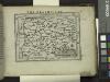
Delphinatus.
from Abraham Ortelius his epitome of the theater of the worlde / nowe latlye ... renewed and augmented ... by Micheal Coignet, mathematitian of Antwarpe.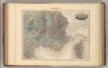
France S.E.
1 : 1615000 Migeon, J.
Carte de la France, 4
1 Blatt : 61 x 83 cm de Belleyme
Strassen-Karte der westlichen Alpen
1 : 700000 Západní Alpy Oesterreichischen Generalquartiermeisterstabs
Strassen-Karte der westlichen Alpen
1 : 700000 Západní Alpy K. u. k. Militärgeographisches Institut
Strassen-Karte der westlichen Alpen
1 : 700000 Západní Alpy K. u. k. Militärgeographisches Institut
Carte de la Savoie ou supplément a la carte des frontières de la République française
1 Karte auf 2 Blättern : Kupferdruck ; 67 x 58 cm Delamarche; Dien; Goujon chez l'auteur rue du Foin St. Jacques
Geognostische Karte der Alpen in Savoyen und der Schweitz in einem Theile von Deutschland, Frankreich, Piemont und der Lombardei
1 : 1300000 1 Karte gez. von F. Schoedinger ; gest. von J. Scheurman [Orell, Füssli und Compagnie], [Zürich]
Galliæ antiquæ descriptio geographica, 4
1 Blatt : 42 x 57 cm s.n.
Geognostische Karte der Alpen in Savoyen und der Schweitz in einem Theile von Deutschland, Frankreich, Piemont und der Lombardei
1 : 1300000 1 Karte gez. von F. Schoedinger ; gest. von J. Scheurmann [Orell, Füssli und Compagnie?], [Zürich?]


