Carte cataloguée
Les montagnes des Alpes ou sont remarqués les passages de France en Italie, le Duché de Milan, et les estats du duc de Savoye &c. / dressé sur les memoires les plus nouveaux par le Sr. Sanson ...


Titre complet:Les montagnes des Alpes ou sont remarqués les passages de France en Italie, le Duché de Milan, et les estats du duc de Savoye &c. / dressé sur les memoires les plus nouveaux par le Sr. Sanson ...
Année de l'image:1676
Éditeur:A Paris : chez H. Iaillot
Taille physique:20 x 30 cm
Échelle de la carte:1:600 000
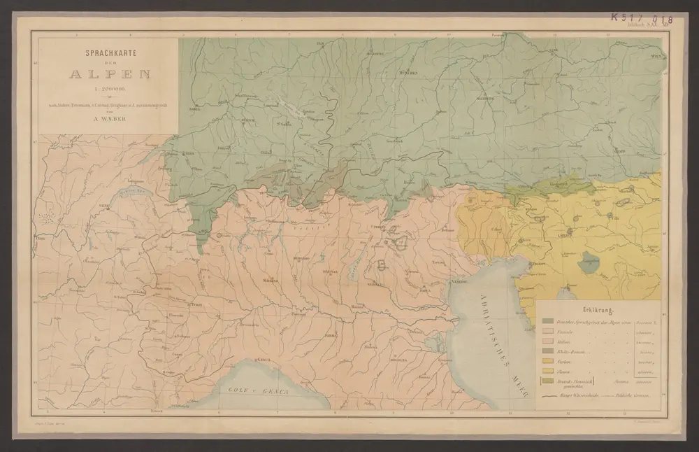
Sprachkarte der Alpen
1879
Wäber, Adolf ; Leuzinger, Rudolf
1:2m
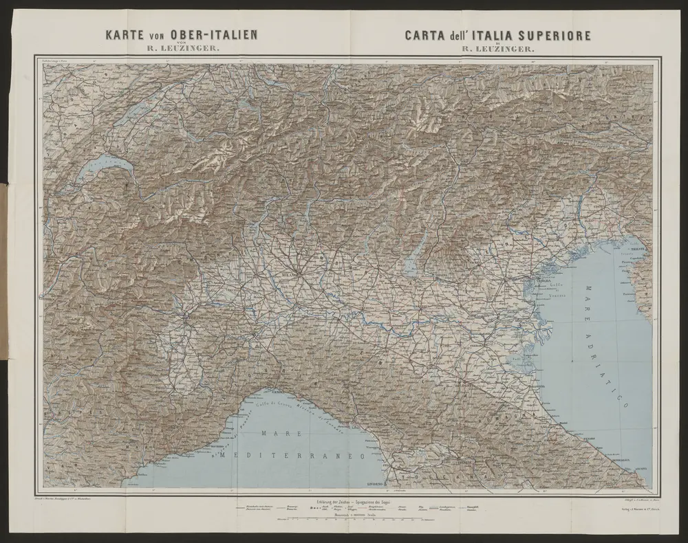
Karte von Ober-Italien
1888
Leuzinger, Rudolf
1:900k
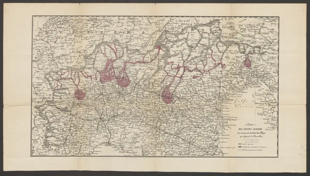
Carte des anciens glagiers [i.e. glaciers] du versant italien des Alpes
1860
Mortillet, Gabriel de
1:1m
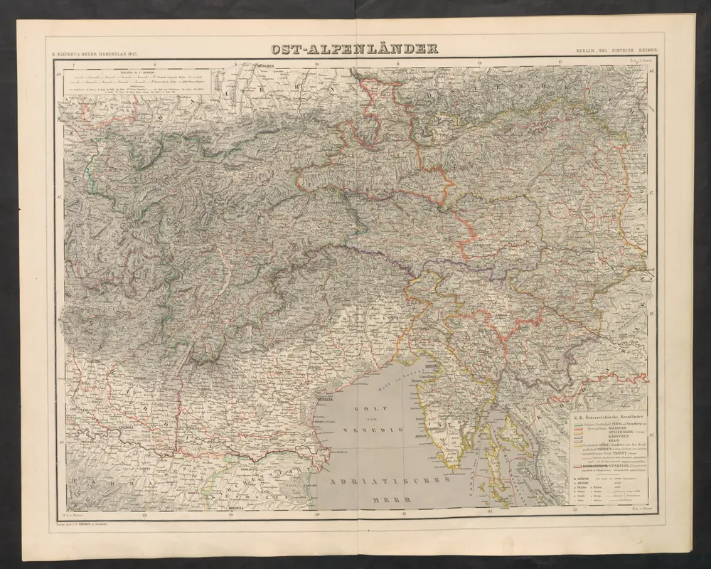
Ost-Alpenländer
1860
Kiepert, Heinrich
Théatre de la guerre actuelle, en Allemagne, en Pologne et en Turquie. n17, Lac de Constance et Venise
1807
Chanlaire, Pierre Grégoire 1758-1817
1:900k
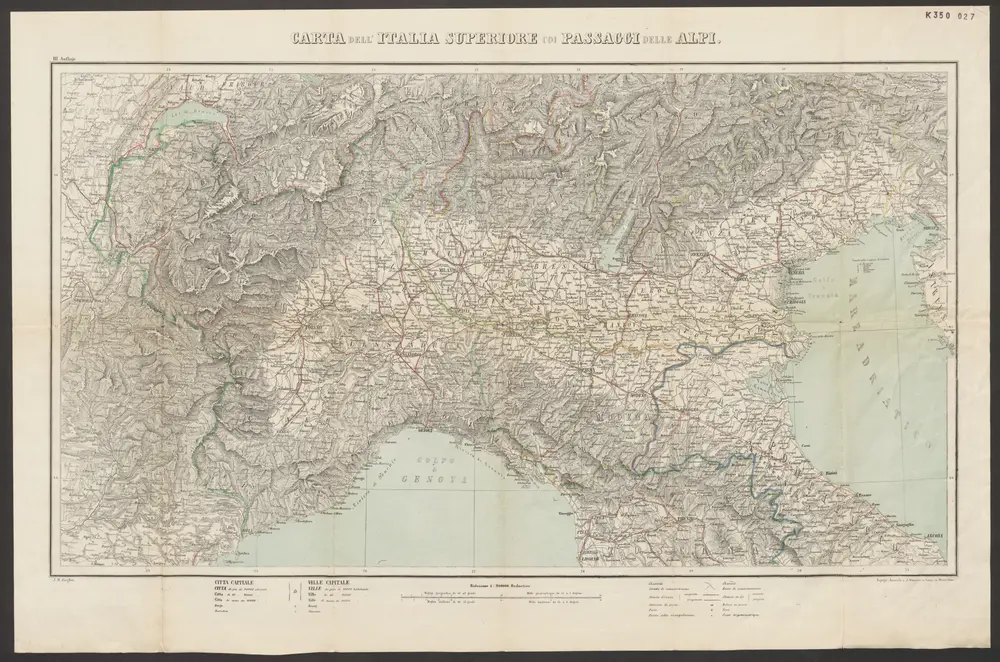
Carta dell'Italia superiore coi passaggi delle Alpi
1870
J. Wurster
1:90k
Kärnten, Krain, Steiermark, Tirol und Vorarberg
1895
F.A. Brockhaus' geogr.-artist. Anstalt
1:2m
Korutany, Krajina, Salcbursko, Štýrsko, Tyrolsko a Vorarlbersko
1900
Köb, Kajetano
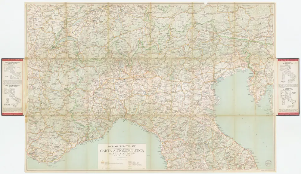
[Kaart], uit: Carta automobilistica alla scala di 1:650.000. [Italia del Nord], foglio 1 / Touring Club Italiano
1950
Touring Club Italiano
1:650k
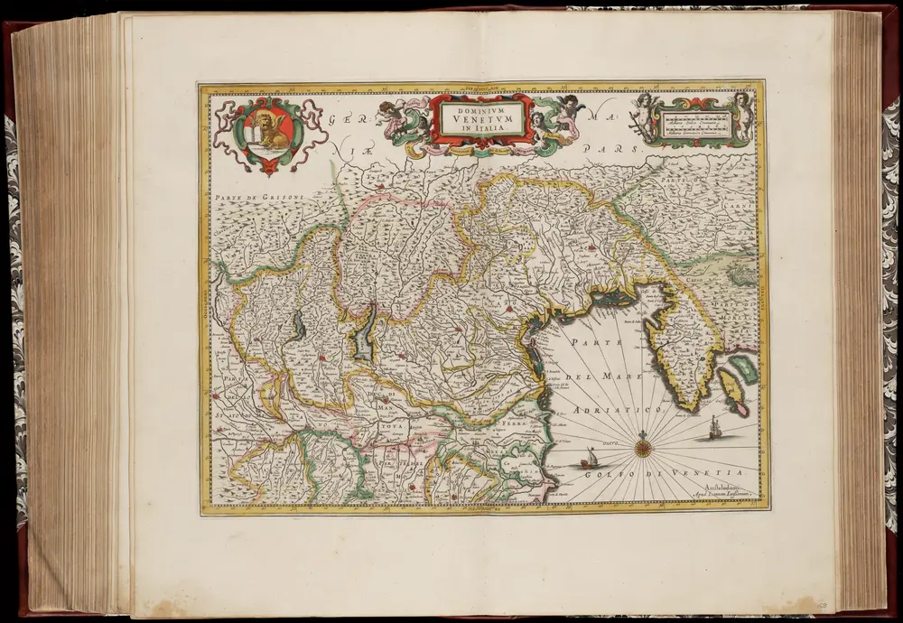
Dominivm Venetvm in Italia
1647
Amstelodami : Apud Ioannem Ianssonium
1:850k