Maps of Vaud

Atlas der alten Eidgenossenschaft in 20 Karten: Republik Genf sowie Genferseeregion
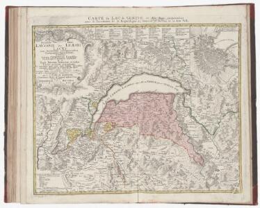
Originaltitel: Carte du Lac de Geneve et des Pays circonvoisins avec le Territoire de la République de Geneve et du Plan de la ditte Ville. Mit Erklärung der Zeichen und Nebenkarte der Stadt Genf. Bearbeitung: Rizzi Zannoni, Joh. Ant., Professor der Mathematik und Geografie Herausgeber: Homännische Erben
Atlas novus Reipublicae Helveticae
1 Atlas ([40] Bl., 97 S.) bey Orell, Gessner und Compagnie, Zürich
Schulwandkarte zur Geschichte der Schweiz
1 : 180000 Südwest-Blatt Oechsli, Wilhelm ; Baldamus, Alfred Kartograph. Verlagsanstalt von Georg Lang
Schulwandkarte zur Geschichte der Schweiz
1 : 180000 1 Karte auf 6 Bl. bearbeitet v. W. Oechsli u. A. Baldamus ; gezeichnet von Ed. Gaebler Kartograph. Verlagsanstalt von Georg Lang, Leipzig
Wandkarte der Schweiz
1 : 200000 1 Karte auf 8 Blättern J.M. Ziegler Wurster, Winterthur
Officielle Eisenbahn-Karte der Schweiz
1 : 250000 Südwest-Blatt [s.n.]
Taschen-Atlas der Schweiz
1 Atlas (25 S., 20 Taf.) gezeichnet und gestochen von Emil Wagner = Atlas de poche de la Suisse : 26 cartes en couleurs / dessinées et gravées par Émile Wagner Eggimann, Genf
Atlas de la Suisse
1 : 450000 1 Atlas (19 Bl.) dessiné par MM. H. Keller, Scheurmann, Pfyffer d'Altishofen, Osterwald, etc. ; gravé par M. Scheurmann Orell Füssli & Co., Zürich
Atlas der Schweiz
1 : 450000 1 Atlas (18 Bl.) gez. u. gest. v. J. Scheurmann Orell Fussli, Zurich
Nova Helvetiae tabula geographica illustrissimis et potentissimis cantonibus et rebuspublicis reformatae religionis Tigurinae, Bernensi, Glaronensi, Basiliensi, Scaphusianae, Abbatis Cellanae
1 : 230000 1 Karte auf 4 Bl. dominis suis clementissimis humillime dicata a Ioh. Iacobo Scheuchzero Tigurino ; Ioh. Melch. Füsslin ornamenta pinx. ; Ioh. Henr. Huber et Eman. Schalch sculps. [Hofmeister], [Zürich]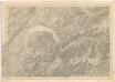
Karte der Schweiz... Blatt III.

<<Le>> canton de Vaud
1 : 390000 1 Karte dessiné par H. Keller ; gravé par J.J. Scheurmann [Orell Fussli et Comp.], [Zurich]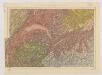
Carte du phénomène erratique et des anciens glaciers du versant nord des Alpes Suisses et de la chaîne du Mont-Blanc
1 : 250000 Südwest-Blatt Favre, Alphonse Imp. par l'Etabl. topogr. de Wurster, Randegger et Cie.
Lausanne
1 : 200000 1 Karte entworfen und bearbeitet von Woerl ; in Stein gestochen unter seiner Leitung 1835 ; Lithographie von B. Herder Herder, Freiburg im Breisgau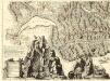
Nova Helvetiae Tabula Geographica
1 : 290000 Mollova mapová sbírka Scheuchzer, Johann Jakob Huber, Johann Heinrich Scheuchzer, Johann Jakob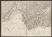
Officielle Eisenbahn-Karte der Schweiz
1 : 250000 Südwest-Blatt Müllhaupt, Hans Heinrich [Eidg. Stabsbureau]
Distanzenkarte von der Schweiz
1 : 200000 1 Karte in 8 Teilen nach den besten Hülfsquellen bearb. von R. Huber Wagner, Bern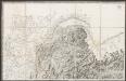
[Hochsavoyen]
1 : 250000 Lecocq, A. [Stato Maggiore]
Les Suisses Leurs Alliés et Leurs Suiets]
1 : 250000 Mollova mapová sbírka Jaillot, Alexis-Hubert Jaillot, Alexis Hubert
Verbigenus Pagus in Helvetiis Partie du Witlispurgergow en Suisse et dans l'Evesché de Lausanne.
1 : 240000 Mollova mapová sbírka Sanson, Nicolas Somer, Jean Pruthenus Sanson, Nicolas
Postkarte der schweizerischen Eidgenossenschaft
1 : 300000 Südwest-Blatt Dufour, Guillaume Henri ; Stengel, Johann Rudolf ; Mohr, Ernst Rudolf Wurster
Carte des cantons de Genève, Vaud, Neuchâtel et Fribourg
1 : 250000 1 Karte Topogr. Anstalt von Wurster, Randegger und Co. Wurster, Zürich
<<Le>> canton de Vaud
1 : 390000 1 Karte dessiné par H. Keller ; gravé par J.J. Scheurmann Orell Fussli et Comp., Zurich
<<Le>> canton de Vaud
1 : 390000 1 Karte dessiné par H. Keller ; gravé par J.J. Scheurmann Orell Fussli et Comp., Zurich
<<Le>> canton de Vaud
1 : 390000 1 Karte dessiné par H. Keller ; gravé par J.J. Scheurmann Orell Fussli & Comp., Zurich
<<Le>> canton de Vaud
1 : 390000 1 Karte dessiné par H. Keller ; gravé par J.J. Scheurmann Orell Fussli & Comp., Zurich
<<Le>> canton de Vaud
1 : 390000 1 Karte dessiné par H. Keller ; gravé par J.J. Scheurmann Orell Fussli & Comp., Zurich
Carte d'une partie des cantons de Berne de Fribourg du païs de Veau et du Valais &c
1 Blatt : Covens et Mortier
Nova Helvetiae tabula geographica, 3
1 Blatt : Pieter Schenk