Maps of Radhošť
Katastrální mapa pro obec Radhošť
1 : 2880
Katastrální mapa pro obec Týníšťko
1 : 2880
Indikační skica mapy stabilního katastru pro obec Týníšťko IV
1 : 2880
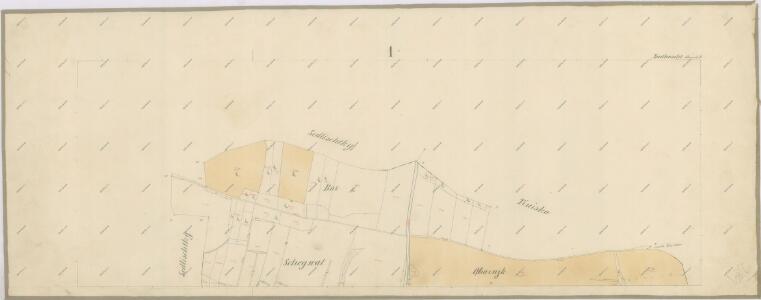
Sedlischtky - c6805-1-002 - Kaiserpflichtexemplar der Landkarten des stabilen Katasters
1 : 2880
Sedlischtky - c6805-1-001 - Kaiserpflichtexemplar der Landkarten des stabilen Katasters
1 : 2880
Mapa pozemků a drenáže vrchnostenského dvora v Radhošti
1 : 2880
Indikační skica mapy stabilního katastru pro obec Trusnov a osadu Žíku
1 : 2880
Radhoscht (Radhosst) - c6342-1-002 - Kaiserpflichtexemplar der Landkarten des stabilen Katasters
1 : 2880
Radhoscht (Radhosst) - c6342-1-001 - Kaiserpflichtexemplar der Landkarten des stabilen Katasters
1 : 2880
Tinisko - c8158-1-001 - Kaiserpflichtexemplar der Landkarten des stabilen Katasters
1 : 2880
Tinisko - c8158-1-002 - Kaiserpflichtexemplar der Landkarten des stabilen Katasters
1 : 2880
Tinisko - c8158-1-003 - Kaiserpflichtexemplar der Landkarten des stabilen Katasters
1 : 2880
Tinisko - c8158-1-004 - Kaiserpflichtexemplar der Landkarten des stabilen Katasters
1 : 2880
Trusnow - c8006-1-001 - Kaiserpflichtexemplar der Landkarten des stabilen Katasters
1 : 2880
Trusnow - c8006-1-003 - Kaiserpflichtexemplar der Landkarten des stabilen Katasters
1 : 2880
Trusnow - c8006-1-004 - Kaiserpflichtexemplar der Landkarten des stabilen Katasters
1 : 2880
Trusnow - c8006-1-002 - Kaiserpflichtexemplar der Landkarten des stabilen Katasters
1 : 2880
Indikační skica mapy stabilního katastru pro obec Týníšťko VI
1 : 2880
Mapa rozparcelovaných pozemků vrchnostenského dvora v Radhošti
1 : 3000
Porostní mapa polesí Uhersko
1 : 10000
Mapa polesí Uhersko - sever
1 : 10000
Mapa polesí Uhersko
1 : 10000
Mapa pozemků vrchnostenského dvora Malejov na chroustovickém panství
1 : 2880
Indikační skica mapy stabilního katastru pro obec Týníšťko
1 : 2880
Katastrální mapa pro obec Týníšťko
1 : 2880

Domäne Daschitz
1 : 57600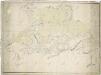
Mapa tzv. Horních revírů (albrechtický, bělečský, holický, hrádecký, chvojenecký a vysocký)
1 : 13500
Rychnov n. Kněž
1 : 75000 Rychnov nad Kněžnou (Česko : oblast) Vojenský zeměpisný ústav