Maps of Dolní Roveň

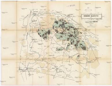
Domäne Daschitz
1 : 57600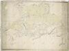
Mapa tzv. Horních revírů (albrechtický, bělečský, holický, hrádecký, chvojenecký a vysocký)
1 : 13500

Reichenau und Tyništ
1 : 75000 Choceň (Česko : oblast) Fenzl K. u. k. militär-geographisches Institut
Reichenau und Tyništ
1 : 75000 Choceň (Česko : oblast) Fenzl K. u. k. Militärgeographisches Institut
Reichenau und Tyništ
1 : 75000 Rychnov nad Kněžnou (Česko : oblast) K. u. k. Militärgeographisches Institut
Rychnov n. Kněž
1 : 75000 Choceň (Česko : oblast) Vojenský zeměpisný ústav
Rychnov n. Kněž
1 : 75000 Rychnov nad Kněžnou (Česko : oblast) Vojenský zeměpisný ústav
III. vojenské mapování 3956
1 : 75000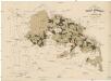
Uibersichtskarte der Daschitzer Domänenforste 1871
Dašice-oblast (Česko) Le-Monnier, Franz von Šafařík, Pavel Josef Verlag des böhm. Forst Vereins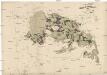
Uibersichtskarte der Daschitzer Domänenforste 1871
Dašice-oblast (Česko) Le-Monnier, Franz von Šafařík, Pavel Josef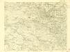
III. vojenské mapování 3956/3
1 : 25000
III. vojenské mapování 3956/3
1 : 25000
Mapa politického okresu Pardubického

Gradkartenblatt
1 : 25000 Třebechovice pod Orebem-oblast (Česko) Böhm, Karl
Gradkartenblatt
1 : 25000 Holice-oblast (Pardubice, Česko) Böhm, Karl
III. vojenské mapování 3956/1
1 : 25000

Přehlední [sic] mapa lesního majetku král. věnného města Hradce Králové
Hradec Králové-oblast (Česko) Rotter, Ottomar Renard
Indikační skica mapy stabilního katastru pro obec Vysoké Chvojno I.-XI.
1 : 2880
Mapa revíru Vysoké Chvojno
1 : 800
Regni Bohemiae circulus Reginohradecensis
1 : 165000 Hradec Králové-oblast (Česko) Hauer, Daniel Adam ab Homannianis Heredibus
Regni Bohemiae Circulus Reginohradecensis
1 : 165000 Hradec Králové (Česko : oblast) Müller, Johann Christoph Hauer, Daniel Adam in lucem editus ab Homannianis Heredibus
Regni Bohemiae circulus Reginohradecensis
1 : 165000 Hradec Králové-oblast (Česko) Hauer, Daniel Adam ab Homannianis Heredibus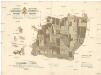
Lesy králov. věnného města Hradce Králové
Hradec Králové (Česko) Strachota, Josef Tykal, Josef
Mapa revíru Holice
1 : 10000
Mapa rybníka Jezero a jeho severního okolí
1 : 10000
Mapa revíru Chvojenec
1 : 6000
Indikační skica mapy stabilního katastru pro obec Čeperka I.-X.
1 : 2880