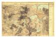
Maps of Bezirk Gmünd

Holičky o. Jindřichův Hradec 1
1 : 2880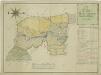
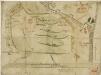
Geometrický plán pozemků jednotáře Holického a okolí

Mapy činžovních pozemků III. sekce třeboňského velkostatku pro obce: Branná, Břilice, Domanín, Herda, Holičky, Kojákovice, Spolí, Třeboň 1

kopie-Hospodářská mapa polesí Zámecký 1
1 : 5760
Porostní mapa polesí Zámecké 1
1 : 10000
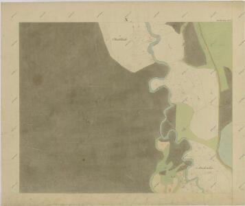
Mapa části povodí Nové Řeky a rybníka Vdovec

Hospodářská mapa polesí Zámecký 1

Hospodářská mapa polesí Zámecký 1
1 : 5760
Mapy činžovních pozemků III. sekce třeboňského velkostatku pro obce: Branná, Břilice, Domanín, Herda, Holičky, Kojákovice, Spolí 1

Hollitzky - c1966-1-007 - Kaiserpflichtexemplar der Landkarten des stabilen Katasters
1 : 2880
Hollitzky - c1966-1-013 - Kaiserpflichtexemplar der Landkarten des stabilen Katasters
1 : 2880
Hollitzky - c1966-1-001 - Kaiserpflichtexemplar der Landkarten des stabilen Katasters
1 : 2880
Hollitzky - c1966-1-005 - Kaiserpflichtexemplar der Landkarten des stabilen Katasters
1 : 2880
Hollitzky - c1966-1-008 - Kaiserpflichtexemplar der Landkarten des stabilen Katasters
1 : 2880
Hollitzky - c1966-1-010 - Kaiserpflichtexemplar der Landkarten des stabilen Katasters
1 : 2880
Hollitzky - c1966-1-009 - Kaiserpflichtexemplar der Landkarten des stabilen Katasters
1 : 2880
Hollitzky - c1966-1-006 - Kaiserpflichtexemplar der Landkarten des stabilen Katasters
1 : 2880
Hollitzky - c1966-1-002 - Kaiserpflichtexemplar der Landkarten des stabilen Katasters
1 : 2880
Hollitzky - c1966-1-004 - Kaiserpflichtexemplar der Landkarten des stabilen Katasters
1 : 2880
Hollitzky - c1966-1-012 - Kaiserpflichtexemplar der Landkarten des stabilen Katasters
1 : 2880
Hollitzky - c1966-1-003 - Kaiserpflichtexemplar der Landkarten des stabilen Katasters
1 : 2880
Hollitzky - c1966-1-011 - Kaiserpflichtexemplar der Landkarten des stabilen Katasters
1 : 2880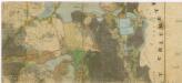
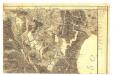
Administrativní mapa třeboňského panství se statky Bzí,Lomnice, Borovany,Hamr a Val 1

Půdní a těžební plán polesí Cep a Zámecký s vyznačením trasy exkurze České lesnické jednoty absolvované v roce 1863 1

Boden- & Hauungsplan-Karte der zur hochfürstlich Schwarzenbergschen Domaine gehörigen Wittingau Waldungen des Ceper u. Schloss Reviers
1 : 28600 Třeboň-oblast (Česko) Kaizl, Rud.
Půdní a těžební plán polesí Cep a Zámecký s vyznačením trasy exkurze české lesnické jednoty absolvované v r. 1863 1
1 : 2800