Maps of Třeboň

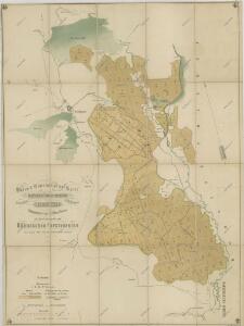
Půdní a těžební plán polesí Cep a Zámecký s vyznačením trasy exkurze české lesnické jednoty absolvované v r. 1863 1
1 : 2800
Boden- & Hauungsplan-Karte der zur hochfürstlich Schwarzenbergschen Domaine gehörigen Wittingau Waldungen des Ceper u. Schloss Reviers
1 : 28600 Třeboň-oblast (Česko) Kaizl, Rud.
Půdní a těžební plán polesí Cep a Zámecký s vyznačením trasy exkurze České lesnické jednoty absolvované v roce 1863 1
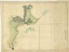
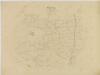
Plán rybníka a luk u Cepu

Porostní mapa polesí Cep 1

Přehledná mapa polesí Cep

Porostní mapa polesí Cep 1

Geometrický plán vrchnostenských lesů v polesí Cep
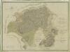
Přehledná mapa polesí Cep

Přehledná mapa polesí Cep

Geometrický plán polesí Cep

Porostní mapa polesí Cep 1
Přehledná hospodářská mapa velkostatku Třeboň 1
1 : 11250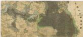
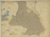
Administrativní mapa třeboňského panství se statky Bzí,Lomnice, Borovany,Hamr a Val 1
Porostní obrysová mapa polesí Cep 1
1 : 15000
Mapa lesních cest v polesí Cep 1
1 : 15000
Porostní mapa polesí Cep 1
1 : 15000
Porostní mapa polesí Cep 1
1 : 15000
Porostní obrysová mapa polesí Cep 1
1 : 15000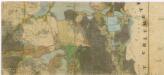
Administrativní mapa třeboňského panství se statky Bzí,Lomnice, Borovany,Hamr a Val 1

Porostní mapa polesí Cep 1
1 : 10000
Porostní mapa polesí Cep 1
1 : 15000
Porostní mapa polesí Cep s číselným vyznačením věkových tříd 1
1 : 10000
Porostní mapa polesí Cep 1
1 : 10000
Porostní mapa polesí Cep 1
1 : 10000
Porostní mapa polesí Cep 1
1 : 15000
Porostní mapa polesí Cep 1
1 : 10000
Mapa lesních cest v polesí Cep 1
1 : 10000