Maps of Chlum u Třeboně
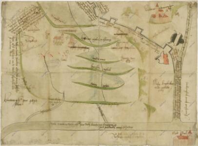
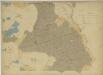
Mapa krajířovských rybníků na Chlumecku a hranic mezi panstvím chlumeckým a ličovským

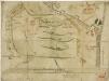
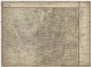
[Mapový list]
1 : 25000 Suchdol nad Lužnicí-oblast (Česko) Zeměpisný ústav ministerstva vnitra
[Mapový list]
1 : 25000 Suchdol nad Lužnicí-oblast (Česko) Vojenský zeměpisný ústav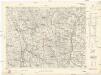
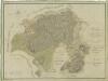
[Gradkartenblatt]
1 : 25000 Suchdol nad Lužnicí-oblast (Česko) Kartographisches Institut
Podrobné mapy zemí Koruny české v měřítku 1:75.000 a mapy vzdáleností všech míst při silnici ležících
1 : 75000 Suchdol nad Lužnicí (Česko : oblast) Bělohlav, Josef F. Topič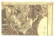
Gradkartenblatt
1 : 25000 Chlum u Třeboně-oblast (Česko) Catinelli, Maximilian von
Půdní a těžební plán polesí Cep a Zámecký s vyznačením trasy exkurze České lesnické jednoty absolvované v roce 1863 1

Půdní a těžební plán polesí Cep a Zámecký s vyznačením trasy exkurze české lesnické jednoty absolvované v r. 1863 1
1 : 2800
Boden- & Hauungsplan-Karte der zur hochfürstlich Schwarzenbergschen Domaine gehörigen Wittingau Waldungen des Ceper u. Schloss Reviers
1 : 28600 Třeboň-oblast (Česko) Kaizl, Rud.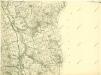
III. vojenské mapování 4454/1
1 : 25000
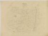
Geometrický plán vrchnostenských lesů v polesí Cep

Porostní mapa polesí Cep 1

Porostní mapa polesí Cep 1
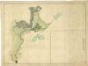
Plán rybníka a luk u Cepu

Geometrický plán polesí Cep

Přehledná mapa polesí Cep
Přehledná mapa polesí Cep

Přehledná mapa polesí Cep

Porostní mapa polesí Cep 1

Mapy činžovních pozemků obce Herda, spadající do III. sekce třeboňského velkostatku 1

Generální mapa panství Třeboň a inkorporovaných statků Bzí, Lomnice, Borovany, Třeboň, Hamr a Val 1
Přehledná hospodářská mapa velkostatku Třeboň 1
1 : 11250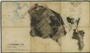
Porostní mapa polesí Zámecké 1
Porostní obrysová mapa polesí Cep 1
1 : 15000
Hollitzky - c1966-1-007 - Kaiserpflichtexemplar der Landkarten des stabilen Katasters
1 : 2880
Hollitzky - c1966-1-013 - Kaiserpflichtexemplar der Landkarten des stabilen Katasters
1 : 2880
Hollitzky - c1966-1-001 - Kaiserpflichtexemplar der Landkarten des stabilen Katasters
1 : 2880
Hollitzky - c1966-1-005 - Kaiserpflichtexemplar der Landkarten des stabilen Katasters
1 : 2880
Hollitzky - c1966-1-008 - Kaiserpflichtexemplar der Landkarten des stabilen Katasters
1 : 2880
Hollitzky - c1966-1-010 - Kaiserpflichtexemplar der Landkarten des stabilen Katasters
1 : 2880
Hollitzky - c1966-1-009 - Kaiserpflichtexemplar der Landkarten des stabilen Katasters
1 : 2880
Hollitzky - c1966-1-006 - Kaiserpflichtexemplar der Landkarten des stabilen Katasters
1 : 2880
Hollitzky - c1966-1-002 - Kaiserpflichtexemplar der Landkarten des stabilen Katasters
1 : 2880
Hollitzky - c1966-1-004 - Kaiserpflichtexemplar der Landkarten des stabilen Katasters
1 : 2880
Hollitzky - c1966-1-012 - Kaiserpflichtexemplar der Landkarten des stabilen Katasters
1 : 2880
Hollitzky - c1966-1-003 - Kaiserpflichtexemplar der Landkarten des stabilen Katasters
1 : 2880