Maps of Pochvalov

Hospodářská mapa polesí Třeboc, list 7 1
1 : 2880
Hospodářská mapa polesí Třeboc, list 6 1
1 : 2880
Hraniční mapa lesních parcel v katastru obce Břínkov, list 3 1
1 : 2880
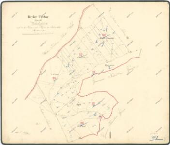
Pochwalow - c5962-1-001 - Kaiserpflichtexemplar der Landkarten des stabilen Katasters
1 : 2880
Pochwalow - c5962-1-002 - Kaiserpflichtexemplar der Landkarten des stabilen Katasters
1 : 2880
Pochwalow - c5962-1-003 - Kaiserpflichtexemplar der Landkarten des stabilen Katasters
1 : 2880
Pochwalow - c5962-1-004 - Kaiserpflichtexemplar der Landkarten des stabilen Katasters
1 : 2880
Unter Rotschow (Področow) - c1374-1-001 - Kaiserpflichtexemplar der Landkarten des stabilen Katasters
1 : 2880
Kopie katastrální mapy obce Třeboc z roku 1841, list XII 1

Porostní mapa polesí Třeboc 1

Porostní mapa polesí Třeboc 1

Porostní mapa polesí Třeboc 1

Ober Rotschow (Hornj Ročow) - c2133-1-003 - Kaiserpflichtexemplar der Landkarten des stabilen Katasters
1 : 2880
Ober Rotschow (Hornj Ročow) - c2133-1-004 - Kaiserpflichtexemplar der Landkarten des stabilen Katasters
1 : 2880
Ober Rotschow (Hornj Ročow) - c2133-1-001 - Kaiserpflichtexemplar der Landkarten des stabilen Katasters
1 : 2880
Ober Rotschow (Hornj Ročow) - c2133-1-002 - Kaiserpflichtexemplar der Landkarten des stabilen Katasters
1 : 2880
Trzebotz (Třeboc) - c8039-1-003 - Kaiserpflichtexemplar der Landkarten des stabilen Katasters
1 : 2880
Trzebotz (Třeboc) - c8039-1-006 - Kaiserpflichtexemplar der Landkarten des stabilen Katasters
1 : 2880
Trzebotz (Třeboc) - c8039-1-002 - Kaiserpflichtexemplar der Landkarten des stabilen Katasters
1 : 2880
Trzebotz (Třeboc) - c8039-1-007 - Kaiserpflichtexemplar der Landkarten des stabilen Katasters
1 : 2880
Trzebotz (Třeboc) - c8039-1-005 - Kaiserpflichtexemplar der Landkarten des stabilen Katasters
1 : 2880
Trzebotz (Třeboc) - c8039-1-001 - Kaiserpflichtexemplar der Landkarten des stabilen Katasters
1 : 2880
Trzebotz (Třeboc) - c8039-1-004 - Kaiserpflichtexemplar der Landkarten des stabilen Katasters
1 : 2880
Hospodářská mapa polesí Třeboc, list 7 1
1 : 2880
Hospodářská mapa polesí Třeboc, list 4 1
1 : 2880
Hospodářská mapa polesí Třeboc, list 5 1
1 : 2880
Kopie katastrální mapy obce Kozojedy, list VI 1

Mapa polesí Třeboc, Obora, Přerubenice 1
1 : 20000
Přehledná mapa lesů lesního okrsku Domoušice 1