Maps of Třeboc

Trzebotz (Třeboc) - c8039-1-003 - Kaiserpflichtexemplar der Landkarten des stabilen Katasters
1 : 2880
Trzebotz (Třeboc) - c8039-1-006 - Kaiserpflichtexemplar der Landkarten des stabilen Katasters
1 : 2880
Trzebotz (Třeboc) - c8039-1-002 - Kaiserpflichtexemplar der Landkarten des stabilen Katasters
1 : 2880
Trzebotz (Třeboc) - c8039-1-007 - Kaiserpflichtexemplar der Landkarten des stabilen Katasters
1 : 2880
Trzebotz (Třeboc) - c8039-1-005 - Kaiserpflichtexemplar der Landkarten des stabilen Katasters
1 : 2880
Trzebotz (Třeboc) - c8039-1-001 - Kaiserpflichtexemplar der Landkarten des stabilen Katasters
1 : 2880
Trzebotz (Třeboc) - c8039-1-004 - Kaiserpflichtexemplar der Landkarten des stabilen Katasters
1 : 2880
Krautschow (Kraučow) - c3572-1-003 - Kaiserpflichtexemplar der Landkarten des stabilen Katasters
1 : 2880
Krautschow (Kraučow) - c3572-1-001 - Kaiserpflichtexemplar der Landkarten des stabilen Katasters
1 : 2880
Krautschow (Kraučow) - c3572-1-002 - Kaiserpflichtexemplar der Landkarten des stabilen Katasters
1 : 2880
Hospodářská mapa polesí Třeboc, list 4 1
1 : 2880
Hospodářská mapa polesí Třeboc, list 5 1
1 : 2880
Kopie katastrální mapy obce Kroučová z roku 1841, list II 1

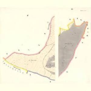
Kopie katastrální mapy obce Třeboc z roku 1841, list II 1

Hraniční mapa lesních parcel v katastru obce Lhota pod Džbánem, list 2 1
1 : 2880
Hospodářská mapa polesí Třeboc, list 3 1
1 : 2880
Hraniční mapa lesních parcel v katastru obce Ročov 1
1 : 2880
Kopie katastrální mapy obce Třeboc z roku 1841, list XII 1

Kopie katastrální mapy obce Třeboc z roku 1841, list IX 1

Mapa činžovních pozemků v polesí Domoušice, sekce 2 1

Záměrná mapa polesí Domoušice, sekce 3 3

Kopie katastrální mapy obce Kroučová z roku 1841, list VII 1

Hospodářská mapa polesí Domoušice z roku 1887, list 2 2
1 : 2880
Hospodářská mapa polesí Třeboc, list 2 1
1 : 2880
Hospodářská mapa polesí Třeboc, list 6 1
1 : 2880
Hospodářská mapa polesí Domoušice z roku 1887, list 3 3
1 : 2880
Hospodářská mapa polesí Domoušice z roku 1926/1927, list 2 2
1 : 2880
Záměrná mapa polesí Domoušice, sekce 4 4

Hospodářská mapa polesí Domoušice z roku 1926/1927, list 3 3
1 : 2880