Maps of Ročov

Ober Rotschow (Hornj Ročow) - c2133-1-003 - Kaiserpflichtexemplar der Landkarten des stabilen Katasters
1 : 2880
Ober Rotschow (Hornj Ročow) - c2133-1-004 - Kaiserpflichtexemplar der Landkarten des stabilen Katasters
1 : 2880
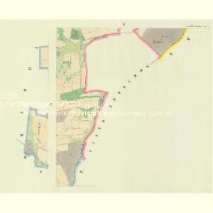
Ober Rotschow (Hornj Ročow) - c2133-1-001 - Kaiserpflichtexemplar der Landkarten des stabilen Katasters
1 : 2880
Ober Rotschow (Hornj Ročow) - c2133-1-002 - Kaiserpflichtexemplar der Landkarten des stabilen Katasters
1 : 2880
Unter Rotschow (Področow) - c1374-1-001 - Kaiserpflichtexemplar der Landkarten des stabilen Katasters
1 : 2880
Kopie katastrální mapy obce Horní Ročov, list II 1

Hraniční mapa lesních parcel v katastru obce Břínkov, list 3 1
1 : 2880
Hospodářská mapa polesí Domoušice, list 1 1

Aulowitz (Aulowic) - c8248-1-002 - Kaiserpflichtexemplar der Landkarten des stabilen Katasters
1 : 2880
Aulowitz (Aulowic) - c8248-1-001 - Kaiserpflichtexemplar der Landkarten des stabilen Katasters
1 : 2880
Hospodářská mapa polesí Domoušice z roku 1887, list 1 1
1 : 2880
Hospodářská mapa polesí Domoušice z roku 1926/1927, list 1 1
1 : 2880
Hospodářská mapa polesí Třeboc, list 7 1
1 : 2880
Hospodářská mapa polesí Třeboc, list 6 1
1 : 2880
Hospodářská mapa polesí Domoušice, list 2 1

Záměrná mapa polesí Domoušice, sekce 2 2

Porostní mapa polesí Třeboc 1

Porostní mapa polesí Třeboc 1

Solopisk - c7142-1-003 - Kaiserpflichtexemplar der Landkarten des stabilen Katasters
1 : 2880
Solopisk - c7142-1-002 - Kaiserpflichtexemplar der Landkarten des stabilen Katasters
1 : 2880
Solopisk - c7142-1-004 - Kaiserpflichtexemplar der Landkarten des stabilen Katasters
1 : 2880
Solopisk - c7142-1-001 - Kaiserpflichtexemplar der Landkarten des stabilen Katasters
1 : 2880
Hospodářská mapa polesí Třeboc, list 7 1
1 : 2880
Mapa lesních činžovních pozemků v polesí Domoušice, list 4 1

Brzinkow (Břinkow) - c0613-1-001 - Kaiserpflichtexemplar der Landkarten des stabilen Katasters
1 : 2880
Brzinkow (Břinkow) - c0613-1-004 - Kaiserpflichtexemplar der Landkarten des stabilen Katasters
1 : 2880
Brzinkow (Břinkow) - c0613-1-003 - Kaiserpflichtexemplar der Landkarten des stabilen Katasters
1 : 2880
Brzinkow (Břinkow) - c0613-1-002 - Kaiserpflichtexemplar der Landkarten des stabilen Katasters
1 : 2880
Záměrná mapa polesí Domoušice, sekce 1 1