Maps of Pochvalov

Pochwalow - c5962-1-001 - Kaiserpflichtexemplar der Landkarten des stabilen Katasters
1 : 2880
Pochwalow - c5962-1-002 - Kaiserpflichtexemplar der Landkarten des stabilen Katasters
1 : 2880
Pochwalow - c5962-1-003 - Kaiserpflichtexemplar der Landkarten des stabilen Katasters
1 : 2880
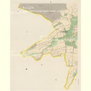
Pochwalow - c5962-1-004 - Kaiserpflichtexemplar der Landkarten des stabilen Katasters
1 : 2880
Hospodářská mapa polesí Třeboc, list 7 1
1 : 2880
Unter Rotschow (Področow) - c1374-1-001 - Kaiserpflichtexemplar der Landkarten des stabilen Katasters
1 : 2880
Hospodářská mapa polesí Třeboc, list 6 1
1 : 2880
Kopie katastrální mapy obce Kozojedy, list VI 1

Hraniční mapa lesních parcel v katastru obce Břínkov, list 3 1
1 : 2880
Porostní mapa lesa nadačního statku Blšany 1

Kopie katastrální mapy obce Třeboc z roku 1841, list XII 1

Hospodářská mapa polesí Třeboc, list 2 1
1 : 2880
Porostní mapa polesí Třeboc 1

Porostní mapa polesí Třeboc 1

Kozoged - c3467-1-005 - Kaiserpflichtexemplar der Landkarten des stabilen Katasters
1 : 2880
Kozoged - c3467-1-004 - Kaiserpflichtexemplar der Landkarten des stabilen Katasters
1 : 2880
Kozoged - c3467-1-002 - Kaiserpflichtexemplar der Landkarten des stabilen Katasters
1 : 2880
Kozoged - c3467-1-001 - Kaiserpflichtexemplar der Landkarten des stabilen Katasters
1 : 2880
Kozoged - c3467-1-003 - Kaiserpflichtexemplar der Landkarten des stabilen Katasters
1 : 2880
Hospodářská mapa polesí Třeboc, list 7 1
1 : 2880
Kopie katastrální mapy obce Kroučová z roku 1841, list VII 1

Hospodářská mapa polesí Třeboc, list 3 1
1 : 2880
Ober Rotschow (Hornj Ročow) - c2133-1-003 - Kaiserpflichtexemplar der Landkarten des stabilen Katasters
1 : 2880
Ober Rotschow (Hornj Ročow) - c2133-1-004 - Kaiserpflichtexemplar der Landkarten des stabilen Katasters
1 : 2880
Ober Rotschow (Hornj Ročow) - c2133-1-001 - Kaiserpflichtexemplar der Landkarten des stabilen Katasters
1 : 2880
Ober Rotschow (Hornj Ročow) - c2133-1-002 - Kaiserpflichtexemplar der Landkarten des stabilen Katasters
1 : 2880
Hospodářská mapa polesí Obora, list 4 1
1 : 2880
Kopie katastrální mapy obce Třeboc z roku 1841, list IX 1

Kopie katastrální mapy obce Kroučová z roku 1841, list II 1