Maps of Selb

Meßtischblatt 5838 : Selb, 1940
1 : 250000 Selb. - Aufn. 1919, Ausg. 1923, Erkund. 1937, bericht. 1. - 1:25000. - München, 1940. - 1 Kt.
III. vojenské mapování 3948
1 : 75000
Asch
1 : 75000 Aš (Česko : oblast) Ansion K. u. k. Militärgeographisches Institut
Asch
1 : 75000 Aš (Česko : oblast) K. u. k. Militärgeographisches Institut
III. vojenské mapování 3948
1 : 75000
Landcharte über die Reichs Adel Zedwizische und der Cron Boeheim zulehen Rührende Herschaft und gütter zu Ascha welche von folgenden possediret werden
Aš-oblast (Česko) Bauer, Joannes Assner, L.
Aš
1 : 75000 Aš (Česko : oblast) Vojenský zeměpisný ústav
Aš
1 : 75000 Aš-oblast (Česko) Vojenský zeměpisný ústav
Podrobná mapa Království českého
1 : 100000 Aš (Česko : oblast) Srp, Jan Jos. R. Vilímek
[Vilímkovy místopisné mapy zemí Koruny české]
1 : 100000 Aš (Česko : oblast) Srp, Jan Jos. R. Vilímek
Karte der Bezirke Eger und Asch
1 : 75000 Aš (Česko : oblast) Stelzig, Heinrich J. Kobrtsch & Gschihay
Soubor přehledných map pro plánování a statistiku: 3848 – Hranice

III. vojenské mapování 3948/2
1 : 25000
Mapy plánování ČSR

[Kartenblatt]
1 : 25000 Aš (Česko : oblast) Reichsamt für Landesaufnahme

[Kartenblatt]
1 : 25000 Arzberg (Bavorsko, Německo) Reichsamt für Landesaufnahme
Gradkartenblatt
1 : 25000 Čechy (Česko) Brzesina, Julius von
Asch.
from Spezialkarte der osterreichisch-ungarischen Monarchie.
Geologische Uibersichtskarte vom Ursprunge der Eger bis Karslbad
Karlovy Vary (Česko)
142. Plauen (bijgeschreven: Löbenstein), uit: Topographische Uebersichtskarte des Deutschen Reiches / herausgegeben v. d. Kartogr. Abt. d. Königl. Preuß. Landesaufnahme
1 : 200000 titelvariant: Topogr. Übersichtskarte des Deutschen Reiches; Annotatie: Titel boven bladen ook: Topogr. Übersichtskarte des Deutschen Reiches; Annotatie geografische gegevens: Op elk blad twee maatstokken: 10 Kilometer = 5,5 cm; 1 geogr. Meile = 3,6 cm; Legenda onder op elk blad Königlich Preußische Landesaufnahme. Kartographische Abtheilung [S.l : Königlich Preußische Landesaufnahme, Kartographische Abtheilung]
Neue Sächsischen Post-Charte mitt denem Post-Wegen und Strasse, wie viele Meilen die Stationem vom ein ander liegen
1 : 480000 Mollova mapová sbírka Schenk, Pieter Schenk, Peter II
Neue Sächsischen Post-Charte mitt denem Post-Wegen und Strasse, wie viele Meilen die Stationem vom ein ander liegen
1 : 480000 Mollova mapová sbírka Schenk, Pieter Schenk, Peter II
Repraesentatio Geographica District Egerani nunc Circulo Cubitensi in quo simul viae Egeranae in Thermas Carolinas in distincta delineatio conspicitur
1 : 200000 Cheb-oblast (Česko) Müller, Johann Christoph apud Homannianos Heredes
Eger
Cheb-oblast (Česko) Woerl Assner, L.
Chur Sächsischer Post-Charten Extract mit allen Chur Sächsischen und vielen daren gräntzenden Post Stationen
1 : 2100000 Mollova mapová sbírka Weigel, Johann Christoph Weigel, Christoph I.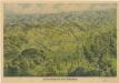
Franzensbad und Seine Umgebung

Charte vom Elbogner Kreise ...

Generální mapa ČSR


