Maps of Fresnay-l'Évêque
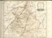
27 Chartres.
1 : 86400 Cassini family; Cassini, Cesar-Francois, 1714-1784
28 Vendome.
1 : 86400 Cassini family; Cassini, Cesar-Francois, 1714-1784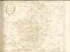

Gowernement de Chartres
1 Karte : Kupferdruck ; 11 x 15 cm Sebastian Cramoisy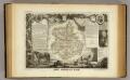
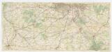
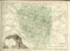
Dept. De L'Eure et Loir.
1 : 568000 Levasseur, Victor.
La Beauce
1 Karte : Kupferdruck ; 41 x 56 cm Sanson; Robert de Vaugondy; Somer chez le Sr. Robert geographe du roy quai de l'Horloge du Palais
Carnutes, evesché de Chartres
1 Karte : Kupferdruck ; 42 x 54 cm Sanson; Robert de Vaugondy ches le S. Robert g. o. du roi quai de l'Horloge du Palais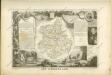

Département d'Eure et Loir
1 Karte : Kupferdruck ; 49 x 48 cm Houdan au bureau de l'atlas national de France rue Serpente n.o 15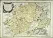
La Beauce
1 Karte : Kupferdruck ; 41 x 56 cm Sanson; Mariette; Somer chez Pierre Mariette rue St. Iacques a l'Esperance
Département de la Seine et de l'Oise
1 Karte : Kupferdruck ; 35 x 30 cm Capitaine s.n.
Partie meridionale de l'evesché de Chartres
1 Karte : Kupferdruck ; 45 x 60 cm Sanson; Jaillot chez H. Iaillot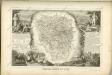
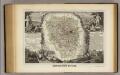
Dept. De Siene et Oise.
1 : 456000 Levasseur, Victor.
[Fontainebleau - Etampes]
1 Blatt : 60 x 91 cm s.n.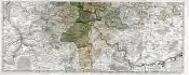
Les environs de Paris, 2
2 Blätter : 45 x 112 cm Nolin
Paris 123, uit: [W. Liebenow's Special-Karte von Mittel-Europa]
1 : 300000 titelvariant: W. Liebenow's Mittel-Europa; Annotatie: Titel boven de bladen: W. Liebenow's Mittel-Europa Johannes Wilhelm Liebenow 1822-1897 Hannover : Hermann Oppermann
Paris 123, uit: Special-Karte von Mittel-Europa / nach amtlichen Quellen bearbeitet von W. Liebenow
1 : 300000 titelvariant: W. Liebenow's Mittel-Europa; Annotatie: Titel boven de bladen: W. Liebenow's Mittel-Europa Johannes Wilhelm Liebenow 1822-1897 Frankfurt a. M. : Ludwig Ravenstein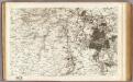
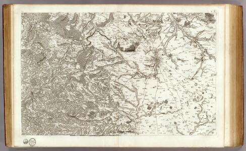
7 Fontainebleau, Etampes.
1 : 86400 Cassini family; Cassini, Cesar-Francois, 1714-1784
Agri Parisiensis tabula particularis, qua maxima pars insulae Franciae, seu regiae celeberrimaeq. Parisiorum urbis vicina regio in suas castellanias accurate divisa exhibetur
1 : 174000 Paříž-oblast (Francie) Vivier, François de a Ioh. Bapt. Homanno
Agri Parisiensis tabula particularis, qua maxima pars insulae Franciae, seu regiae celeberrimaeq. Parisiorum urbis vicina regio in suas castellanias accurate divisa exhibetur
1 : 174000 Paříž-oblast (Francie) Vivier, François de Homann, Johann Baptist a Ioh. Bapt. Homanno
AGRI PARISIENSIS Tabula particularis
1 : 190000 Francie Vivier, François de Homann, Johann Baptist a Ioh. Bapt. Homanno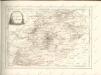

[Chartres]
1 Blatt : 60 x 91 cm Brunet; Desbruslins s.n.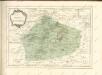
[Michelin 95], uit: Environs de Paris : carte des curiosités et des routes pittoresques
1 : 100000 Paris : Services du Tourisme Michelin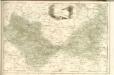
Flle. 10. Rambouillet, uit: Carte topographique des environs de Versailles dite "Carte des chasses du Roi"
1 : 28800 titelvariant: Carte des chasses du Roi; Annotatie: Herdruk van originele koperplaten; Oorspr. uitg.: 1764-1807; Voor aanwezige bladen zie overzichtsblad; Annotatie geografische gegevens: Opname: 1764-1773 [Paris : IGN]