Maps of Eure-et-Loir

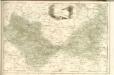
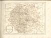
Département d'Eure et Loir
1 Karte : Kupferdruck ; 49 x 48 cm Houdan au bureau de l'atlas national de France rue Serpente n.o 15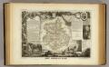
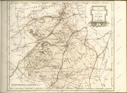
Dept. De L'Eure et Loir.
1 : 568000 Levasseur, Victor.
La Beauce. [Karte], in: Gerardi Mercatoris et I. Hondii Newer Atlas, oder, Grosses Weltbuch, Bd. 2, S. 68.
1 Karte aus Atlas Mercator, Gerhard und Hondius, Jodocus Jansson, Jan
Govvernement de Blois
1 Karte : Kupferdruck ; 11 x 15 cm Sebastian Cramoisy
La Beauce
1 Karte : Kupferdruck ; 41 x 56 cm Sanson; Robert de Vaugondy; Somer chez le Sr. Robert geographe du roy quai de l'Horloge du Palais
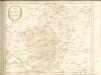
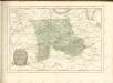
Carnutes, evesché de Chartres
1 Karte : Kupferdruck ; 42 x 54 cm Sanson; Robert de Vaugondy ches le S. Robert g. o. du roi quai de l'Horloge du Palais
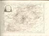
Partie meridionale de l'evesché de Chartres
1 Karte : Kupferdruck ; 45 x 60 cm Sanson; Jaillot chez H. Iaillot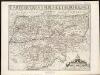
Carte du Grand Perche et Perche Gouet
1 : 285000
Perchensis Comitatus La Perche Comte [Karte], in: Novus atlas absolutissimus, Bd. 4, S. 118.
1 Karte aus Atlas Janssonius Offizin
Perchensis Comitatus La Perche Comté [Karte], in: Le théâtre du monde, ou, Nouvel atlas contenant les chartes et descriptions de tous les païs de la terre, Bd. 2, S. 104.
1 Karte aus Atlas Blaeu, Willem Janszoon und Blaeu, Joan Blaeu, Willem Janszoon
Perchensis Comitatus La Perche Comté [Karte], in: Novus Atlas, das ist, Weltbeschreibung, Bd. 2, S. 106.
1 Karte aus Atlas Blaeu, Joan Blaeu, Willem Janszoon
Perchensis Comitatus La Perche Comté [Karte], in: Theatrum orbis terrarum, sive, Atlas novus, Bd. 2, S. 70.
1 Karte aus Atlas Blaeu, Joan Blaeu, Willem Janszoon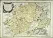
La Beauce
1 Karte : Kupferdruck ; 41 x 56 cm Sanson; Mariette; Somer chez Pierre Mariette rue St. Iacques a l'Esperance
Perchensis comitatvs
2 Karten auf 1 Blatt : Kupferdruck ; Bildgrösse 39 x 50 cm Janssonius; Du Temps Joannes Janssonius
Perchensis comitatvs
2 Karten auf 1 Blatt : Kupferdruck ; Bildgrösse 39 x 50 cm Blaeu; Du Temps apud Guiljelmum Blaeuw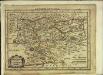
Perchensis comitatus
1 Karte : Kupferdruck ; 17 x 25 cm Mercator Cloppenburgh
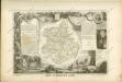
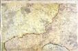
[Chartres]
1 Blatt : 60 x 91 cm Brunet; Desbruslins s.n.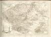
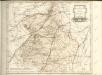
[Evreux - Dreux]
1 Blatt : 60 x 91 cm s.n.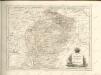

Carte de Beauce
1 Karte : Kupferdruck ; 11 x 16 cm Sebastian Cramoisy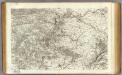
28 Vendome.
1 : 86400 Cassini family; Cassini, Cesar-Francois, 1714-1784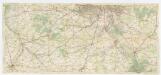
[Michelin 95], uit: Environs de Paris : carte des curiosités et des routes pittoresques
1 : 100000 Paris : Services du Tourisme Michelin