Mappa catalogata
n/a


Titolo completo:n/a
Anno di illustrazione:1791
Data di pubblicazione:1791
Dimensione fisica:20 x 30 cm
n/a
1791
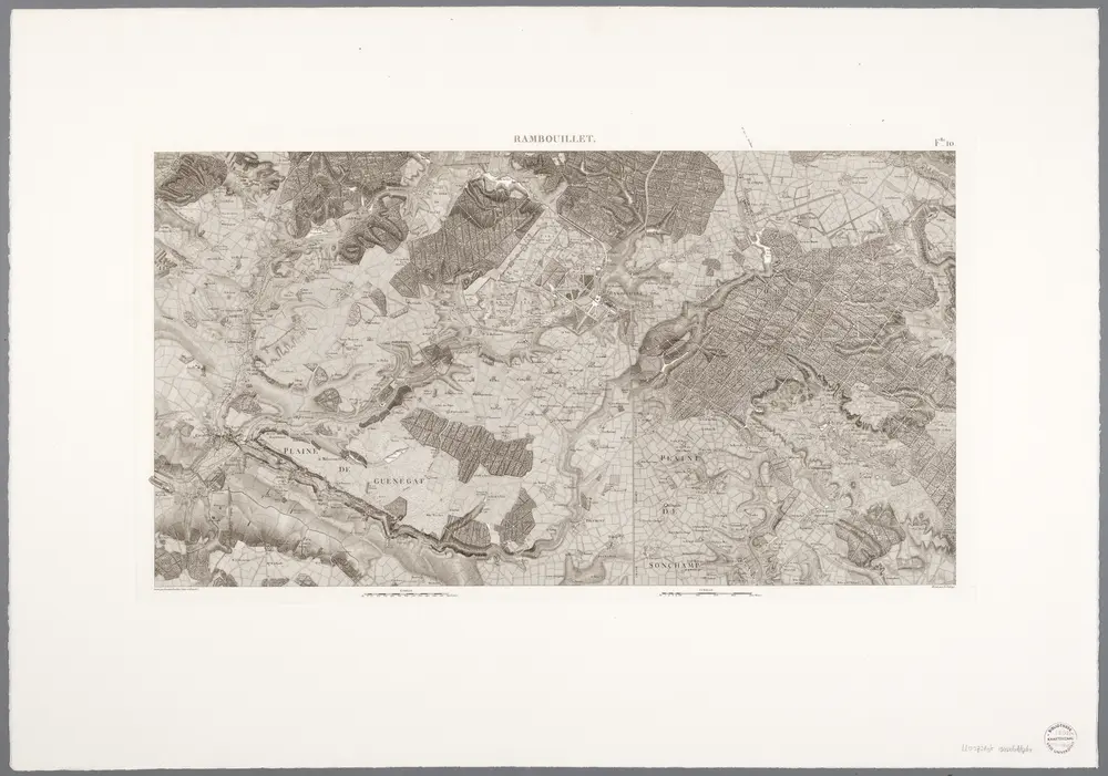
Flle. 10. Rambouillet, uit: Carte topographique des environs de Versailles dite "Carte des chasses du Roi"
1976
[Paris : IGN]
1:29k
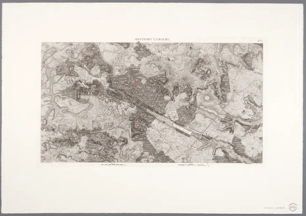
Flle. 7. Montfort L'amaury, uit: Carte topographique des environs de Versailles dite "Carte des chasses du Roi"
1976
[Paris : IGN]
1:29k
Gowernement de Chartres
1638
Sebastian Cramoisy
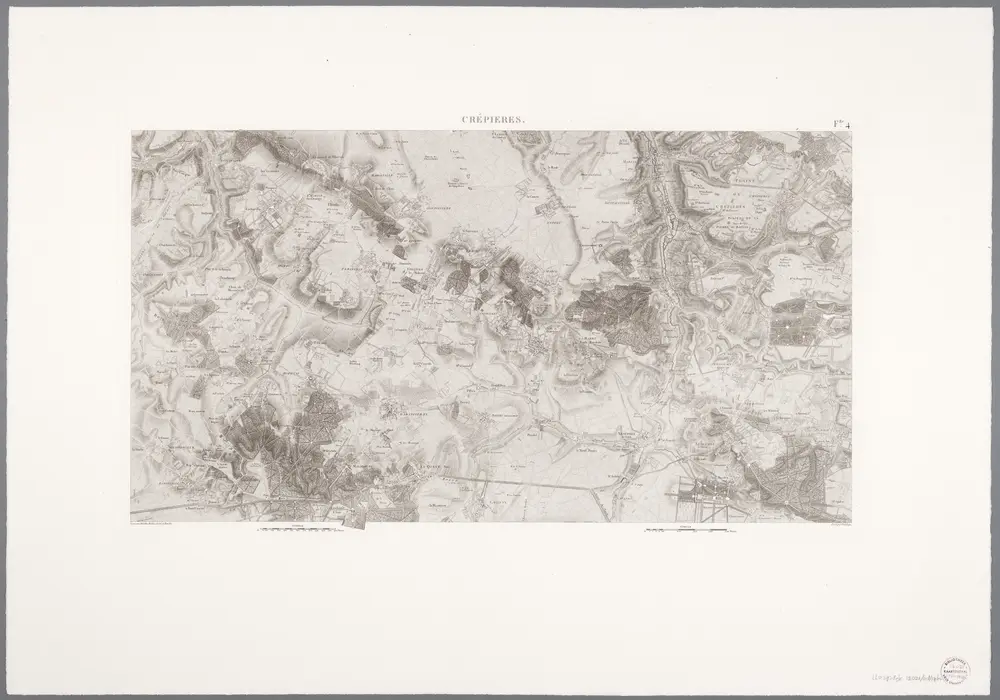
Flle. 4. Crépieres, uit: Carte topographique des environs de Versailles dite "Carte des chasses du Roi"
1976
[Paris : IGN]
1:29k
n/a
1791
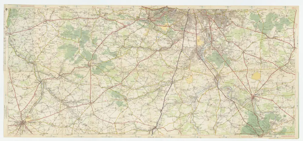
[Michelin 95], uit: Environs de Paris : carte des curiosités et des routes pittoresques
1946
Paris : Services du Tourisme Michelin
1:100k
n/a
1791
n/a
1728
Carte de la prevoste et vicomte de Paris
1740
Seutter