Maps of Switzerland

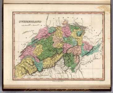
Switzerland.
1 : 1300000 Finley, Anthony
Switzerland.
1 : 950000 Hughes, William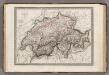
Suisse.
1 : 1020000 Monin, C.V.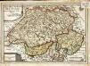
Les XIII. cantons des Suisses leurs alliez et leurs sujets
1 Karte : Kupferdruck ; 22 x 32 cm Fer; Inselin chez l'auteur dans l'isle du Palais a la sphere royale
Switzerland.
1 : 1300000 Tanner, Henry S.

Carte générale de la Suisse suivant les nouvelles divisions, qui comprennent les ci-devant XIII cantons, leurs alliés et sujets, et forment actuellement la république helvétique une et invisible
1 : 525000 Mechel, Christian von Chrétien de Mechel
Geologische Karte der Schweiz
1 : 500000 Švýcarsko Leuzinger, Rudolf Kommisionverlag von A. Francke
Reisekarte der Schweiz
1 : 750000 Švýcarsko Füssli
Geologische Karte der Schweiz |p [Abzug der schwarzen Druckplatte]
1 : 500000 Heim, Albert [Topogr. Anstalt Winterthur. J. Schlumpf]
Umriss von der Schweiz nach der neuen Eintheilung von 1798
1 Karte : Kupferdruck ; 36 x 48 cm s.n.
La Suisse
1 Karte : Kupferdruck ; 46 x 63 cm Bonne; Lattré chés Lattré grav.r ord. de Mons.gr le Dauphin ruë S. Jacques à la ville de Bordeaux
Geologische Karte der Schweiz
1 : 500000 1 Karte auf Grundlage der "Beiträge zur geolog. Karte der Schweiz" und der neuesten Materialien, sowie unter Mitwirkung der Herren Renevier ... [et al.] bearb. im Auftrage der Schweizerischen Geologischen Commission von Alb. Heim & C. Schmidt ; topogr. Grundlage von R. Leuzinger ; hrsg. von der Schweiz. Geologischen Commission Schlumpf, Winterthur
Carte scolaire de la Suisse
1 : 600000 Švýcarsko Kümmerly, H. Kümmerly & Frey
[Recto], uit: Carte du touriste de Suisse / Institut géograph de Kümmerly & Frey
1 : 600000 titelvariant: Suisse; Suisse: carte et guide; Annotatie: Titel op omslag: Suisse : Carte et Guide; Verso: toeristische informatie Kümmerly + Frey, Bern Zürich [etc.] : Office suisse du Tourisme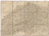
Helvetien und Wallis
Švýcarsko Mechel, Christian von Weiss, Johann Heinrich im Verlage des Kunst u. Industrie Comptoirs
Geologische Karte der Schweiz |p [stumme Karte]
1 : 500000 Heim, Albert Topogr. Anstalt Winterthur. J. Schlumpf
Carte de Suisse
1 Karte dressé sur les memoires de Merveilleux par Guillaume de l'Isle chez l'auteur sur le Quay de l'Horloge, Paris
La Suisse.
1 : 980000 Clouet, J. B. L. (Jean-Baptiste Louis), b. 1730
Die Helvetische Republik in Cantone und Districte eingetheilt
1 Karte : Typometrie ; 36 x 49 cm Haas gedruckt bey Wilhelm Haas dem Sohne
Die Schweiz
Plastischer Schul-Atlas über alle Theile der Erde : in 24 Karten Woldermann, G Verlag von P. Eckerlein
Karte der Schweiz
1 : 400000 Leuzinger, Rudolf J. Dalp (C. Schmid)
Der Helvetischen Republik neue Cantons und Districts Eintheilung
1 Karte : Typometrie ; 37 x 49 cm Haas Wilhelm Haas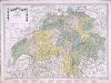
Karte von der Schweiz
1 Karte : Kupferdruck ; 45 x 63 cm bey Fuessli & Comp
Neüe Charte von Helvetien
1 Karte : Kupferdruck ; 45 x 63 cm bey Fuessli & Comp
Petite carte de la Suisse pour les écoles
1 : 800000 1 Karte gezeichnet und herausgegeben von H. Keller Heinrich Keller, untere Zäune No. 367, Zürich
Switzerland.
1 : 1050000 Schonberg & Co.
Nouvelle carte itinéraire dressée pour servir de guide aux voyageurs dans les XXII cantons de la Confédération Suisse = Neue Reise Karte verfertiget zum Behuf des Wegweisers durch die XXII Kantone der schweizerischen Eidgenossenschaft
1 : 700000 titelvariant: Neue Reise Karte verfertiget zum Behuf des Wegweisers durch die XXII Kantone der schweizerischen Eidgenossenschaft; Annotatie geografische gegevens: Met legenda en hoogtentabel Weiss, H. (fl. 1820) Á Berne : publié par I.I. Bourgdorfer
Roadmap of Switzerland
1 : 355000 Müllhaupt, Hans Heinrich ; Bressanini, Rinaldo ; Leuthold, Hans Felix Leuthold