Maps of Switzerland
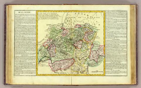
La Suisse.
1 : 980000 Clouet, J. B. L. (Jean-Baptiste Louis), b. 1730
Die Schweiz

Die Helvetische Republik in Cantone und Districte eingetheilt
1 Karte : Typometrie ; 36 x 49 cm Haas gedruckt bey Wilhelm Haas dem Sohne
Switzerland.
1 : 1280000 Mitchell, Samuel Augustus
Geologische Karte der Schweiz
1 : 500000 Švýcarsko Leuzinger, Rudolf Kommisionverlag von A. Francke
[Karte der Schweiz]
1 Karte : Kupferdruck ; 16 x 20 cm Heidegger; Halder s.n.
Umriss von der Schweiz nach der neuen Eintheilung von 1798
1 Karte : Kupferdruck ; 36 x 48 cm s.n.
[Recto], uit: Tourist map of Switzerland
1 : 600000 Berne [etc.] : Swiss National Tourist Office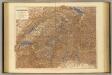
Switzerland.
1 : 506880 Stanford, Edward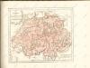
Les XIII. cantons des Suisses leurs alliez et leurs sujets
1 Karte : Kupferdruck ; 22 x 32 cm Fer; Inselin chez l'auteur dans l'isle du Palais a la sphere royale
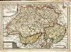
Nova Totius Helvetiae cum suis Subditis ac Sociis Tab. Geogr.
1 : 1200000 Mollova mapová sbírka Seutter, Matthäus Seutter, Matthäus
Die Schweiz
E. von Sydow's Schul-Atlas in sechs und dreissig Karten Sydow, Emil von bei Justus Perthes
Geologische Karte der Schweiz |p [stumme Karte]
1 : 500000 Heim, Albert Topogr. Anstalt Winterthur. J. Schlumpf
La Suisse
1 Karte : Kupferdruck ; 43 x 54 cm Bonne; Santini G. A. Remondini?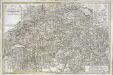
Carte de la Suisse ou l'on a marqué les routes suivies par M.re Wil. Coxe
1 Karte auf 2 Blatt : Kupferdruck ; 45 x 69 cm Coxe s.n.
Geologische Karte der Schweiz
1 : 500000 1 Karte auf Grundlage der "Beiträge zur geolog. Karte der Schweiz" und der neuesten Materialien, sowie unter Mitwirkung der Herren Renevier ... [et al.] bearb. im Auftrage der Schweizerischen Geologischen Commission von Alb. Heim & C. Schmidt ; topogr. Grundlage von R. Leuzinger ; hrsg. von der Schweiz. Geologischen Commission Schlumpf, Winterthur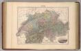
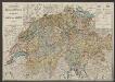
Suisse.
1 : 795000 Migeon, J.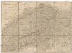
Helvetien und Wallis
Švýcarsko Mechel, Christian von Weiss, Johann Heinrich im Verlage des Kunst u. Industrie Comptoirs
Karte der Schweiz für Schulen
1 : 750000 Leuzinger, Rudolf Benziger & Co. A.G.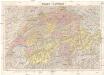
Suisse - Schweiz
1 : 300000 Švýcarsko Kümmerly & Frey
Die Schweiz auch Fürstenthum Liechtenstein
Schul-Atlas über alle Theile der Erde nach dem neuesten Zustande, und über das Weltgebäude Stieler, Adolf Justus Perthes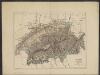
Suisse
1 : 1500000 Dunan, Maurice 1850-1919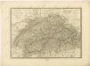

Switzerland.
1 : 950000 Hughes, William
Die Schweiz
Plastischer Schul-Atlas über alle Theile der Erde : in 24 Karten Woldermann, G Verlag von P. Eckerlein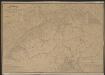
Postkarte der schweizerischen Eidgenossenschaft
1 : 300000 Stengel, Johann Rudolf ; Mohr, Ernst Rudolf Topogr. Anstalt v. J. Wurster u. Comp.
Die Schweiz
Stieler's Hand-Atlas Stieler, Adolf bei Justus Perthes