Maps of Fairfield County

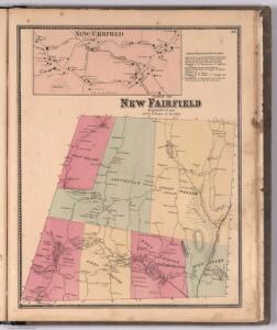
Town of New Fairfield, Fairfield County, Connecticut. (inset) New Fairfield.
1 : 31680 Beers, Frederick W.
Danbury
1 : 24000
Danbury
1 : 24000
Danbury
1 : 24000
Danbury
1 : 24000
Danbury
1 : 24000
Danbury
1 : 31680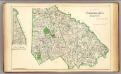
Fairfield Co. N.
1 : 72000 D.H. Hurd & Co.
Map of Dutchess County New York
from New illustrated atlas of Dutchess County, New York. / Compiled & drawn from personal examinations, surveys etc. under the personal supervision of O.W. Gray & Son and F.A. Davis, and published under the superintendence of H. L. Kochersperger.
Bridgeport
1 : 100000
Bridgeport
1 : 100000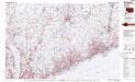
Bridgeport
1 : 100000
Map of Dutchess County, New-York from original surveys / J.C. Sidney C.E., author of 12 miles around New York.
from Counties
Map of the counties of Dutchess and Putnam / by David H. Burr ; engd. by Rawdon, Clark & Co., Albany, & Rawdon, Wright & Co., New York.
from An atlas of the state of New York : containing a map of the state and of the several counties. / Projected and drawn under the superintendence and direction of Simeon de Witt ... And also the physical geography of the State ...
[Dutchess County].
from New York Atlas.
Map of the counties of Dutchess and Putnam / by David H. Burr ; engd. by Rawdon, Clark & Co., Albany, & Rawdon, Wright & Co., New York.
from An atlas of the state of New York : containing a map of the state and of the several counties / by David H. Burr.
Map of the county of Westchester / by David H. Burr ; engd. by Rawdon, Clark & Co., Albany, & Rawdon, Wright & Co., New York.
from An atlas of the state of New York : containing a map of the state and of the several counties. / Projected and drawn under the superintendence and direction of Simeon de Witt ... And also the physical geography of the State ...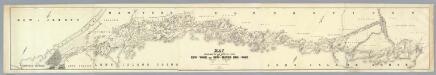
Map Exhibiting The ... Lines for the New-York and New-Haven Rail-Road.
1 : 40000 Anderson, P.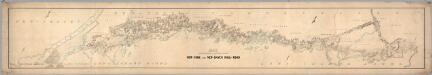
Map Exhibiting The ... Lines for the New-York and New-Haven Rail-Road.
1 : 20000 Anderson, P.
Map of the counties of Dutchess and Putnam / by David H. Burr ; engd. by Rawdon, Clark & Co., Albany, & Rawdon, Wright & Co., N.Y.
from (A-Z)
Map of the counties of Dutchess and Putnam / by David H. Burr ; engd. by Rawdon, Clark & Co., Albany, & Rawdon, Wright & Co., New York.
from An atlas of the state of New York, designed for the use of engineers, containing a map of the state and of the several counties. / Projected and drawn ... under the superintendence and direction of Simeon de Witt.
N.Y., Kings, Queens, Richmond, Rockland, Westchester, Putnam counties.
1 : 158400 Bien, Joseph Rudolf
Map of Long Island with the environs of New-York and the southern part of Connecticut / compiled from various surveys & documents by J. Calvin Smith ; engraved & printed by S. Stiles & Co., N. York.
From Long Island
A Correct Map of Connecticut.
1 : 442000 Doolittle, Amos
Westchester, Plate No. 1 [Map of Westchester County and Surroundings] / prepared under the direction of Joseph R. Bien, from general surveys and official records.
From Atlas of Westchester County, New York
Map of Long Island with the environs of New-York and the southern part of Connecticut / compiled from various surveys & documents by J. Calvin Smith ; engraved & printed by S. Stiles & Co., N. York.
From Long Island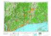
Hartford
1 : 250000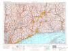
Hartford
1 : 250000
Hartford
1 : 250000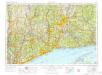
Hartford
1 : 250000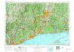
Hartford
1 : 250000
Hartford
1 : 250000
Hartford
1 : 250000
Hartford
1 : 250000
Hartford
1 : 250000
Hartford
1 : 250000